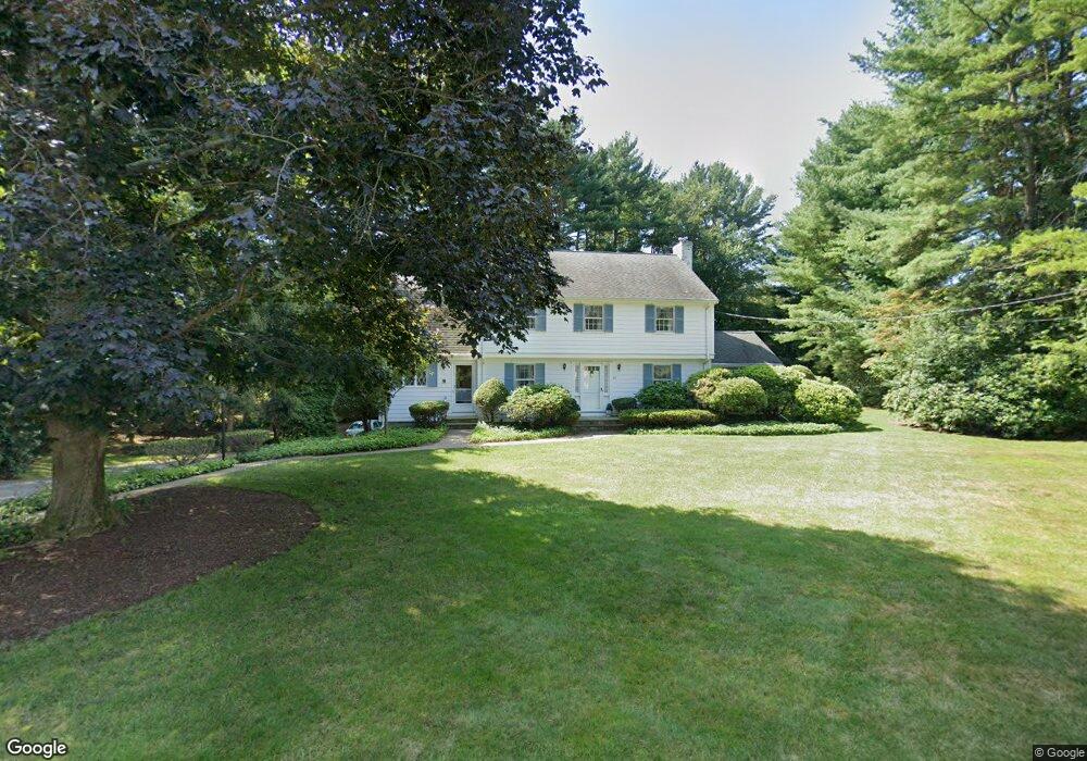
97 Sherburn Cir Weston, MA 02493
Estimated Value: $1,685,198 - $2,795,000
4
Beds
3
Baths
2,738
Sq Ft
$752/Sq Ft
Est. Value
About This Home
This home is located at 97 Sherburn Cir, Weston, MA 02493 and is currently estimated at $2,058,550, approximately $751 per square foot. 97 Sherburn Cir is a home located in Middlesex County with nearby schools including Country Elementary School, Woodland Elementary School, and Field Elementary School.
Ownership History
Date
Name
Owned For
Owner Type
Purchase Details
Closed on
Aug 22, 1988
Sold by
Morris Walter F
Bought by
Ohare Robert J M
Current Estimated Value
Home Financials for this Owner
Home Financials are based on the most recent Mortgage that was taken out on this home.
Original Mortgage
$275,000
Interest Rate
10.32%
Mortgage Type
Purchase Money Mortgage
Create a Home Valuation Report for This Property
The Home Valuation Report is an in-depth analysis detailing your home's value as well as a comparison with similar homes in the area
Home Values in the Area
Average Home Value in this Area
Purchase History
| Date | Buyer | Sale Price | Title Company |
|---|---|---|---|
| Ohare Robert J M | $555,000 | -- |
Source: Public Records
Mortgage History
| Date | Status | Borrower | Loan Amount |
|---|---|---|---|
| Closed | Ohare Robert J M | $200,000 | |
| Closed | Ohare Robert J M | $203,000 | |
| Closed | Ohare Robert J M | $275,000 | |
| Previous Owner | Ohare Robert J M | $45,000 |
Source: Public Records
Tax History
| Year | Tax Paid | Tax Assessment Tax Assessment Total Assessment is a certain percentage of the fair market value that is determined by local assessors to be the total taxable value of land and additions on the property. | Land | Improvement |
|---|---|---|---|---|
| 2025 | $14,115 | $1,271,600 | $832,100 | $439,500 |
| 2024 | $13,924 | $1,252,200 | $832,100 | $420,100 |
| 2023 | $14,212 | $1,200,300 | $832,100 | $368,200 |
| 2022 | $13,694 | $1,069,000 | $783,700 | $285,300 |
| 2021 | $7,295 | $1,018,400 | $746,200 | $272,200 |
| 2020 | $12,798 | $997,500 | $746,200 | $251,300 |
| 2019 | $11,957 | $949,700 | $701,300 | $248,400 |
| 2018 | $6,283 | $949,700 | $701,300 | $248,400 |
| 2017 | $4,382 | $949,700 | $701,300 | $248,400 |
| 2016 | $11,548 | $949,700 | $701,300 | $248,400 |
| 2015 | $11,169 | $909,500 | $668,100 | $241,400 |
Source: Public Records
Map
Nearby Homes
- 91 Sherburn Cir
- 7 Fenmere Ave
- 103 Sherburn Cir
- 104 Sherburn Cir
- 47 Manor Ave
- 1 Fenmere Ave
- 90 Sherburn Cir
- 51 Manor Ave
- 12 Argyle Ave
- 59 Manor Ave
- 1 Pinevale Ave
- 87 Sherburn Cir
- 41 Manor Ave
- 41 Manor Ave Unit 1
- 1 Brookdale Ave
- 61 Manor Ave
- 109 Sherburn Cir
- 116 Sherburn Cir
- 52 Manor Ave
- 52 Manor Ave Unit 52, Wellesley Ma 024
Your Personal Tour Guide
Ask me questions while you tour the home.