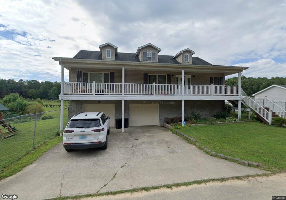
97 Smokey Ln Corbin, KY 40701
Estimated Value: $285,805 - $302,000
3
Beds
2
Baths
2,700
Sq Ft
$108/Sq Ft
Est. Value
About This Home
This home is located at 97 Smokey Ln, Corbin, KY 40701 and is currently estimated at $291,451, approximately $107 per square foot. 97 Smokey Ln is a home located in Laurel County with nearby schools including Heart To Heart Christian School.
Ownership History
Date
Name
Owned For
Owner Type
Purchase Details
Closed on
Oct 20, 2022
Sold by
Yaden Katrina Denise and Yaden Timothy Wayne
Bought by
Baker Joshua and Baker Michelle
Current Estimated Value
Home Financials for this Owner
Home Financials are based on the most recent Mortgage that was taken out on this home.
Original Mortgage
$215,033
Outstanding Balance
$206,448
Interest Rate
5.89%
Mortgage Type
FHA
Estimated Equity
$85,003
Purchase Details
Closed on
Aug 30, 2017
Sold by
Compton George and Compton Martha Nipper
Bought by
Yaden Katrina Denise and Yaden Timothy Wayne
Purchase Details
Closed on
Dec 18, 2013
Sold by
James Richard James Richard
Bought by
Compton George E and Compton Martha
Purchase Details
Closed on
Jul 9, 2013
Bought by
Johnston James Ricahrd
Create a Home Valuation Report for This Property
The Home Valuation Report is an in-depth analysis detailing your home's value as well as a comparison with similar homes in the area
Home Values in the Area
Average Home Value in this Area
Purchase History
| Date | Buyer | Sale Price | Title Company |
|---|---|---|---|
| Baker Joshua | $219,000 | -- | |
| Baker Joshua | $219,000 | -- | |
| Yaden Katrina Denise | $166,000 | Kentucky Mtn Land Title | |
| Yaden Katrina Denise | $166,000 | Kentucky Mtn Land Title | |
| Compton George E | $149,900 | -- | |
| Compton George E | $149,900 | -- | |
| Johnston James Ricahrd | $85,000 | -- | |
| Johnston James Ricahrd | $85,000 | -- |
Source: Public Records
Mortgage History
| Date | Status | Borrower | Loan Amount |
|---|---|---|---|
| Open | Baker Joshua | $215,033 |
Source: Public Records
Tax History
| Year | Tax Paid | Tax Assessment Tax Assessment Total Assessment is a certain percentage of the fair market value that is determined by local assessors to be the total taxable value of land and additions on the property. | Land | Improvement |
|---|---|---|---|---|
| 2025 | $1,704 | $219,000 | $15,000 | $204,000 |
| 2024 | $1,688 | $219,000 | $0 | $0 |
| 2023 | $1,732 | $219,000 | $0 | $0 |
| 2022 | $1,481 | $186,000 | $0 | $0 |
| 2021 | $1,370 | $166,000 | $0 | $0 |
| 2020 | $1,376 | $166,000 | $0 | $0 |
| 2019 | $1,384 | $166,000 | $0 | $0 |
| 2018 | $1,381 | $166,000 | $0 | $0 |
| 2017 | $1,247 | $149,900 | $0 | $0 |
| 2015 | $1,243 | $149,900 | $10,000 | $139,900 |
| 2012 | $1,123 | $140,000 | $15,000 | $125,000 |
Source: Public Records
Map
Nearby Homes
- 72/71 Blossom Ridge Dr
- 46 Brandon Dr
- 969 E Highway 312
- 154 Bryan Dr
- 585 Cotton Rd
- 550 E 312
- 283 Cotton Rd
- 24 Beehive Ln
- 2198 Level Green Rd
- 136 Martin Rd
- 688 Rooks Branch Rd
- 72 Vine St
- 63 Hollywood Dr
- 64 Hollywood Dr
- 66 Hollywood Dr
- 79 Hollywood Dr
- 504 Earl Howard Rd
- 35 Malibu Dr
- 75 Malibu Dr
- 36 Malibu Dr
- 97 Smokey Ln
- 143 Smokey Ln
- 99 Blossom Ridge Dr
- 67 Blossom Ridge Dr
- 4 Smokey Ln
- 5 Smokey Ln
- 115 Blossom Ridge Dr
- 198 Smokey Ln
- 55 Blossom Ridge Dr
- 55 Blossom Ridge Dr
- 137 Blossom Ridge Dr
- 33 Blossom Ridge Dr
- 153 Blossom Ridge Dr
- 80 Blossom Ridge Dr
- 53 Smokey Ln
- 21 Blossom Ridge Dr
- 1 Smokey Ln
- 2 Smokey Ln
- 177 Blossom Ridge Dr
- 128 Blossom Ridge Dr