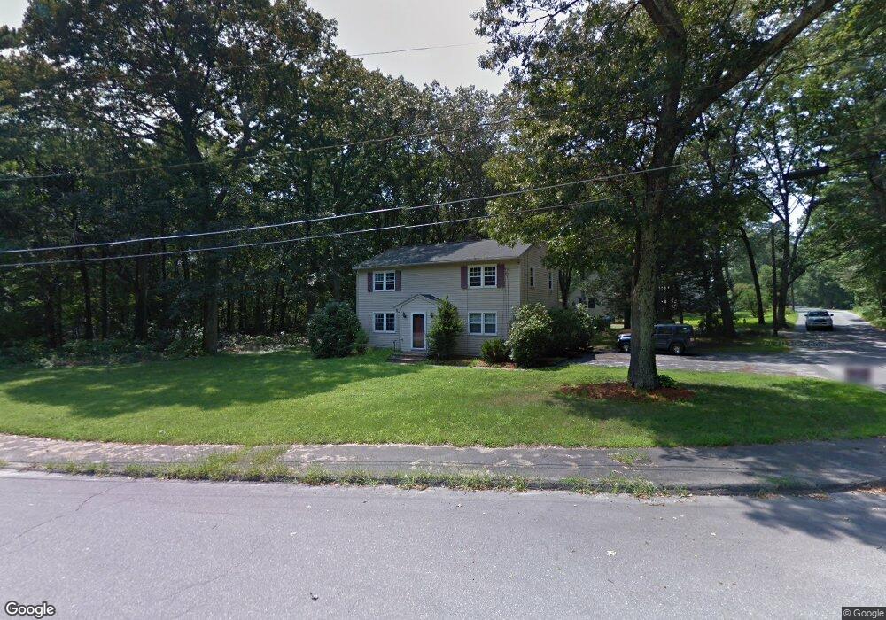
97 Sunset Dr Northborough, MA 01532
Estimated Value: $578,159 - $746,000
4
Beds
2
Baths
1,728
Sq Ft
$389/Sq Ft
Est. Value
About This Home
This home is located at 97 Sunset Dr, Northborough, MA 01532 and is currently estimated at $671,790, approximately $388 per square foot. 97 Sunset Dr is a home located in Worcester County with nearby schools including Marguerite E. Peaslee Elementary School, Robert E. Melican Middle School, and Algonquin Regional High School.
Ownership History
Date
Name
Owned For
Owner Type
Purchase Details
Closed on
Jul 30, 2012
Sold by
Azzariti Daniel J
Bought by
Abouchleih Mohammad
Current Estimated Value
Purchase Details
Closed on
Jul 26, 2004
Sold by
Bourque Deborah and Gautreau Deborah
Bought by
Azzariti Daniel J
Home Financials for this Owner
Home Financials are based on the most recent Mortgage that was taken out on this home.
Original Mortgage
$270,400
Interest Rate
6.28%
Mortgage Type
Purchase Money Mortgage
Purchase Details
Closed on
Dec 1, 1998
Sold by
Zinck Gary R
Bought by
Bourque Paul and Gautreau Deborah
Home Financials for this Owner
Home Financials are based on the most recent Mortgage that was taken out on this home.
Original Mortgage
$190,670
Interest Rate
6.83%
Mortgage Type
Purchase Money Mortgage
Create a Home Valuation Report for This Property
The Home Valuation Report is an in-depth analysis detailing your home's value as well as a comparison with similar homes in the area
Home Values in the Area
Average Home Value in this Area
Purchase History
| Date | Buyer | Sale Price | Title Company |
|---|---|---|---|
| Abouchleih Mohammad | $189,000 | -- | |
| Azzariti Daniel J | $338,000 | -- | |
| Bourque Paul | $198,000 | -- |
Source: Public Records
Mortgage History
| Date | Status | Borrower | Loan Amount |
|---|---|---|---|
| Previous Owner | Azzariti Daniel J | $270,400 | |
| Previous Owner | Bourque Paul | $225,000 | |
| Previous Owner | Bourque Paul | $188,000 | |
| Previous Owner | Bourque Paul | $188,000 | |
| Previous Owner | Bourque Paul | $190,670 |
Source: Public Records
Tax History
| Year | Tax Paid | Tax Assessment Tax Assessment Total Assessment is a certain percentage of the fair market value that is determined by local assessors to be the total taxable value of land and additions on the property. | Land | Improvement |
|---|---|---|---|---|
| 2025 | $6,790 | $476,500 | $259,500 | $217,000 |
| 2024 | $6,090 | $426,500 | $215,100 | $211,400 |
| 2023 | $6,126 | $414,200 | $203,100 | $211,100 |
| 2022 | $5,849 | $354,700 | $193,300 | $161,400 |
| 2021 | $5,603 | $327,300 | $175,600 | $151,700 |
| 2020 | $5,470 | $317,100 | $175,600 | $141,500 |
| 2019 | $5,332 | $310,900 | $170,400 | $140,500 |
| 2018 | $5,323 | $306,100 | $166,700 | $139,400 |
| 2017 | $5,154 | $296,400 | $166,700 | $129,700 |
| 2016 | $4,832 | $281,400 | $163,300 | $118,100 |
| 2015 | $4,793 | $286,500 | $166,000 | $120,500 |
| 2014 | $4,995 | $301,100 | $166,000 | $135,100 |
Source: Public Records
Map
Nearby Homes
- 19 Intervale Farm Ln
- 18 Joseph Rd
- 10 Thoreau Rd
- 106 School St
- 59 School St Unit B-12
- 9 Powder Hill Way Unit 9
- 194 Milk St
- 5 Swan View Common Dr
- 29 Thayer St
- 2 Codman Way Unit 104
- 2 Codman Way Unit 408
- 5 Peters Farm Way Unit 209
- 5 Peters Farm Way Unit 111
- 5 Peters Farm Way Unit 206
- 5 Peters Farm Way Unit 107
- 5 Peters Farm Way Unit 103
- 5 Peters Farm Way Unit 406
- 5 Peters Farm Way Unit 201
- 5 Peters Farm Way Unit 113
- 5 Peters Farm Way Unit 401
Your Personal Tour Guide
Ask me questions while you tour the home.