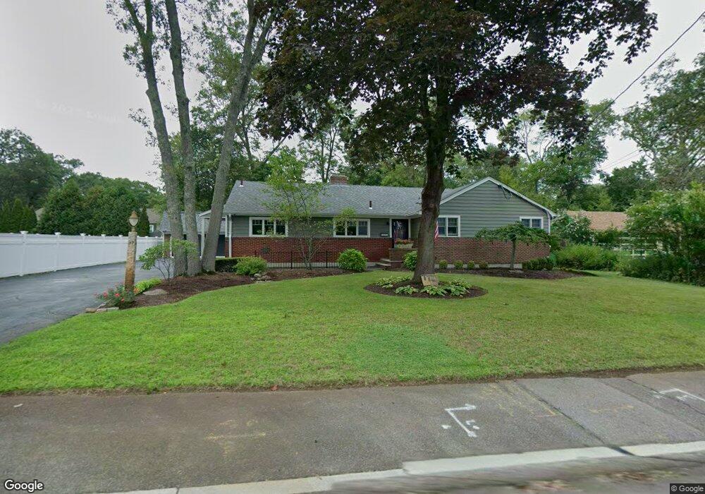
97 Sutherland Rd North Attleboro, MA 02760
North Attleboro NeighborhoodEstimated Value: $577,000 - $785,000
3
Beds
2
Baths
2,079
Sq Ft
$334/Sq Ft
Est. Value
About This Home
This home is located at 97 Sutherland Rd, North Attleboro, MA 02760 and is currently estimated at $694,049, approximately $333 per square foot. 97 Sutherland Rd is a home located in Bristol County with nearby schools including North Attleboro High School and Bishop Feehan High School.
Ownership History
Date
Name
Owned For
Owner Type
Purchase Details
Closed on
Nov 11, 2024
Sold by
Calautti John and Calautti Jean
Bought by
Calautti Ft and Calautti
Current Estimated Value
Purchase Details
Closed on
Oct 1, 1996
Sold by
97 Sutherland Rd Rt
Bought by
Calautti John and Calautti Jean
Create a Home Valuation Report for This Property
The Home Valuation Report is an in-depth analysis detailing your home's value as well as a comparison with similar homes in the area
Home Values in the Area
Average Home Value in this Area
Purchase History
| Date | Buyer | Sale Price | Title Company |
|---|---|---|---|
| Calautti Ft | -- | None Available | |
| Calautti Ft | -- | None Available | |
| Calautti John | $175,000 | -- | |
| Calautti John | $175,000 | -- |
Source: Public Records
Mortgage History
| Date | Status | Borrower | Loan Amount |
|---|---|---|---|
| Previous Owner | Calautti John | $125,000 | |
| Previous Owner | Calautti John | $140,000 | |
| Previous Owner | Calautti John | $123,000 |
Source: Public Records
Tax History Compared to Growth
Tax History
| Year | Tax Paid | Tax Assessment Tax Assessment Total Assessment is a certain percentage of the fair market value that is determined by local assessors to be the total taxable value of land and additions on the property. | Land | Improvement |
|---|---|---|---|---|
| 2025 | $7,943 | $673,700 | $145,000 | $528,700 |
| 2024 | $7,492 | $649,200 | $145,000 | $504,200 |
| 2023 | $7,324 | $572,600 | $151,300 | $421,300 |
| 2022 | $6,525 | $468,400 | $145,000 | $323,400 |
| 2021 | $6,491 | $454,900 | $145,000 | $309,900 |
| 2020 | $6,057 | $422,100 | $145,000 | $277,100 |
| 2019 | $5,823 | $408,900 | $131,800 | $277,100 |
| 2018 | $5,079 | $380,700 | $131,800 | $248,900 |
| 2017 | $4,877 | $368,900 | $131,800 | $237,100 |
| 2016 | $4,689 | $354,700 | $152,800 | $201,900 |
| 2015 | $4,529 | $344,700 | $159,200 | $185,500 |
| 2014 | $4,274 | $322,800 | $139,700 | $183,100 |
Source: Public Records
Map
Nearby Homes
- Lot 6 Sperry Ln
- 80 Broadway Unit 9
- 130 E Washington St Unit 57
- 130 E Washington St Unit 71
- 23-R Eddy Street (Eddy St Rear)
- 137 Sumner St
- 40 Roosevelt Ave
- 121 E Washington St Unit 8
- 121 E Washington St Unit 12
- 121 E Washington St Unit 13
- 121 E Washington St Unit 11
- 41 Roosevelt Ave
- 300 E Washington St Unit 54R
- 300 E Washington St Unit 20N
- 16 Johnson St
- 47 Reservoir St
- 36 Jefferson St
- 90 Walnut Rd
- 93 Bank St
- 138 Jefferson St
- 91 Sutherland Rd
- 109 Sutherland Rd
- 120 Metcalf Rd
- 112 Metcalf Rd
- 128 Metcalf Rd
- 83 Sutherland Rd
- 165 Anawan Rd
- 96 Sutherland Rd
- 104 Sutherland Rd
- 104 Metcalf Rd
- 136 Metcalf Rd
- 88 Sutherland Rd
- 155 Anawan Rd
- 121 Metcalf Rd
- 80 Sutherland Rd
- 113 Metcalf Rd
- 96 Metcalf Rd
- 8 Hillside Rd
- 147 Anawan Rd
- 91 Calvin Rd