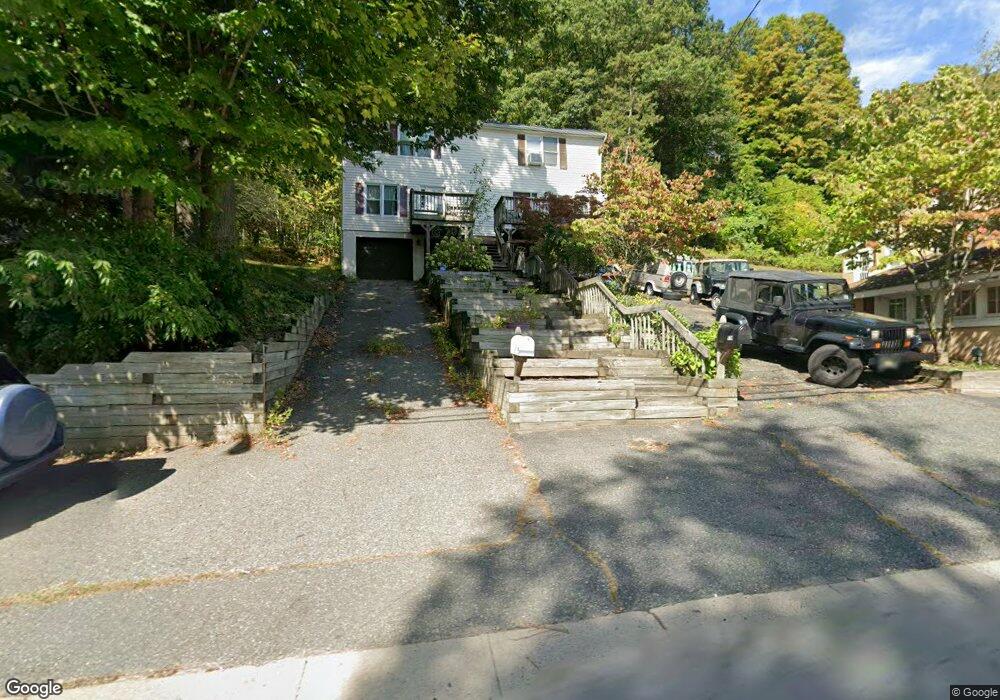
97 W Dewey Ave Wharton, NJ 07885
Estimated Value: $293,055 - $439,000
--
Bed
--
Bath
1,134
Sq Ft
$311/Sq Ft
Est. Value
About This Home
This home is located at 97 W Dewey Ave, Wharton, NJ 07885 and is currently estimated at $353,014, approximately $311 per square foot. 97 W Dewey Ave is a home located in Morris County with nearby schools including Marie V. Duffy Elementary School and A C Mac Kinnon Middle School.
Ownership History
Date
Name
Owned For
Owner Type
Purchase Details
Closed on
Oct 28, 1999
Sold by
Hrebenak Laurie
Bought by
Oswald David W and Taylor Laurie Beth
Current Estimated Value
Home Financials for this Owner
Home Financials are based on the most recent Mortgage that was taken out on this home.
Original Mortgage
$89,600
Outstanding Balance
$33,569
Interest Rate
10.74%
Estimated Equity
$319,445
Create a Home Valuation Report for This Property
The Home Valuation Report is an in-depth analysis detailing your home's value as well as a comparison with similar homes in the area
Home Values in the Area
Average Home Value in this Area
Purchase History
| Date | Buyer | Sale Price | Title Company |
|---|---|---|---|
| Oswald David W | $112,000 | -- |
Source: Public Records
Mortgage History
| Date | Status | Borrower | Loan Amount |
|---|---|---|---|
| Open | Oswald David W | $89,600 |
Source: Public Records
Tax History Compared to Growth
Tax History
| Year | Tax Paid | Tax Assessment Tax Assessment Total Assessment is a certain percentage of the fair market value that is determined by local assessors to be the total taxable value of land and additions on the property. | Land | Improvement |
|---|---|---|---|---|
| 2025 | $6,371 | $230,700 | $56,000 | $174,700 |
| 2024 | $6,009 | $215,300 | $53,700 | $161,600 |
| 2023 | $6,009 | $200,700 | $51,500 | $149,200 |
| 2022 | $5,547 | $190,000 | $51,500 | $138,500 |
| 2021 | $5,547 | $181,800 | $51,500 | $130,300 |
| 2020 | $5,410 | $174,000 | $49,200 | $124,800 |
| 2019 | $5,190 | $168,300 | $49,200 | $119,100 |
| 2018 | $4,874 | $161,300 | $47,000 | $114,300 |
| 2017 | $4,793 | $156,900 | $44,700 | $112,200 |
| 2016 | $4,487 | $157,600 | $44,700 | $112,900 |
| 2015 | $4,727 | $156,300 | $44,700 | $111,600 |
| 2014 | $4,741 | $155,100 | $44,700 | $110,400 |
Source: Public Records
Map
Nearby Homes
- 19123 Westview Unit 19123
- 22145 Westview
- 42 Fern Ave
- 12 Sunset Dr
- 8 Baker Ave
- 14 Kelly Ln
- 1 Beirne Ln
- 52 W Union Turnpike
- 10 Fernandez Ln
- 17 Anderson Rd
- 322 P7 Richard Mine Rd Unit 7
- 322 M5richard Mine Rd Unit 5
- 322 Richard Mine Rd Unit 9
- 322 Richard Mine Rd Unit 4
- 18 Wabash Ave
- 37 Garden Ave
- 75 White St
- 8 N Elk Ave
- 417 W Black Well St Ab
- 62 U S 46
- 99 W Dewey Ave Unit B
- 95 W Dewey Ave
- 96 W Dewey Ave
- 87 W Dewey Ave Unit 89
- 87-89 W Dewey Ave
- 88 W Dewey Ave
- 86 W Dewey Ave
- 77 W Dewey Ave
- 80 W Dewey Ave
- 46 High St
- 74 W Dewey Ave
- 40 High St
- 68 W Dewey Ave
- 26 High St
- 60 W Dewey Ave
- 59 W Dewey Ave
- 58 W Dewey Ave
- 20 High St
- 54 W Dewey Ave
- 49 W Dewey Ave