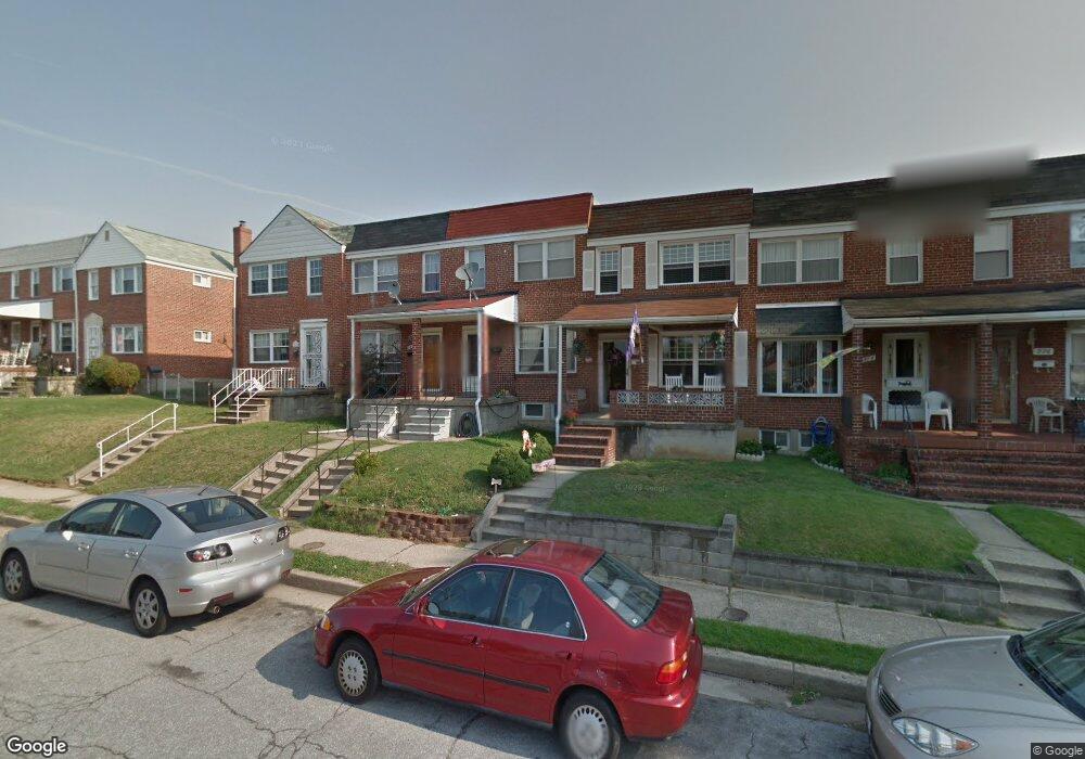
970 Dalton Ave Baltimore, MD 21224
Estimated Value: $166,000 - $211,000
3
Beds
1
Bath
1,024
Sq Ft
$179/Sq Ft
Est. Value
About This Home
This home is located at 970 Dalton Ave, Baltimore, MD 21224 and is currently estimated at $183,241, approximately $178 per square foot. 970 Dalton Ave is a home located in Baltimore County with nearby schools including Berkshire Elementary School, Holabird Middle School, and Patapsco High & Center for Arts.
Ownership History
Date
Name
Owned For
Owner Type
Purchase Details
Closed on
Mar 12, 2010
Sold by
Bank Of America National
Bought by
Haga Anthony S
Current Estimated Value
Purchase Details
Closed on
Nov 20, 2009
Sold by
Mcbee Michelle L
Bought by
Bank Of America National Association
Purchase Details
Closed on
Dec 1, 2005
Sold by
Mcbee James M
Bought by
Mcbee Michelle L
Home Financials for this Owner
Home Financials are based on the most recent Mortgage that was taken out on this home.
Original Mortgage
$100,000
Interest Rate
8.2%
Mortgage Type
Adjustable Rate Mortgage/ARM
Purchase Details
Closed on
Jun 9, 1999
Sold by
Craft John J
Bought by
Mcbee James M and Mcbee Michelle L
Create a Home Valuation Report for This Property
The Home Valuation Report is an in-depth analysis detailing your home's value as well as a comparison with similar homes in the area
Home Values in the Area
Average Home Value in this Area
Purchase History
We collect this data history from publicly available records. To have your information removed, we recommend requesting removal directly through your county’s website.
| Date | Buyer | Sale Price | Title Company |
|---|---|---|---|
| Haga Anthony S | $90,000 | -- | |
| Bank Of America National Association | $126,640 | -- | |
| Mcbee Michelle L | -- | -- | |
| Mcbee James M | $68,900 | -- |
Source: Public Records
Mortgage History
We collect this data history from publicly available records. To have your information removed, we recommend requesting removal directly through your county’s website.
| Date | Status | Borrower | Loan Amount |
|---|---|---|---|
| Previous Owner | Mcbee Michelle L | $100,000 |
Source: Public Records
Tax History
| Year | Tax Paid | Tax Assessment Tax Assessment Total Assessment is a certain percentage of the fair market value that is determined by local assessors to be the total taxable value of land and additions on the property. | Land | Improvement |
|---|---|---|---|---|
| 2025 | $2,352 | $137,400 | -- | -- |
| 2024 | $2,352 | $126,200 | $0 | $0 |
| 2023 | $1,105 | $115,000 | $30,000 | $85,000 |
| 2022 | $2,137 | $113,467 | $0 | $0 |
| 2021 | $1,950 | $111,933 | $0 | $0 |
| 2020 | $1,950 | $110,400 | $30,000 | $80,400 |
| 2019 | $1,966 | $106,433 | $0 | $0 |
| 2018 | $0 | $102,467 | $0 | $0 |
| 2017 | $1,763 | $98,500 | $0 | $0 |
| 2016 | $1,623 | $94,333 | $0 | $0 |
| 2015 | $1,623 | $90,167 | $0 | $0 |
| 2014 | $1,623 | $86,000 | $0 | $0 |
Source: Public Records
Map
Nearby Homes
- 930 Dalton Ave
- 7506 Belmont Ave
- 7412 Poplar Ave
- 7602 Carson Ave
- 7406 Poplar Ave
- 7487 Berkshire Rd
- 7450 Manchester Rd
- 608 Northpoint Rd
- 521 Fairview Ave
- 729 Aldworth Rd
- 856 Jeannette Ave
- 762 Fulbrook Rd
- 499 Fairview Ave
- 1219 N Point Rd
- 8002 Lansdale Rd
- 8013 Gough St
- 1301 N Point Rd
- 2426 Plainfield Rd
- 7812 Wynbrook Rd
- 7905 Eastdale Rd
Your Personal Tour Guide
Ask me questions while you tour the home.