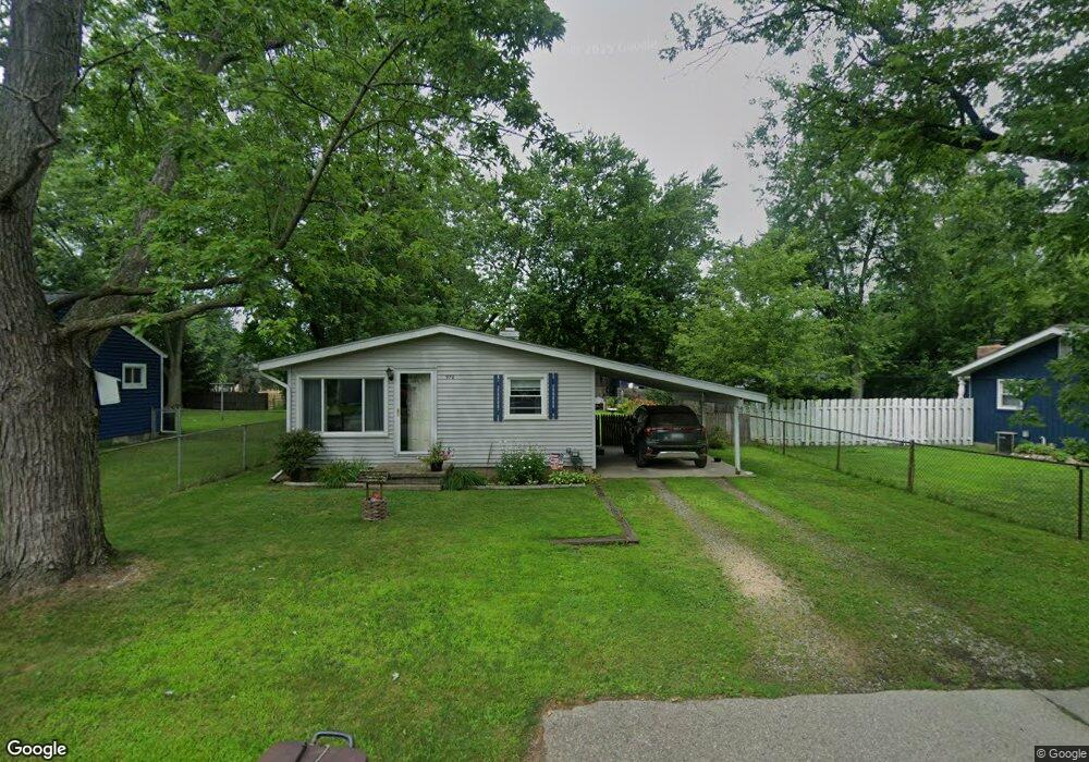
970 Gill St Oxford, MI 48371
Estimated Value: $212,534 - $237,000
3
Beds
1
Bath
920
Sq Ft
$245/Sq Ft
Est. Value
About This Home
This home is located at 970 Gill St, Oxford, MI 48371 and is currently estimated at $225,384, approximately $244 per square foot. 970 Gill St is a home located in Oakland County with nearby schools including Clear Lake Elementary School, Oxford Middle School, and Oxford High School.
Ownership History
Date
Name
Owned For
Owner Type
Purchase Details
Closed on
Aug 16, 2016
Sold by
Billgren Jacqueline
Bought by
Billgren Michael C and Billgren Jacqueline
Current Estimated Value
Purchase Details
Closed on
Nov 4, 2014
Sold by
Sherman Cheryl Lee
Bought by
Billgren Jacqueline
Purchase Details
Closed on
Oct 22, 2004
Sold by
Billgren Clair N and Billgren Nora Ann
Bought by
Billgren Jacqueline
Create a Home Valuation Report for This Property
The Home Valuation Report is an in-depth analysis detailing your home's value as well as a comparison with similar homes in the area
Home Values in the Area
Average Home Value in this Area
Purchase History
| Date | Buyer | Sale Price | Title Company |
|---|---|---|---|
| Billgren Michael C | -- | None Available | |
| Billgren Jacqueline | $30,564 | None Available | |
| Billgren Jacqueline | $30,564 | -- | |
| Billgren Clair N | -- | -- |
Source: Public Records
Mortgage History
| Date | Status | Borrower | Loan Amount |
|---|---|---|---|
| Closed | Billgren Jacqueline | $0 |
Source: Public Records
Tax History Compared to Growth
Tax History
| Year | Tax Paid | Tax Assessment Tax Assessment Total Assessment is a certain percentage of the fair market value that is determined by local assessors to be the total taxable value of land and additions on the property. | Land | Improvement |
|---|---|---|---|---|
| 2024 | $1,154 | $72,330 | $0 | $0 |
| 2023 | $1,101 | $71,930 | $0 | $0 |
| 2022 | $1,710 | $64,260 | $0 | $0 |
| 2021 | $1,635 | $59,090 | $0 | $0 |
| 2020 | $1,004 | $55,180 | $0 | $0 |
| 2019 | $1,468 | $50,370 | $0 | $0 |
| 2018 | $1,440 | $49,630 | $0 | $0 |
| 2017 | $1,384 | $47,680 | $0 | $0 |
| 2016 | $1,381 | $45,940 | $0 | $0 |
| 2015 | -- | $43,900 | $0 | $0 |
| 2014 | -- | $39,220 | $0 | $0 |
| 2011 | -- | $40,460 | $0 | $0 |
Source: Public Records
Map
Nearby Homes
- 967 Keith St
- 774 Keith St
- 2060 W Drahner Rd
- 1612 Royal Birkdale Dr Unit 77
- 1628 Royal Birkdale Dr Unit 76
- 1667 Royal Birkdale Dr
- 1611 Harwood Dr
- 1315 Beemer Ct
- 1320 W Drahner Rd
- 302 Tanview Dr
- 1910 Royal Birkdale Dr
- 1858 Sandy Shores Dr
- 1904 Sandy Shores Dr
- 1126 Watersmeet Dr
- 1531 Seymour Lake Rd
- 1974 Sandy Shores Dr
- 1 Pinery Ct
- 1060 Tinley Blvd
- 861 Seymour Lake Rd
- 948 Watersmeet Dr