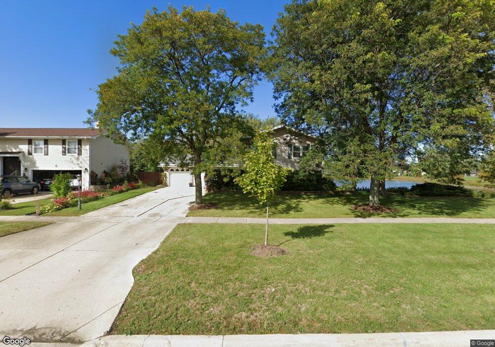
970 Hassell Rd Hoffman Estates, IL 60169
High Point Park NeighborhoodEstimated Value: $419,000 - $469,000
4
Beds
3
Baths
1,511
Sq Ft
$294/Sq Ft
Est. Value
About This Home
This home is located at 970 Hassell Rd, Hoffman Estates, IL 60169 and is currently estimated at $444,755, approximately $294 per square foot. 970 Hassell Rd is a home located in Cook County with nearby schools including MacArthur International Spanish Academy, Dwight D Eisenhower Junior High School, and Hoffman Estates High School.
Ownership History
Date
Name
Owned For
Owner Type
Purchase Details
Closed on
May 15, 2003
Sold by
Brougham Francis X and Brougham Val
Bought by
Schneider Adam John and Schneider Kari Ann
Current Estimated Value
Home Financials for this Owner
Home Financials are based on the most recent Mortgage that was taken out on this home.
Original Mortgage
$252,000
Interest Rate
5.78%
Mortgage Type
Balloon
Create a Home Valuation Report for This Property
The Home Valuation Report is an in-depth analysis detailing your home's value as well as a comparison with similar homes in the area
Home Values in the Area
Average Home Value in this Area
Purchase History
| Date | Buyer | Sale Price | Title Company |
|---|---|---|---|
| Schneider Adam John | $315,000 | -- | |
| Schneider Adam John | $315,000 | -- |
Source: Public Records
Mortgage History
| Date | Status | Borrower | Loan Amount |
|---|---|---|---|
| Closed | Schneider Adam John | $252,000 |
Source: Public Records
Tax History
| Year | Tax Paid | Tax Assessment Tax Assessment Total Assessment is a certain percentage of the fair market value that is determined by local assessors to be the total taxable value of land and additions on the property. | Land | Improvement |
|---|---|---|---|---|
| 2025 | $8,778 | $37,000 | $8,694 | $28,306 |
| 2024 | $8,778 | $31,920 | $7,245 | $24,675 |
| 2023 | $8,464 | $31,920 | $7,245 | $24,675 |
| 2022 | $8,464 | $31,920 | $7,245 | $24,675 |
| 2021 | $6,391 | $22,406 | $4,830 | $17,576 |
| 2020 | $6,316 | $22,406 | $4,830 | $17,576 |
| 2019 | $6,285 | $24,896 | $4,830 | $20,066 |
| 2018 | $6,435 | $23,169 | $4,105 | $19,064 |
| 2017 | $6,339 | $23,169 | $4,105 | $19,064 |
| 2016 | $6,159 | $23,169 | $4,105 | $19,064 |
| 2015 | $5,569 | $19,963 | $3,622 | $16,341 |
| 2014 | $5,488 | $19,963 | $3,622 | $16,341 |
| 2013 | $5,329 | $19,963 | $3,622 | $16,341 |
Source: Public Records
Map
Nearby Homes
- 1095 Lancaster Ct
- 730 Ashley Ct
- 1665 Chippendale Rd
- 1410 Nottingham Ln
- 590 Durham Ct
- 1360 Devonshire Ln
- 1570 Jefferson Rd
- 755 Cambridge Ln
- 1930 Kenilworth Cir Unit E
- 1938 Huntington Blvd
- 1335 Blair Ln
- 1750 Sleepy Hollow Ct Unit 3
- 1712 Fayette Walk Unit D
- 1834 Jamestown Cir Unit 3114
- 1365 Newcastle Ln
- 1769 Sessions Walk Unit C
- 100 White Oak Ct Unit 1
- 1724 Fayette Walk Unit J
- 720 Hill Dr Unit 8303
- 1180 Meadow Ln Unit 6306
- 980 Hassell Rd
- 2010 Carling Rd
- 990 Hassell Rd
- 2020 Carling Rd
- 2030 Carling Rd
- 2040 Carling Rd
- 1010 Hassell Rd
- 1015 Mayfield Ln
- 1960 N Lakeside Plaza
- 930 Hassell Rd
- 2050 Carling Rd
- 1950 N Lakeside Plaza
- 1020 Hassell Rd
- 1025 Mayfield Ln
- 1970 N Lakeside Plaza
- 1005 Hassell Rd
- 920 Hassell Rd
- 1010 Mayfield Ln
- 2060 Carling Rd
- 1015 Hassell Rd
Your Personal Tour Guide
Ask me questions while you tour the home.