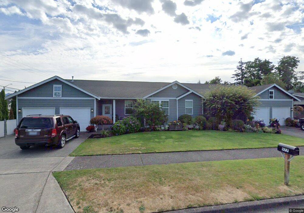
970 Natalie Place Unit 2 Enumclaw, WA 98022
Estimated Value: $390,000 - $428,000
3
Beds
2
Baths
1,275
Sq Ft
$320/Sq Ft
Est. Value
About This Home
This home is located at 970 Natalie Place Unit 2, Enumclaw, WA 98022 and is currently estimated at $407,645, approximately $319 per square foot. 970 Natalie Place Unit 2 is a home located in King County with nearby schools including Sunrise Elementary School, Enumclaw Middle School, and Enumclaw Senior High School.
Ownership History
Date
Name
Owned For
Owner Type
Purchase Details
Closed on
Sep 13, 2006
Sold by
Wilmoor Development Corp
Bought by
Rick Burnstead Construction Co
Current Estimated Value
Purchase Details
Closed on
Mar 1, 2006
Sold by
Persons Rental Properties Commercial Llc
Bought by
Mckee Josh C and Mckee Natalie
Home Financials for this Owner
Home Financials are based on the most recent Mortgage that was taken out on this home.
Original Mortgage
$180,800
Interest Rate
6.15%
Mortgage Type
Fannie Mae Freddie Mac
Create a Home Valuation Report for This Property
The Home Valuation Report is an in-depth analysis detailing your home's value as well as a comparison with similar homes in the area
Home Values in the Area
Average Home Value in this Area
Purchase History
| Date | Buyer | Sale Price | Title Company |
|---|---|---|---|
| Rick Burnstead Construction Co | $1,900,000 | Chicago Title | |
| Mckee Josh C | $226,000 | Stewart Title |
Source: Public Records
Mortgage History
| Date | Status | Borrower | Loan Amount |
|---|---|---|---|
| Previous Owner | Mckee Josh C | $180,800 |
Source: Public Records
Tax History
| Year | Tax Paid | Tax Assessment Tax Assessment Total Assessment is a certain percentage of the fair market value that is determined by local assessors to be the total taxable value of land and additions on the property. | Land | Improvement |
|---|---|---|---|---|
| 2024 | $3,803 | $396,000 | $74,400 | $321,600 |
| 2023 | $3,421 | $426,000 | $74,400 | $351,600 |
| 2022 | $3,143 | $376,000 | $60,000 | $316,000 |
| 2021 | $3,229 | $313,000 | $55,000 | $258,000 |
| 2020 | $3,016 | $293,000 | $53,200 | $239,800 |
| 2018 | $3,261 | $283,000 | $52,500 | $230,500 |
| 2017 | $3,005 | $266,000 | $50,000 | $216,000 |
| 2016 | $2,438 | $253,000 | $50,000 | $203,000 |
| 2015 | $2,357 | $202,000 | $40,000 | $162,000 |
| 2014 | -- | $187,000 | $40,000 | $147,000 |
| 2013 | -- | $187,000 | $50,000 | $137,000 |
Source: Public Records
Map
Nearby Homes
- 2054 Roosevelt Ave
- 1234 Lincoln Ave Unit A
- 1101 Wells St
- 522 Harmony Ln
- 525 Grand Fir Dr
- 520 Willow Dr Unit 111
- 1170 Cedar Dr
- 1137 Spruce Dr
- 209 Noble Fir Cir Unit 60
- 272 Grand Fir Dr Unit 26
- 207 Noble Fir Cir
- 901 Bathke Ave
- 915 Mountain Villa Dr
- 3189 Roosevelt Ave
- 936 Mountain Villa Dr
- 823 Cottonwood Dr
- 1107 Griffin Ave
- 3183 Roosevelt Ave
- 1722 Harding St
- 806 Pine Dr
- 970 Natalie Place Unit 1
- 963 Natalie Place
- 927 Natalie Place
- 917 Natalie Place Unit 2
- 917 Natalie Place Unit 1
- 917 Natalie Place
- 917 Natalie Place Unit B
- 917 Natalie Place Unit A
- 919 Natalie Place
- 2250 Roosevelt Ave
- 948 Myrtine St
- 928 Myrtine St
- 922 Natalie Place
- 907 Natalie Place
- 2247 Roosevelt Ave
- 2300 Roosevelt Ave
- 910 Natalie Place
- 910 Myrtine St
- 2145 Roosevelt Ave
- 1024 Pioneer St
Your Personal Tour Guide
Ask me questions while you tour the home.