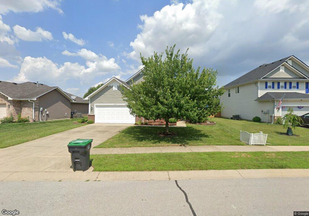
970 Nicole Way Whiteland, IN 46184
Estimated Value: $236,000 - $280,000
3
Beds
2
Baths
1,755
Sq Ft
$151/Sq Ft
Est. Value
About This Home
This home is located at 970 Nicole Way, Whiteland, IN 46184 and is currently estimated at $265,396, approximately $151 per square foot. 970 Nicole Way is a home located in Johnson County with nearby schools including Break-O-Day Elementary School, Clark-Pleasant Middle School, and Whiteland Community High School.
Ownership History
Date
Name
Owned For
Owner Type
Purchase Details
Closed on
Jun 25, 2008
Sold by
Olsson Michael S
Bought by
Stiff Earl B and Stiff Georgia C
Current Estimated Value
Home Financials for this Owner
Home Financials are based on the most recent Mortgage that was taken out on this home.
Original Mortgage
$89,000
Interest Rate
6.1%
Purchase Details
Closed on
Nov 22, 2006
Sold by
Dura Builders Inc
Bought by
Olsson Michael S
Create a Home Valuation Report for This Property
The Home Valuation Report is an in-depth analysis detailing your home's value as well as a comparison with similar homes in the area
Home Values in the Area
Average Home Value in this Area
Purchase History
| Date | Buyer | Sale Price | Title Company |
|---|---|---|---|
| Stiff Earl B | -- | Chicago Title Insurance Co | |
| Olsson Michael S | -- | Stewart Title Services Of In |
Source: Public Records
Mortgage History
| Date | Status | Borrower | Loan Amount |
|---|---|---|---|
| Previous Owner | Stiff Earl B | $89,000 |
Source: Public Records
Tax History Compared to Growth
Tax History
| Year | Tax Paid | Tax Assessment Tax Assessment Total Assessment is a certain percentage of the fair market value that is determined by local assessors to be the total taxable value of land and additions on the property. | Land | Improvement |
|---|---|---|---|---|
| 2025 | $2,507 | $247,400 | $56,000 | $191,400 |
| 2024 | $2,507 | $240,000 | $56,000 | $184,000 |
| 2023 | $2,456 | $235,300 | $56,000 | $179,300 |
| 2022 | $2,080 | $200,900 | $29,900 | $171,000 |
| 2021 | $1,765 | $170,300 | $29,900 | $140,400 |
| 2020 | $1,573 | $151,200 | $29,900 | $121,300 |
| 2019 | $1,447 | $139,400 | $29,900 | $109,500 |
| 2018 | $1,393 | $133,900 | $17,600 | $116,300 |
| 2017 | $1,392 | $137,300 | $17,600 | $119,700 |
| 2016 | $1,329 | $131,900 | $17,600 | $114,300 |
| 2014 | $1,240 | $122,800 | $21,600 | $101,200 |
| 2013 | $1,240 | $123,600 | $21,600 | $102,000 |
Source: Public Records
Map
Nearby Homes
- 132 Arabian Ct
- 1003 Hilltop Commons Blvd
- 647 Bluestem Cir
- 733 Hanover Dr
- 587 Bluestem Ln
- 114 Tracy Ridge Blvd
- 588 Bluestem Ln
- Lincoln Plan at Crossroads at Southport
- Liberty Plan at Crossroads at Southport
- Rushmore Plan at Crossroads at Southport
- Jefferson Plan at Crossroads at Southport
- Washington Plan at Crossroads at Southport
- 76 Fernleaf Dr
- 190 Tracy Ridge Blvd
- 652 Mooreland Dr
- 1195 Count Turf Ct
- 125 Hilltop Farms Blvd
- 256 Bittersweet Dr
- 240 Shelton Place
- 0 E 700 N Unit MBR22036500