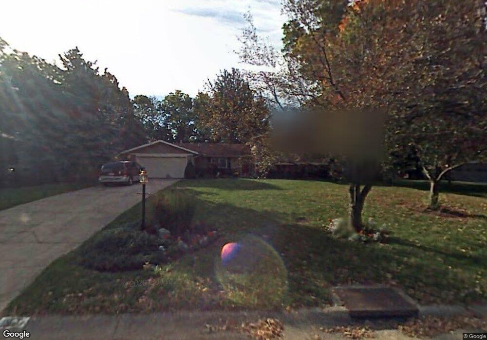
970 Pheasant Run Dr Dayton, OH 45458
Estimated Value: $396,000 - $472,000
4
Beds
3
Baths
2,760
Sq Ft
$162/Sq Ft
Est. Value
About This Home
This home is located at 970 Pheasant Run Dr, Dayton, OH 45458 and is currently estimated at $447,385, approximately $162 per square foot. 970 Pheasant Run Dr is a home located in Montgomery County with nearby schools including Primary Village South, Cline Elementary, and Magsig Middle School.
Ownership History
Date
Name
Owned For
Owner Type
Purchase Details
Closed on
Jul 30, 2018
Sold by
Stolte Christopher D and Stolte Samantha J
Bought by
Brandell Jason and Brandell Sarah
Current Estimated Value
Home Financials for this Owner
Home Financials are based on the most recent Mortgage that was taken out on this home.
Original Mortgage
$286,150
Outstanding Balance
$248,510
Interest Rate
4.5%
Mortgage Type
Future Advance Clause Open End Mortgage
Estimated Equity
$198,875
Purchase Details
Closed on
Nov 13, 2012
Bought by
Stolte Christopher D and Stolte Samantha J
Home Financials for this Owner
Home Financials are based on the most recent Mortgage that was taken out on this home.
Original Mortgage
$178,000
Interest Rate
3.37%
Mortgage Type
VA
Purchase Details
Closed on
Jan 25, 2005
Sold by
Mawhirter Catherine J
Bought by
Mawhirter John M
Create a Home Valuation Report for This Property
The Home Valuation Report is an in-depth analysis detailing your home's value as well as a comparison with similar homes in the area
Home Values in the Area
Average Home Value in this Area
Purchase History
| Date | Buyer | Sale Price | Title Company |
|---|---|---|---|
| Brandell Jason | $295,000 | Fidelity Lawyers Title Agenc | |
| Stolte Christopher D | $178,000 | Sterling Land Title North Ll | |
| Mawhirter John M | -- | Chicago Title Insurance Co |
Source: Public Records
Mortgage History
| Date | Status | Borrower | Loan Amount |
|---|---|---|---|
| Open | Brandell Jason | $286,150 | |
| Previous Owner | Stolte Christopher D | $178,000 |
Source: Public Records
Tax History Compared to Growth
Tax History
| Year | Tax Paid | Tax Assessment Tax Assessment Total Assessment is a certain percentage of the fair market value that is determined by local assessors to be the total taxable value of land and additions on the property. | Land | Improvement |
|---|---|---|---|---|
| 2024 | $8,534 | $138,590 | $20,290 | $118,300 |
| 2023 | $8,534 | $138,590 | $20,290 | $118,300 |
| 2022 | $7,824 | $100,510 | $14,700 | $85,810 |
| 2021 | $7,845 | $100,510 | $14,700 | $85,810 |
| 2020 | $7,834 | $100,510 | $14,700 | $85,810 |
| 2019 | $5,624 | $64,410 | $14,700 | $49,710 |
| 2018 | $5,023 | $64,410 | $14,700 | $49,710 |
| 2017 | $4,970 | $64,410 | $14,700 | $49,710 |
| 2016 | $4,848 | $59,220 | $14,700 | $44,520 |
| 2015 | $4,770 | $59,220 | $14,700 | $44,520 |
| 2014 | $4,770 | $59,220 | $14,700 | $44,520 |
| 2012 | -- | $63,340 | $14,700 | $48,640 |
Source: Public Records
Map
Nearby Homes
- 9618 Whalers Wharf Unit 833
- 240 Queens Crossing Unit 23121
- 154 Queens Crossing Unit 31152
- 9230 Bottega South Dr Unit 38
- 9155 Remy Ct
- 9161 Remy
- 9215 Bottega South Dr Unit 66
- 9197 Remy Ct
- 9971 Stonemeade Way
- 1016 Quiet Brook Trail
- 10055 Mallet Dr
- 300 Grassy Creek Way
- 9652 Belfry Ct Unit 29652
- 1052 Quiet Brook Trail
- 30 Edinburgh Village Dr Unit 530
- 9667 Quailwood Trail
- 184 Edinburgh Village Dr Unit 13184
- 9517 Moorgate Ct
- 1071 Star Valley Ct
- 1200 Sweet Audrey Ct
- 980 Pheasant Run Dr
- 960 Pheasant Run Dr
- 9621 Burnet Isle Dr
- 9611 Burnet Isle Dr
- 971 Pheasant Run Dr
- 950 Pheasant Run Dr
- 990 Pheasant Run Dr
- 961 Pheasant Run Dr
- 981 Pheasant Run Dr
- 9641 Burnet Isle Dr
- 9601 Burnet Isle Dr
- 951 Pheasant Run Dr
- 991 Pheasant Run Dr
- 9651 Burnet Isle Dr
- 9509 Lindner Ln
- 9600 Burnet Isle Dr
- 840 Watkins Glen Dr
- 9505 Lindner Ln
- 9647 Atchison Rd
- 9661 Burnet Isle Dr