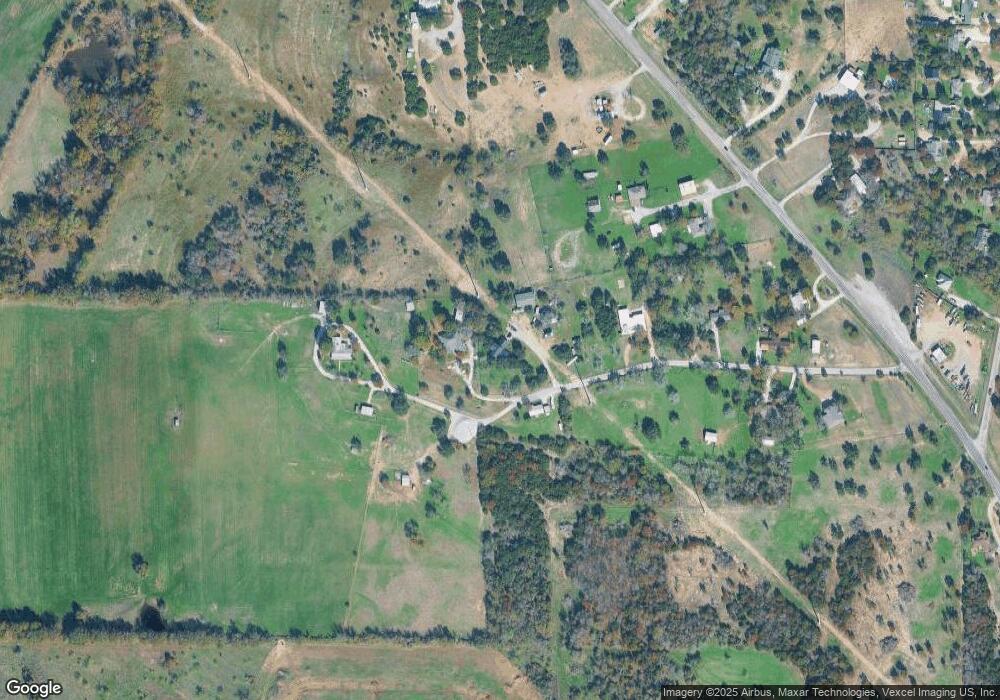
970 Red Bird Ln Weatherford, TX 76088
Estimated Value: $558,000 - $663,000
3
Beds
3
Baths
2,854
Sq Ft
$215/Sq Ft
Est. Value
About This Home
This home is located at 970 Red Bird Ln, Weatherford, TX 76088 and is currently estimated at $612,920, approximately $214 per square foot. 970 Red Bird Ln is a home located in Parker County with nearby schools including Peaster Elementary School, Peaster Middle School, and Peaster High School.
Ownership History
Date
Name
Owned For
Owner Type
Purchase Details
Closed on
Nov 27, 2006
Sold by
Kirkpatrick Terry and Kirkpatrick Karen
Bought by
Colledge George R and Colledge Anna J
Current Estimated Value
Purchase Details
Closed on
Oct 21, 2004
Sold by
Colledge George E and Colledge Anna J
Bought by
Colledge George R and Colledge Anna J
Purchase Details
Closed on
Jun 30, 1995
Bought by
Colledge George R and Colledge Anna J
Purchase Details
Closed on
May 9, 1988
Bought by
Colledge George R and Colledge Anna J
Create a Home Valuation Report for This Property
The Home Valuation Report is an in-depth analysis detailing your home's value as well as a comparison with similar homes in the area
Home Values in the Area
Average Home Value in this Area
Purchase History
| Date | Buyer | Sale Price | Title Company |
|---|---|---|---|
| Colledge George R | -- | None Available | |
| Colledge George R | -- | -- | |
| Colledge George R | -- | -- | |
| Colledge George R | -- | -- |
Source: Public Records
Tax History Compared to Growth
Tax History
| Year | Tax Paid | Tax Assessment Tax Assessment Total Assessment is a certain percentage of the fair market value that is determined by local assessors to be the total taxable value of land and additions on the property. | Land | Improvement |
|---|---|---|---|---|
| 2025 | $10,470 | $498,220 | $224,590 | $273,630 |
| 2024 | $10,470 | $604,740 | $199,410 | $405,330 |
| 2023 | $10,470 | $603,840 | $199,410 | $404,430 |
| 2022 | $8,747 | $438,540 | $125,940 | $312,600 |
| 2021 | $8,816 | $438,540 | $125,940 | $312,600 |
| 2020 | $7,733 | $377,050 | $97,250 | $279,800 |
| 2019 | $8,125 | $377,050 | $97,250 | $279,800 |
| 2018 | $5,772 | $267,070 | $31,170 | $235,900 |
| 2017 | $5,744 | $267,070 | $31,170 | $235,900 |
| 2016 | $5,426 | $252,280 | $31,170 | $221,110 |
| 2015 | $5,351 | $252,280 | $31,170 | $221,110 |
| 2014 | $4,453 | $217,780 | $31,170 | $186,610 |
Source: Public Records
Map
Nearby Homes
- 905 Zion Hill Rd
- 107 Hall St
- 105 Oxford Ct
- 3004 Greg Allen Dr
- 2124 Pepperdine Dr
- 2016 Vanderbilt Dr
- 2020 Vanderbilt Dr
- 2117 Pepperdine Dr
- Lot 11 Pepperdine Dr
- Lot 12 Pepperdine Dr
- Lot 10 Pepperdine Dr
- 104 Lagrange Ct
- TBD Hwy 920 Hwy
- 2000 Vanderbilt Dr
- Hillside Plan at Woodland Lakes Estates
- Haven Plan at Woodland Lakes Estates
- 1045 Woodland Rd
- 1037 Woodland Rd
- 2050 Woodland Rd
- 2055 Woodland Rd
- 980 Red Bird Ln
- 971 Red Bird Ln
- 960 Red Bird Ln
- 990 Red Bird Ln
- 1101 Zion Hill Rd
- 1105 Zion Hill Rd
- 950 Red Bird Ln
- 1265 Zion Hill Rd
- 941 Red Bird Ln
- 940 Red Bird Ln
- 1055 Zion Hill Rd
- 0000 Zion Hill Rd
- 000 Zion Hill Rd
- TBD Zion Hill Rd
- 1051 Zion Hill Rd
- 1301 Zion Hill Rd
- 1102 Zion Hill Rd
- 1260 Zion Hill Rd
- 1280 Zion Hill Rd
- 1270 Zion Hill Rd
