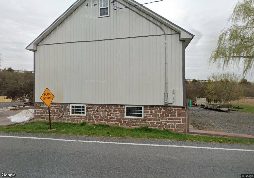
970 Stone Hill Rd Denver, PA 17517
Estimated Value: $288,000 - $386,000
3
Beds
1
Bath
1,664
Sq Ft
$210/Sq Ft
Est. Value
About This Home
This home is located at 970 Stone Hill Rd, Denver, PA 17517 and is currently estimated at $348,792, approximately $209 per square foot. 970 Stone Hill Rd is a home located in Lancaster County with nearby schools including Cocalico Senior High School and Gehmans Mennonite School.
Ownership History
Date
Name
Owned For
Owner Type
Purchase Details
Closed on
Apr 14, 2010
Sold by
Brubaker James M
Bought by
Wise Grant H
Current Estimated Value
Home Financials for this Owner
Home Financials are based on the most recent Mortgage that was taken out on this home.
Original Mortgage
$105,750
Outstanding Balance
$70,328
Interest Rate
4.97%
Mortgage Type
Credit Line Revolving
Estimated Equity
$278,464
Create a Home Valuation Report for This Property
The Home Valuation Report is an in-depth analysis detailing your home's value as well as a comparison with similar homes in the area
Home Values in the Area
Average Home Value in this Area
Purchase History
| Date | Buyer | Sale Price | Title Company |
|---|---|---|---|
| Wise Grant H | $140,000 | None Available |
Source: Public Records
Mortgage History
| Date | Status | Borrower | Loan Amount |
|---|---|---|---|
| Open | Wise Grant H | $105,750 |
Source: Public Records
Tax History Compared to Growth
Tax History
| Year | Tax Paid | Tax Assessment Tax Assessment Total Assessment is a certain percentage of the fair market value that is determined by local assessors to be the total taxable value of land and additions on the property. | Land | Improvement |
|---|---|---|---|---|
| 2025 | $5,012 | $201,200 | $93,900 | $107,300 |
| 2024 | $5,012 | $201,200 | $93,900 | $107,300 |
| 2023 | $4,889 | $201,200 | $93,900 | $107,300 |
| 2022 | $4,759 | $201,200 | $93,900 | $107,300 |
| 2021 | $4,752 | $201,200 | $93,900 | $107,300 |
| 2020 | $4,752 | $201,200 | $93,900 | $107,300 |
| 2019 | $4,696 | $201,200 | $93,900 | $107,300 |
| 2018 | $3,761 | $201,200 | $93,900 | $107,300 |
| 2017 | $4,285 | $149,800 | $52,700 | $97,100 |
| 2016 | $4,285 | $149,800 | $52,700 | $97,100 |
| 2015 | $3,344 | $149,800 | $52,700 | $97,100 |
| 2014 | $3,344 | $149,800 | $52,700 | $97,100 |
Source: Public Records
Map
Nearby Homes
- 17 Sanderling Dr
- 13 Sanderling Dr
- 82 Scenic Dr
- 17 W Kestrel Dr
- 20 Hill Rd
- 27 Lausch Rd
- 303 W Swartzville Rd
- 2101 Kramer Mill Rd
- 102 Evergreen Rd
- 93 E Main St
- 3 Whitetail Dr
- 256 W Valley Rd
- Westbrooke Plan at Hawk Valley Estates
- Callahan Plan at Hawk Valley Estates
- Silverbrooke Plan at Hawk Valley Estates
- Wesley Plan at Hawk Valley Estates
- Bridgemont Plan at Hawk Valley Estates
- Logan Plan at Hawk Valley Estates
- Brookfield Plan at Hawk Valley Estates
- Kingston Plan at Hawk Valley Estates
- 985 Stone Hill Rd
- 985 Stone Hill Rd
- 985 Stone Hill Rd
- 35 Grouse Dr
- 37 Grouse Dr
- 39 Grouse Dr
- 33 Grouse Dr
- 41 Grouse Dr
- 31 Grouse Dr
- 29 Grouse Dr
- 27 Grouse Dr
- 25 Grouse Dr
- 23 Grouse Dr
- 21 Grouse Dr
- 19 Grouse Dr
- 17 Grouse Dr
- 0 S Muddy Creek Rd Unit 1005881990
- 0 S Muddy Creek Rd Unit 20 1002728545
- 0 S Muddy Creek Rd
- 15 Grouse Dr