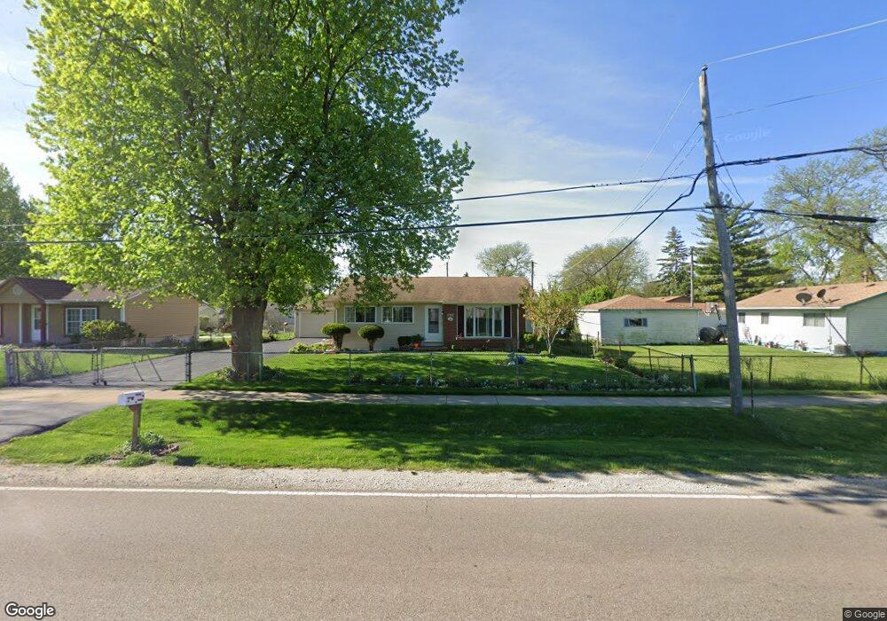
970 Sullivan Rd Unit 1 Aurora, IL 60506
North River NeighborhoodEstimated Value: $267,000 - $308,000
3
Beds
2
Baths
1,209
Sq Ft
$238/Sq Ft
Est. Value
About This Home
This home is located at 970 Sullivan Rd Unit 1, Aurora, IL 60506 and is currently estimated at $288,257, approximately $238 per square foot. 970 Sullivan Rd Unit 1 is a home located in Kane County with nearby schools including Smith Elementary School, Jewel Middle School, and West Aurora High School.
Ownership History
Date
Name
Owned For
Owner Type
Purchase Details
Closed on
Oct 27, 1994
Sold by
Bui Nang The
Bought by
Rodriguez Alfredo and Rodriguez Maria P
Current Estimated Value
Home Financials for this Owner
Home Financials are based on the most recent Mortgage that was taken out on this home.
Original Mortgage
$68,600
Interest Rate
8.68%
Create a Home Valuation Report for This Property
The Home Valuation Report is an in-depth analysis detailing your home's value as well as a comparison with similar homes in the area
Home Values in the Area
Average Home Value in this Area
Purchase History
| Date | Buyer | Sale Price | Title Company |
|---|---|---|---|
| Rodriguez Alfredo | $98,000 | First American Title Insuran |
Source: Public Records
Mortgage History
| Date | Status | Borrower | Loan Amount |
|---|---|---|---|
| Closed | Rodriguez Alfredo | $68,600 |
Source: Public Records
Tax History
| Year | Tax Paid | Tax Assessment Tax Assessment Total Assessment is a certain percentage of the fair market value that is determined by local assessors to be the total taxable value of land and additions on the property. | Land | Improvement |
|---|---|---|---|---|
| 2024 | $3,637 | $84,240 | $11,933 | $72,307 |
| 2023 | $3,935 | $75,268 | $10,662 | $64,606 |
| 2022 | $4,509 | $68,675 | $9,728 | $58,947 |
| 2021 | $5,111 | $63,937 | $9,057 | $54,880 |
| 2020 | $5,495 | $66,702 | $8,413 | $58,289 |
| 2019 | $5,261 | $61,801 | $7,795 | $54,006 |
| 2018 | $4,781 | $55,894 | $7,210 | $48,684 |
| 2017 | $4,079 | $47,629 | $6,643 | $40,986 |
| 2016 | $3,960 | $45,273 | $5,694 | $39,579 |
| 2015 | -- | $39,541 | $4,896 | $34,645 |
| 2014 | -- | $36,881 | $4,709 | $32,172 |
| 2013 | -- | $38,620 | $4,642 | $33,978 |
Source: Public Records
Map
Nearby Homes
- 1337 Eastwood Dr
- 742 Cedardale Place Unit 2
- 900 Old Indian Trail
- 1041 N Elmwood Dr
- 691 Old Indian Trail
- 461 Sullivan Rd
- 847 Foran Ln
- 422 Princeton Dr
- 451 Colorado Ave
- 28 S Willow Way
- 833 N Randall Rd Unit C4
- 1317 Monomoy St Unit E
- 732 N Fordham Ave
- 1911 Ash Ct
- 1335 Foxcroft Dr
- 1000 Grand Ave
- 991 Sapphire Ln
- 975 Sapphire Ln
- 963 Sapphire Ln
- 987 Sapphire Ln
- 960 Sullivan Rd
- 1491 N Elmwood Dr
- 1481 N Elmwood Dr
- 971 Arlon Rd
- 950 Sullivan Rd
- 961 Arlon Rd
- 981 Arlon Rd
- 951 Arlon Rd
- 940 Sullivan Rd
- 941 Arlon Rd
- 1490 N Elmwood Dr
- 1480 N Elmwood Dr
- 930 Sullivan Rd
- 1470 N Elmwood Dr
- 980 Arlon Rd
- 970 Arlon Rd
- 931 Arlon Rd
- 960 Arlon Rd
- 1460 N Elmwood Dr
- 920 Sullivan Rd
Your Personal Tour Guide
Ask me questions while you tour the home.