Estimated Value: $479,000 - $566,000
3
Beds
3
Baths
1,596
Sq Ft
$323/Sq Ft
Est. Value
About This Home
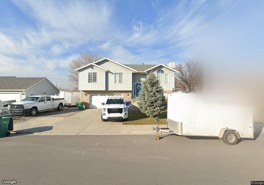
This home is located at 970 W 1600 N, Lehi, UT 84043 and is currently estimated at $515,497, approximately $322 per square foot. 970 W 1600 N is a home located in Utah County with nearby schools including Lehi Elementary School, Lehi Junior High School, and Lehi High School.
Ownership History
Date
Name
Owned For
Owner Type
Purchase Details
Closed on
Jan 16, 2020
Sold by
Washburn Brian Mckay
Bought by
Aranguren Maria Paula Cascavita and Camelo Jorge A
Current Estimated Value
Home Financials for this Owner
Home Financials are based on the most recent Mortgage that was taken out on this home.
Original Mortgage
$307,800
Outstanding Balance
$271,954
Interest Rate
3.6%
Mortgage Type
New Conventional
Estimated Equity
$243,543
Purchase Details
Closed on
Sep 15, 2017
Sold by
Griggs Niko A
Bought by
Washburn Brian Mckay
Home Financials for this Owner
Home Financials are based on the most recent Mortgage that was taken out on this home.
Original Mortgage
$238,400
Interest Rate
3.93%
Mortgage Type
New Conventional
Purchase Details
Closed on
Jan 19, 2016
Sold by
Black Ray Merle and Black Brandy
Bought by
Griggs Niko
Purchase Details
Closed on
Sep 3, 2003
Sold by
Black Ray Merle and Black Brandy
Bought by
Black Ray Merle and Black Brandy
Home Financials for this Owner
Home Financials are based on the most recent Mortgage that was taken out on this home.
Original Mortgage
$150,636
Interest Rate
5.87%
Mortgage Type
FHA
Purchase Details
Closed on
Jan 20, 1999
Sold by
Smith Jeffrey S and Smith Michelle D
Bought by
Smith Jeffery S and Smith Michelle B
Home Financials for this Owner
Home Financials are based on the most recent Mortgage that was taken out on this home.
Original Mortgage
$136,800
Interest Rate
6.63%
Purchase Details
Closed on
Oct 1, 1998
Sold by
Minnig Dale M
Bought by
Smith Jeffrey S and Smith Michelle B
Home Financials for this Owner
Home Financials are based on the most recent Mortgage that was taken out on this home.
Original Mortgage
$133,000
Interest Rate
6.88%
Purchase Details
Closed on
Sep 4, 1997
Sold by
Minnig Dale F
Bought by
Minnig Dale F
Create a Home Valuation Report for This Property
The Home Valuation Report is an in-depth analysis detailing your home's value as well as a comparison with similar homes in the area
Home Values in the Area
Average Home Value in this Area
Purchase History
| Date | Buyer | Sale Price | Title Company |
|---|---|---|---|
| Aranguren Maria Paula Cascavita | -- | Gt Title Svcs Spanish Fork | |
| Washburn Brian Mckay | -- | Backman Title Services Ltd | |
| Griggs Niko | -- | None Available | |
| Black Ray Merle | -- | Old Republic Title Company | |
| Black Ray Merle | -- | Old Republic Title Company | |
| Smith Jeffery S | -- | Provo Land Title Company | |
| Smith Jeffrey S | -- | -- | |
| Minnig Dale F | -- | -- |
Source: Public Records
Mortgage History
| Date | Status | Borrower | Loan Amount |
|---|---|---|---|
| Open | Aranguren Maria Paula Cascavita | $307,800 | |
| Previous Owner | Washburn Brian Mckay | $238,400 | |
| Previous Owner | Black Ray Merle | $150,636 | |
| Previous Owner | Smith Jeffery S | $136,800 | |
| Previous Owner | Smith Jeffrey S | $133,000 |
Source: Public Records
Tax History Compared to Growth
Tax History
| Year | Tax Paid | Tax Assessment Tax Assessment Total Assessment is a certain percentage of the fair market value that is determined by local assessors to be the total taxable value of land and additions on the property. | Land | Improvement |
|---|---|---|---|---|
| 2025 | $2,016 | $246,015 | $180,900 | $266,400 |
| 2024 | $2,016 | $235,895 | $0 | $0 |
| 2023 | $1,888 | $239,910 | $0 | $0 |
| 2022 | $2,025 | $249,480 | $0 | $0 |
| 2021 | $1,814 | $337,900 | $104,700 | $233,200 |
| 2020 | $1,710 | $314,800 | $96,900 | $217,900 |
| 2019 | $1,497 | $286,400 | $96,900 | $189,500 |
| 2018 | $1,419 | $256,700 | $91,900 | $164,800 |
| 2017 | $1,303 | $125,345 | $0 | $0 |
| 2016 | $1,338 | $119,405 | $0 | $0 |
| 2015 | $1,317 | $111,595 | $0 | $0 |
| 2014 | $1,323 | $111,375 | $0 | $0 |
Source: Public Records
Map
Nearby Homes
- 1610 N 1125 W
- 902 W 1500 N
- 1817 W Bad Rock Cir
- 1011 W Mountain Way Unit 316
- 1094 W 1425 N
- 1249 W 1800 N
- 1272 W 1800 N
- 1332 W 1500 N
- 1301 N 900 W Unit 12
- 1132 Titan Dr
- 1627 W Boxwood Dr Unit 110
- 1659 W Boxwood Dr Unit 109
- 1032 Titan Dr
- 1127 N 1500 W
- 2287 N 750 W
- 1755 N 250 W
- 497 W 2200 N
- 1542 N 1900 W
- 497 W 2280 N
- 5312 N Springview Ct Unit 106
- 994 W 1600 N
- 967 W 1600 N
- 1650 N Trinnaman Ln
- 1016 W 1600 N
- 989 W 1600 N
- 1700 Trinnaman Ln
- 1695 N Trinnaman Ln
- 1695 N Trinnaman Ln
- 1567 N Trinnaman Ln
- 1013 W 1600 N
- 1700 N Trinnaman Ln
- 1038 W 1600 N
- 1567 N Trinnaman Ln
- 1708 Trinnaman Ln
- 1039 W 1600 N
- 1060 W 1600 N
- 1545 Trinnaman Ln
- 1055 W 1600 N
- 1082 W 1600 N
- 1533 Trinnaman Ln