Estimated Value: $307,652 - $368,000
4
Beds
4
Baths
946
Sq Ft
$343/Sq Ft
Est. Value
About This Home
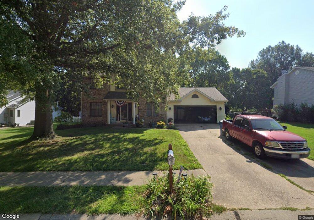
This home is located at 970 Weathervane Ln, Troy, IL 62294 and is currently estimated at $324,913, approximately $343 per square foot. 970 Weathervane Ln is a home located in Madison County with nearby schools including Silver Creek Elementary School, Triad Middle School, and Triad High School.
Ownership History
Date
Name
Owned For
Owner Type
Purchase Details
Closed on
Jun 4, 2004
Sold by
Brugger Michael L and Brugger Kathleen A
Bought by
Davis Mark E and Davis Theresa M
Current Estimated Value
Home Financials for this Owner
Home Financials are based on the most recent Mortgage that was taken out on this home.
Original Mortgage
$134,400
Outstanding Balance
$59,015
Interest Rate
4.5%
Mortgage Type
Unknown
Estimated Equity
$265,898
Create a Home Valuation Report for This Property
The Home Valuation Report is an in-depth analysis detailing your home's value as well as a comparison with similar homes in the area
Home Values in the Area
Average Home Value in this Area
Purchase History
| Date | Buyer | Sale Price | Title Company |
|---|---|---|---|
| Davis Mark E | $168,000 | Fatic |
Source: Public Records
Mortgage History
| Date | Status | Borrower | Loan Amount |
|---|---|---|---|
| Open | Davis Mark E | $134,400 |
Source: Public Records
Tax History
| Year | Tax Paid | Tax Assessment Tax Assessment Total Assessment is a certain percentage of the fair market value that is determined by local assessors to be the total taxable value of land and additions on the property. | Land | Improvement |
|---|---|---|---|---|
| 2024 | $5,705 | $92,670 | $16,470 | $76,200 |
| 2023 | $5,705 | $84,130 | $14,950 | $69,180 |
| 2022 | $5,249 | $77,470 | $13,770 | $63,700 |
| 2021 | $4,812 | $73,630 | $13,090 | $60,540 |
| 2020 | $5,197 | $71,730 | $12,750 | $58,980 |
| 2019 | $5,109 | $70,260 | $12,490 | $57,770 |
| 2018 | $4,976 | $65,090 | $11,570 | $53,520 |
| 2017 | $4,804 | $63,730 | $11,330 | $52,400 |
| 2016 | $4,766 | $63,730 | $11,330 | $52,400 |
| 2015 | $4,275 | $61,620 | $10,960 | $50,660 |
| 2014 | $4,275 | $61,620 | $10,960 | $50,660 |
| 2013 | $4,275 | $61,620 | $10,960 | $50,660 |
Source: Public Records
Map
Nearby Homes
- 2002 Morningside Place
- 1847 Robins Mill Ct
- 1847 Appleton Ct
- 1824 Appleton Ct
- 205 Eisenhower Blvd
- 821 Copper Ridge
- 213 George Bush Blvd
- 224 George Bush Blvd
- 0 Homes of Liberty Place
- 420 Chamberlain Dr
- 421 Chamberlain Dr
- 421 George Bush Blvd
- 620 Eisenhower Blvd
- 7430 Clarence Ct
- 6845 Manchester Dr
- 9 Bliss Terrace
- 15 Sonata Ln
- 13 Sonata Ln
- 518 Bargraves Blvd Unit B
- 201 S Lange Ave
- 972 Weathervane Ln
- 968 Weathervane Ln
- 966 Weathervane Ln
- 974 Weathervane Ln
- 971 Weathervane Ln
- 973 Weathervane Ln
- 969 Weathervane Ln
- 960 Wagon Trail Ct
- 958 Wagon Trail Ct
- 976 Weathervane Ln
- 967 Weathervane Ln
- 977 Weathervane Ln
- 956 Wagon Trail Ct
- 964 Weathervane Ln
- 965 Weathervane Ln
- 978 Weathervane Ln
- 981 Weathervane Ln
- 96 Sugarmill Rd
- 98 Sugarmill Rd
- 94 Sugarmill Rd
Your Personal Tour Guide
Ask me questions while you tour the home.