Estimated Value: $154,934 - $201,000
--
Bed
--
Bath
--
Sq Ft
15.34
Acres
About This Home
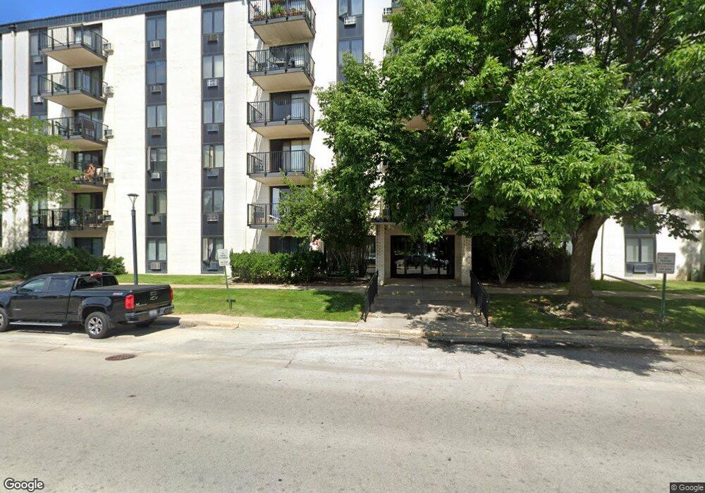
This home is located at 9701 N Dee Rd Unit 97015H, Niles, IL 60714 and is currently estimated at $173,734. 9701 N Dee Rd Unit 97015H is a home located in Cook County with nearby schools including Apollo Elementary School, Gemini Middle School, and Maine East High School.
Ownership History
Date
Name
Owned For
Owner Type
Purchase Details
Closed on
Feb 9, 2023
Sold by
Gabriel Louise E and Gabriel Edward J
Bought by
Gabriel Family Revocable Trust and Gabriel
Current Estimated Value
Purchase Details
Closed on
Nov 10, 2005
Sold by
Lundin Carol A and Lundin Richard E
Bought by
Gabriel Louise E and Gabriel Edward J
Home Financials for this Owner
Home Financials are based on the most recent Mortgage that was taken out on this home.
Original Mortgage
$80,000
Interest Rate
6.2%
Mortgage Type
Fannie Mae Freddie Mac
Purchase Details
Closed on
Jan 7, 2002
Sold by
Froelich Daniel M
Bought by
Lundin Richard E and Lundin Carol A
Home Financials for this Owner
Home Financials are based on the most recent Mortgage that was taken out on this home.
Original Mortgage
$84,000
Interest Rate
7.16%
Create a Home Valuation Report for This Property
The Home Valuation Report is an in-depth analysis detailing your home's value as well as a comparison with similar homes in the area
Home Values in the Area
Average Home Value in this Area
Purchase History
| Date | Buyer | Sale Price | Title Company |
|---|---|---|---|
| Gabriel Family Revocable Trust | -- | None Listed On Document | |
| Gabriel Louise E | $134,000 | Cti | |
| Lundin Richard E | $106,000 | Chicago Title Insurance Co |
Source: Public Records
Mortgage History
| Date | Status | Borrower | Loan Amount |
|---|---|---|---|
| Previous Owner | Gabriel Louise E | $80,000 | |
| Previous Owner | Lundin Richard E | $84,000 |
Source: Public Records
Tax History Compared to Growth
Tax History
| Year | Tax Paid | Tax Assessment Tax Assessment Total Assessment is a certain percentage of the fair market value that is determined by local assessors to be the total taxable value of land and additions on the property. | Land | Improvement |
|---|---|---|---|---|
| 2024 | $2,099 | $8,119 | $533 | $7,586 |
| 2023 | $1,973 | $8,119 | $533 | $7,586 |
| 2022 | $1,973 | $8,119 | $533 | $7,586 |
| 2021 | $2,020 | $6,901 | $819 | $6,082 |
| 2020 | $1,909 | $6,901 | $819 | $6,082 |
| 2019 | $1,845 | $7,598 | $819 | $6,779 |
| 2018 | $1,375 | $5,078 | $717 | $4,361 |
| 2017 | $1,366 | $5,078 | $717 | $4,361 |
| 2016 | $1,273 | $5,078 | $717 | $4,361 |
| 2015 | $957 | $3,499 | $614 | $2,885 |
| 2014 | $922 | $3,499 | $614 | $2,885 |
| 2013 | $906 | $3,499 | $614 | $2,885 |
Source: Public Records
Map
Nearby Homes
- 9701 N Dee Rd Unit 5E
- 9701 N Dee Rd Unit 2I
- 9098 W Terrace Dr Unit 1L
- 9074 W Terrace Dr Unit 4N
- 9078 W Heathwood Dr Unit 5
- 9724 Bianco Terrace Unit A
- 9588 Terrace Place Unit 1C
- 9026 W Heathwood Cir Unit C1
- 9561 Dee Rd Unit 1D
- 9561 Dee Rd Unit 2D
- 9001 Golf Rd Unit 5B
- 9009 Golf Rd Unit 2A
- 9501 Terrace Place
- 9411 Harrison St Unit 471494
- 9460 Terrace Place
- 8904 Jody Ln Unit 1C
- 8936 Northshore Dr Unit 104D
- 9446 Dee Rd Unit 2F
- 8896 David Place Unit 2E
- 8872 Jody Ln Unit 2E
- 9701 N Dee Rd Unit 6A
- 9701 N Dee Rd Unit 1M
- 9701 N Dee Rd Unit 3A
- 9701 N Dee Rd Unit 5L
- 9701 N Dee Rd Unit 5G
- 9701 N Dee Rd Unit 97012F
- 9701 N Dee Rd Unit 97011A
- 9701 N Dee Rd Unit 97013A
- 9701 N Dee Rd Unit 97016N
- 9701 N Dee Rd Unit 97016L
- 9701 N Dee Rd Unit 97016G
- 9701 N Dee Rd Unit 97015N
- 9701 N Dee Rd Unit 97015L
- 9701 N Dee Rd Unit 97015I
- 9701 N Dee Rd Unit 97015D
- 9701 N Dee Rd Unit 97015C
- 9701 N Dee Rd Unit 97015B
- 9701 N Dee Rd Unit 97014K
- 9701 N Dee Rd Unit 97014H
- 9701 N Dee Rd Unit 97014D