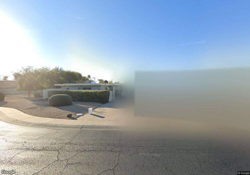
9701 W Lancaster Dr Sun City, AZ 85351
Estimated Value: $177,542 - $278,000
--
Bed
1
Bath
1,174
Sq Ft
$182/Sq Ft
Est. Value
About This Home
This home is located at 9701 W Lancaster Dr, Sun City, AZ 85351 and is currently estimated at $213,386, approximately $181 per square foot. 9701 W Lancaster Dr is a home located in Maricopa County with nearby schools including Arrowhead Montessori.
Ownership History
Date
Name
Owned For
Owner Type
Purchase Details
Closed on
Nov 19, 2007
Sold by
Ruisinger Kenneth R and Ruisinger Kathryn A
Bought by
Ruisinger 3 Llc
Current Estimated Value
Purchase Details
Closed on
Jan 27, 1998
Sold by
Carlington Harry A and Carlington Clara E
Bought by
Ruisinger Kenneth R and Ruisinger Kathryn A
Purchase Details
Closed on
Nov 22, 1996
Sold by
Malott Bernard J and Malott Phyllis J
Bought by
Carlington Harry A and Carlington Clara E
Home Financials for this Owner
Home Financials are based on the most recent Mortgage that was taken out on this home.
Original Mortgage
$63,000
Interest Rate
7.67%
Mortgage Type
New Conventional
Create a Home Valuation Report for This Property
The Home Valuation Report is an in-depth analysis detailing your home's value as well as a comparison with similar homes in the area
Home Values in the Area
Average Home Value in this Area
Purchase History
| Date | Buyer | Sale Price | Title Company |
|---|---|---|---|
| Ruisinger 3 Llc | -- | None Available | |
| Ruisinger Kenneth R | $73,000 | -- | |
| Carlington Harry A | $70,000 | Nations Title Insurance |
Source: Public Records
Mortgage History
| Date | Status | Borrower | Loan Amount |
|---|---|---|---|
| Previous Owner | Carlington Harry A | $63,000 |
Source: Public Records
Tax History Compared to Growth
Tax History
| Year | Tax Paid | Tax Assessment Tax Assessment Total Assessment is a certain percentage of the fair market value that is determined by local assessors to be the total taxable value of land and additions on the property. | Land | Improvement |
|---|---|---|---|---|
| 2025 | $728 | $8,056 | -- | -- |
| 2024 | $652 | $7,672 | -- | -- |
| 2023 | $652 | $14,650 | $2,930 | $11,720 |
| 2022 | $621 | $12,280 | $2,450 | $9,830 |
| 2021 | $635 | $11,010 | $2,200 | $8,810 |
| 2020 | $618 | $10,510 | $2,100 | $8,410 |
| 2019 | $611 | $8,900 | $1,780 | $7,120 |
| 2018 | $596 | $7,350 | $1,470 | $5,880 |
| 2017 | $574 | $6,620 | $1,320 | $5,300 |
| 2016 | $319 | $5,550 | $1,110 | $4,440 |
| 2015 | $513 | $5,630 | $1,120 | $4,510 |
Source: Public Records
Map
Nearby Homes
- 13207 N 98th Ave Unit L
- 13611 N 98th Ave Unit D
- 13608 N 98th Ave Unit Q
- 13621 N 98th Ave Unit H
- 13232 N 98th Ave Unit G
- 13232 N 98th Ave Unit K
- 13709 N 98th Ave Unit B
- 13622 N 98th Ave Unit D
- 13207 N Branding Iron Dr
- 13720 N 98th Ave Unit A
- 13215 N Lakeforest Dr
- 9300 W Wood Dr
- 9834 W Emberwood Dr
- 9295 W Wood Dr
- 9325 W Arrowhead Dr
- 9430 W Arrowhead Dr
- 13233 N 99th Dr Unit 24B
- 9313 W Arrowhead Dr
- 13222 N 99th Dr
- 10050 W Lancaster Dr
- 9702 W Teakwood Dr
- 9703 W Lancaster Dr
- 9704 W Teakwood Dr
- 9626 W Teakwood Dr
- 9706 W Teakwood Dr Unit 28B
- 9740 W Lancaster Dr
- 9732 W Lancaster Dr
- 9703 W Teakwood Dr Unit 28B
- 9618 W Teakwood Dr
- 9744 W Lancaster Dr
- 9705 W Teakwood Dr
- 9704 W Redwood Dr
- 9748 W Lancaster Dr
- 13207 N 98th Ave Unit H
- 13207 N 98th Ave Unit D
- 13207 N 98th Ave Unit G
- 13207 N 98th Ave
- 13207 N 98th Ave
- 13207 N 98th Ave
- 13207 N 98th Ave Unit C