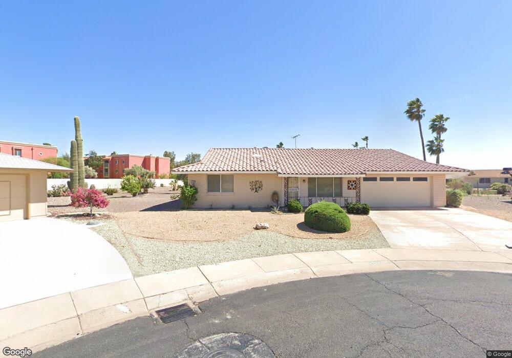
9703 W Cedar Dr Sun City, AZ 85351
Estimated Value: $252,379 - $292,000
--
Bed
2
Baths
1,160
Sq Ft
$233/Sq Ft
Est. Value
About This Home
This home is located at 9703 W Cedar Dr, Sun City, AZ 85351 and is currently estimated at $270,595, approximately $233 per square foot. 9703 W Cedar Dr is a home located in Maricopa County with nearby schools including Desert Mirage Elementary School, Ombudsman - Northwest Charter, and Peoria Accelerated High School.
Ownership History
Date
Name
Owned For
Owner Type
Purchase Details
Closed on
May 1, 2007
Sold by
Morphew Mary A and Morphew Billy F
Bought by
Plautz Harold Curtis and Plautz Nancy U
Current Estimated Value
Home Financials for this Owner
Home Financials are based on the most recent Mortgage that was taken out on this home.
Original Mortgage
$130,400
Interest Rate
6.12%
Mortgage Type
New Conventional
Purchase Details
Closed on
Apr 3, 1995
Sold by
Kreider Boltz Sr James M and Kreider Boltz Isabelle
Bought by
Morphew Mary A and Morphew Billy F
Home Financials for this Owner
Home Financials are based on the most recent Mortgage that was taken out on this home.
Original Mortgage
$60,000
Interest Rate
8.44%
Mortgage Type
New Conventional
Create a Home Valuation Report for This Property
The Home Valuation Report is an in-depth analysis detailing your home's value as well as a comparison with similar homes in the area
Home Values in the Area
Average Home Value in this Area
Purchase History
| Date | Buyer | Sale Price | Title Company |
|---|---|---|---|
| Plautz Harold Curtis | $163,000 | First American Title Ins Co | |
| Morphew Mary A | $90,000 | Security Title Agency |
Source: Public Records
Mortgage History
| Date | Status | Borrower | Loan Amount |
|---|---|---|---|
| Closed | Plautz Harold Curtis | $130,400 | |
| Previous Owner | Morphew Mary A | $60,000 |
Source: Public Records
Tax History Compared to Growth
Tax History
| Year | Tax Paid | Tax Assessment Tax Assessment Total Assessment is a certain percentage of the fair market value that is determined by local assessors to be the total taxable value of land and additions on the property. | Land | Improvement |
|---|---|---|---|---|
| 2025 | $1,023 | $11,476 | -- | -- |
| 2024 | $924 | $10,930 | -- | -- |
| 2023 | $924 | $19,770 | $3,950 | $15,820 |
| 2022 | $875 | $15,830 | $3,160 | $12,670 |
| 2021 | $894 | $14,660 | $2,930 | $11,730 |
| 2020 | $871 | $12,610 | $2,520 | $10,090 |
| 2019 | $862 | $11,280 | $2,250 | $9,030 |
| 2018 | $832 | $10,410 | $2,080 | $8,330 |
| 2017 | $804 | $9,270 | $1,850 | $7,420 |
| 2016 | $754 | $8,750 | $1,750 | $7,000 |
| 2015 | $721 | $7,760 | $1,550 | $6,210 |
Source: Public Records
Map
Nearby Homes
- 12415 N Vista Grande Ct
- 12418 N Vista Grande Ct
- 9839 W Cedar Dr
- 9834 W Emberwood Dr
- 9851 W Cedar Dr
- 12819 N Sun Valley Dr
- 12635 N Sun Valley Dr
- 13207 N Branding Iron Dr
- 13215 N Lakeforest Dr
- 12881 N 99th Dr Unit 24C
- 9295 W Wood Dr
- 9300 W Wood Dr
- 9830 W Teakwood Dr
- 13207 N 98th Ave Unit L
- 12219 N Sun Valley Dr
- 9955 W Forrester Dr
- 9960 W Forrester Dr
- 13018 N 99th Dr
- 13233 N 99th Dr Unit 24B
- 13232 N 98th Ave Unit G
- 9702 W Cedar Dr
- 9706 W Royal Oak Rd
- 9707 W Cedar Dr
- 9702 W Royal Oak Rd
- 9710 W Royal Oak Rd
- 9711 W Cedar Dr Unit 10A
- 9706 W Cedar Dr
- 9710 W Cedar Dr
- 9714 W Royal Oak Rd
- 9714 W Cedar Dr
- 9715 W Cedar Dr
- 9703 W Royal Oak Rd
- 9718 W Royal Oak Rd
- 9711 W Royal Oak Rd
- 9707 W Royal Oak Rd
- 9718 W Cedar Dr
- 9711 W Forrester Dr
- 9715 W Royal Oak Rd
- 9715 W Forrester Dr
- 9719 W Royal Oak Rd