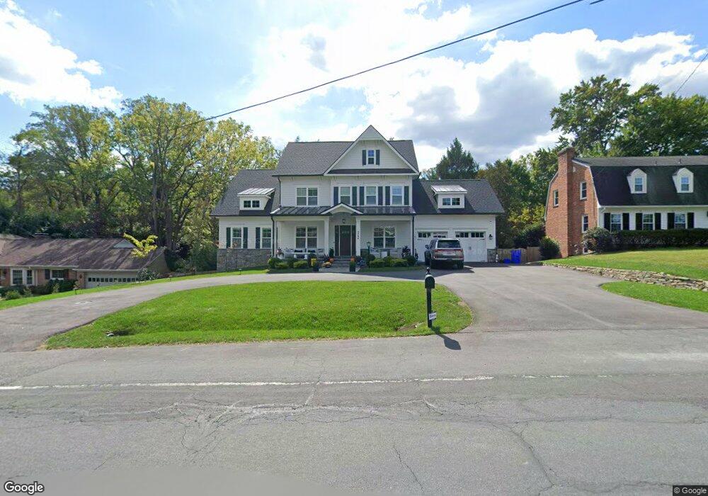
9704 Kentsdale Dr Potomac, MD 20854
Estimated Value: $2,194,000 - $2,764,000
Studio
4
Baths
5,147
Sq Ft
$490/Sq Ft
Est. Value
About This Home
This home is located at 9704 Kentsdale Dr, Potomac, MD 20854 and is currently estimated at $2,522,611, approximately $490 per square foot. 9704 Kentsdale Dr is a home located in Montgomery County with nearby schools including Seven Locks Elementary School, Cabin John Middle School, and Winston Churchill High School.
Ownership History
Date
Name
Owned For
Owner Type
Purchase Details
Closed on
Mar 4, 2002
Sold by
Callahan James F and Callahan M C
Bought by
Behrens Suzanne B and Behrens Siegfried G
Current Estimated Value
Purchase Details
Closed on
Jun 1, 1994
Sold by
Brooks By St G T
Bought by
Callahan James F
Home Financials for this Owner
Home Financials are based on the most recent Mortgage that was taken out on this home.
Original Mortgage
$300,000
Interest Rate
8.49%
Create a Home Valuation Report for This Property
The Home Valuation Report is an in-depth analysis detailing your home's value as well as a comparison with similar homes in the area
Home Values in the Area
Average Home Value in this Area
Purchase History
| Date | Buyer | Sale Price | Title Company |
|---|---|---|---|
| Behrens Suzanne B | $797,275 | -- | |
| Callahan James F | $587,500 | -- |
Source: Public Records
Mortgage History
| Date | Status | Borrower | Loan Amount |
|---|---|---|---|
| Previous Owner | Callahan James F | $300,000 |
Source: Public Records
Tax History
| Year | Tax Paid | Tax Assessment Tax Assessment Total Assessment is a certain percentage of the fair market value that is determined by local assessors to be the total taxable value of land and additions on the property. | Land | Improvement |
|---|---|---|---|---|
| 2025 | $7,871 | $1,949,600 | $603,000 | $1,346,600 |
| 2024 | $7,871 | $603,000 | $603,000 | -- |
| 2023 | $14,915 | $1,187,100 | $0 | $0 |
| 2022 | $12,020 | $1,104,200 | $603,000 | $501,200 |
| 2021 | $11,374 | $1,079,100 | $0 | $0 |
| 2020 | $11,374 | $1,054,000 | $0 | $0 |
| 2019 | $11,075 | $1,028,900 | $603,000 | $425,900 |
| 2018 | $10,777 | $1,000,767 | $0 | $0 |
| 2017 | $10,663 | $972,633 | $0 | $0 |
| 2016 | -- | $944,500 | $0 | $0 |
| 2015 | $9,732 | $944,500 | $0 | $0 |
| 2014 | $9,732 | $944,500 | $0 | $0 |
Source: Public Records
Map
Nearby Homes
- 8709 Crider Brook Way
- 6 Mercy Ct
- 9460 Tobin Cir
- 9225 Aldershot Dr
- 9216 Beech Hill Dr
- 8610 Hidden Hill Ln
- 7917 Greentree Rd
- 9721 Sorrel Ave
- 8880 Bradley Blvd
- 9431 Newbridge Dr
- 10336 Democracy Ln
- 8917 Harvest Square Ct
- 9201 Laurel Oak Dr
- 7819 English Way
- 10421 Windsor View Dr
- 9939 Bentcross Dr
- 10229 Sundance Ct
- 10409 Democracy Ln
- 10240 Democracy Blvd
- 7604 Charleston Dr
- 9708 Kentsdale Dr
- 9700 Kentsdale Dr
- 9701 Kendale Rd
- 9705 Kendale Rd
- 9612 Kentsdale Dr
- 9701 Kentsdale Dr
- 9705 Kentsdale Dr
- 9709 Kentsdale Dr
- 9617 Kentsdale Dr
- 9613 Kentsdale Dr
- 9801 Kendale Rd
- 9608 Kentsdale Dr
- 9609 Kentsdale Dr
- 9805 Kendale Rd
- 9540 Purcell Dr
- 9800 Kendale Rd
- 9604 Kentsdale Dr
- 9605 Kentsdale Dr
- 8504 White Post Ct
- 9704 Kendale Rd
Your Personal Tour Guide
Ask me questions while you tour the home.