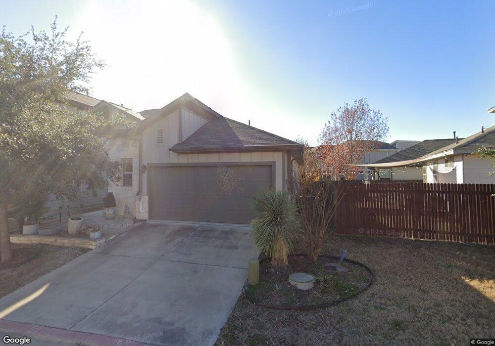
9704 Tall Tree Ln Unit 131 Austin, TX 78748
Slaughter Creek NeighborhoodEstimated Value: $354,043 - $418,000
3
Beds
2
Baths
1,285
Sq Ft
$295/Sq Ft
Est. Value
About This Home
This home is located at 9704 Tall Tree Ln Unit 131, Austin, TX 78748 and is currently estimated at $378,761, approximately $294 per square foot. 9704 Tall Tree Ln Unit 131 is a home located in Travis County with nearby schools including Casey Elementary School, Akins High School, and Valor South Austin.
Ownership History
Date
Name
Owned For
Owner Type
Purchase Details
Closed on
Jul 30, 2021
Sold by
Jarrett Carol M
Bought by
Wilson Michael S
Current Estimated Value
Home Financials for this Owner
Home Financials are based on the most recent Mortgage that was taken out on this home.
Original Mortgage
$394,250
Outstanding Balance
$358,656
Interest Rate
2.93%
Mortgage Type
New Conventional
Estimated Equity
$20,105
Purchase Details
Closed on
Jan 18, 2017
Sold by
Milestone Community Builders Llc
Bought by
Jarrett Carol M
Create a Home Valuation Report for This Property
The Home Valuation Report is an in-depth analysis detailing your home's value as well as a comparison with similar homes in the area
Home Values in the Area
Average Home Value in this Area
Purchase History
| Date | Buyer | Sale Price | Title Company |
|---|---|---|---|
| Wilson Michael S | -- | None Listed On Document | |
| Jarrett Carol M | -- | None Available |
Source: Public Records
Mortgage History
| Date | Status | Borrower | Loan Amount |
|---|---|---|---|
| Open | Wilson Michael S | $394,250 |
Source: Public Records
Tax History Compared to Growth
Tax History
| Year | Tax Paid | Tax Assessment Tax Assessment Total Assessment is a certain percentage of the fair market value that is determined by local assessors to be the total taxable value of land and additions on the property. | Land | Improvement |
|---|---|---|---|---|
| 2025 | $5,409 | $332,898 | $36,121 | $296,777 |
| 2023 | $5,409 | $389,487 | $35,837 | $353,650 |
| 2022 | $7,665 | $388,099 | $35,837 | $352,262 |
| 2021 | $5,762 | $264,722 | $35,837 | $228,885 |
| 2020 | $5,430 | $253,144 | $35,837 | $217,307 |
| 2019 | $5,560 | $253,144 | $35,837 | $217,307 |
| 2018 | $2,649 | $260,533 | $35,837 | $224,696 |
| 2017 | $2,668 | $119,636 | $33,328 | $86,308 |
Source: Public Records
Map
Nearby Homes
- 915 Totis Rd
- 1010 Boatswain Way
- 907 Totis Rd
- 9302 Tanager Way
- 808 Totis Rd
- 800 Totis Rd
- 9311 Independence Loop
- 9229 Independence Loop
- 9313 Independence Loop
- 9003 Acorn Cup Dr Unit 34
- 10005 Milton Albert Way
- 1012 Legend Milton Ln
- 9110 Chisholm Ln
- 808 Minturn Ln
- 1517 Waxberry Ln
- 10116 Aly May Dr
- 9516 Hunter Ln
- 8615 Croydon Loop
- 9517 Hunter Ln
- 10016 Wading Pool Path
- 9704 Tall Tree Ln Unit 131
- 9704 Tall Tree Ln
- 9706 Tall Tree Ln
- 9515 Tanager Way Unit 133
- 9513 Tanager Way Unit 132
- 9708 Tall Tree Ln
- 9708 Tall Tree Ln Unit 129
- 9710 Tall Tree Ln Unit 128
- 9603 Tanager Way
- 9603 Tanager Way Unit 135
- 9601 Tanager Way Unit 134
- 9603 Tanager Way
- 9601 Tanager Way
- 9605 Tanager Way
- 9705 Tall Tree Ln
- 9703 Tall Tree Ln
- 9703 Tall Tree Ln Unit 124
- 9701 Tall Tree Ln Unit 123
- 1008 Totis Rd
- 1008 Totis Rd Unit 152