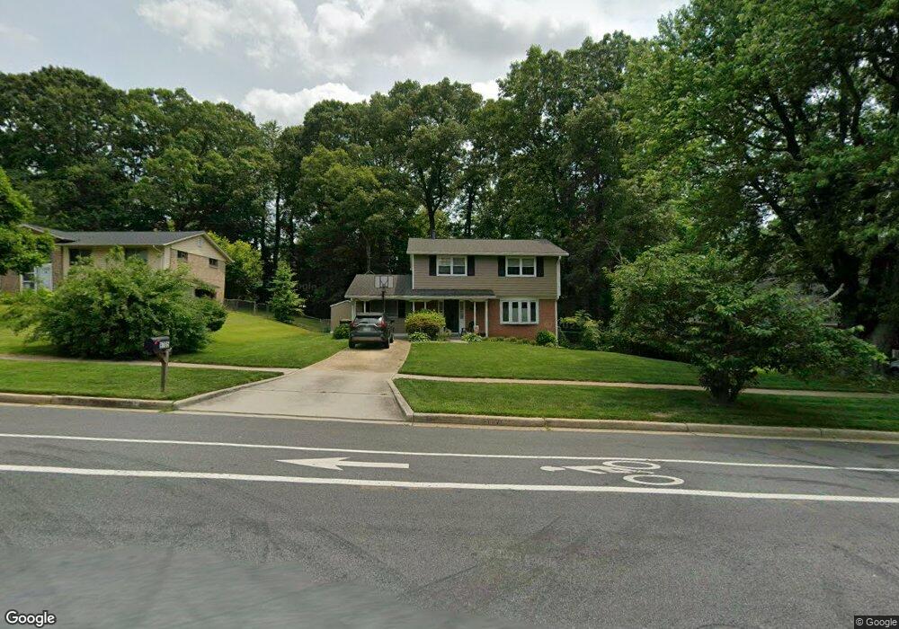
9705 Commonwealth Blvd Fairfax, VA 22032
Estimated Value: $792,000 - $933,000
4
Beds
4
Baths
1,902
Sq Ft
$444/Sq Ft
Est. Value
About This Home
This home is located at 9705 Commonwealth Blvd, Fairfax, VA 22032 and is currently estimated at $845,291, approximately $444 per square foot. 9705 Commonwealth Blvd is a home located in Fairfax County with nearby schools including Laurel Ridge Elementary School, James W Robinson, Jr. Secondary School, and Holy Spirit School.
Ownership History
Date
Name
Owned For
Owner Type
Purchase Details
Closed on
Nov 15, 1994
Sold by
Reifsnyder Daniel A
Bought by
Okada Ted T
Current Estimated Value
Home Financials for this Owner
Home Financials are based on the most recent Mortgage that was taken out on this home.
Original Mortgage
$175,500
Interest Rate
8.78%
Create a Home Valuation Report for This Property
The Home Valuation Report is an in-depth analysis detailing your home's value as well as a comparison with similar homes in the area
Home Values in the Area
Average Home Value in this Area
Purchase History
| Date | Buyer | Sale Price | Title Company |
|---|---|---|---|
| Okada Ted T | $185,000 | -- |
Source: Public Records
Mortgage History
| Date | Status | Borrower | Loan Amount |
|---|---|---|---|
| Closed | Okada Ted T | $175,500 |
Source: Public Records
Tax History Compared to Growth
Tax History
| Year | Tax Paid | Tax Assessment Tax Assessment Total Assessment is a certain percentage of the fair market value that is determined by local assessors to be the total taxable value of land and additions on the property. | Land | Improvement |
|---|---|---|---|---|
| 2025 | $8,354 | $786,780 | $286,000 | $500,780 |
| 2024 | $8,354 | $721,070 | $281,000 | $440,070 |
| 2023 | $7,952 | $704,670 | $281,000 | $423,670 |
| 2022 | $7,284 | $636,960 | $256,000 | $380,960 |
| 2021 | $7,053 | $601,050 | $236,000 | $365,050 |
| 2020 | $6,756 | $570,890 | $221,000 | $349,890 |
| 2019 | $6,543 | $552,890 | $216,000 | $336,890 |
| 2018 | $6,212 | $540,130 | $216,000 | $324,130 |
| 2017 | $6,047 | $520,810 | $206,000 | $314,810 |
| 2016 | $5,741 | $495,530 | $191,000 | $304,530 |
| 2015 | $5,530 | $495,530 | $191,000 | $304,530 |
| 2014 | $5,373 | $482,510 | $181,000 | $301,510 |
Source: Public Records
Map
Nearby Homes
- 9717 Commonwealth Blvd
- 5137 Richardson Dr
- 5006 Lone Oak Place
- 9883 Becket Ct
- 9896 Becket Ct
- 4947 Mcfarland Ct
- 4869 Nash Dr
- 5370 Gainsborough Dr
- 4906 Mcfarland Dr
- 5313 Stonington Dr
- 5361 Gainsborough Dr
- 9710 Ashbourn Dr
- 10017 Whitefield St
- 5207 Stonington Dr
- 9438 Wallingford Dr
- 5307 Richardson Dr
- 9755 Abington Ct
- 9370 Colbert Ct
- 9769 High Water Ct
- 10116 Dundalk St
- 9703 Commonwealth Blvd
- 9707 Commonwealth Blvd
- 9700 Galsworth Ct
- 5102 Richardson Dr
- 9709 Commonwealth Blvd
- 9702 Galsworth Ct
- 9701 Commonwealth Blvd
- 5104 Richardson Dr
- 9701 Galsworth Ct
- 5105 Walport Ln
- 9708 Commonwealth Blvd
- 5106 Richardson Dr
- 9711 Commonwealth Blvd
- 9704 Galsworth Ct
- 9702 Commonwealth Blvd
- 9710 Commonwealth Blvd
- 5103 Walport Ln
- 5108 Richardson Dr
- 9700 Commonwealth Blvd
- 9703 Galsworth Ct