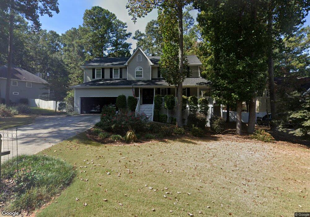
971 Deron Dr Unit 11 Lawrenceville, GA 30044
Gwinnett Place NeighborhoodEstimated Value: $469,000 - $530,000
4
Beds
3
Baths
2,666
Sq Ft
$186/Sq Ft
Est. Value
About This Home
This home is located at 971 Deron Dr Unit 11, Lawrenceville, GA 30044 and is currently estimated at $494,882, approximately $185 per square foot. 971 Deron Dr Unit 11 is a home located in Gwinnett County with nearby schools including Craig Elementary School, Alton C. Crews Middle School, and Brookwood High School.
Ownership History
Date
Name
Owned For
Owner Type
Purchase Details
Closed on
Apr 26, 2024
Sold by
Fonseca Joseph E
Bought by
Milligan Kristin M
Current Estimated Value
Home Financials for this Owner
Home Financials are based on the most recent Mortgage that was taken out on this home.
Original Mortgage
$451,250
Outstanding Balance
$444,813
Interest Rate
6.79%
Mortgage Type
New Conventional
Estimated Equity
$50,069
Purchase Details
Closed on
Oct 7, 2002
Sold by
Lagi David P
Bought by
Fonseca Joseph E and Fonseca Lynn K
Home Financials for this Owner
Home Financials are based on the most recent Mortgage that was taken out on this home.
Original Mortgage
$170,000
Interest Rate
6.21%
Mortgage Type
New Conventional
Create a Home Valuation Report for This Property
The Home Valuation Report is an in-depth analysis detailing your home's value as well as a comparison with similar homes in the area
Home Values in the Area
Average Home Value in this Area
Purchase History
| Date | Buyer | Sale Price | Title Company |
|---|---|---|---|
| Milligan Kristin M | $475,000 | -- | |
| Fonseca Joseph E | $220,000 | -- |
Source: Public Records
Mortgage History
| Date | Status | Borrower | Loan Amount |
|---|---|---|---|
| Open | Milligan Kristin M | $451,250 | |
| Previous Owner | Fonseca Joseph E | $170,000 |
Source: Public Records
Tax History Compared to Growth
Tax History
| Year | Tax Paid | Tax Assessment Tax Assessment Total Assessment is a certain percentage of the fair market value that is determined by local assessors to be the total taxable value of land and additions on the property. | Land | Improvement |
|---|---|---|---|---|
| 2024 | $5,213 | $184,960 | $30,000 | $154,960 |
| 2023 | $5,213 | $189,120 | $33,200 | $155,920 |
| 2022 | $3,826 | $120,000 | $24,000 | $96,000 |
| 2021 | $3,883 | $120,000 | $24,000 | $96,000 |
| 2020 | $3,910 | $128,560 | $24,000 | $104,560 |
| 2019 | $3,742 | $117,160 | $24,000 | $93,160 |
| 2018 | $3,748 | $117,160 | $24,000 | $93,160 |
| 2016 | $3,345 | $97,640 | $18,000 | $79,640 |
| 2015 | $3,192 | $89,280 | $18,000 | $71,280 |
| 2014 | -- | $91,520 | $13,840 | $77,680 |
Source: Public Records
Map
Nearby Homes
- 1195 Haverhill Trail
- 969 Flowers Crossing
- 1107 Hardwyck Pass
- 2061 Vicarage Ln
- 971 Providence Dr Unit 3
- 2011 Montrose Ct
- 825 Connell Ln
- 1870 Milfield Cir
- 2071 Havenview Ct
- 543 Grassmeade Way
- 1810 Talbot Ct
- 4105 Vicksburg Dr
- 1035 Bridgewater Walk
- 3217 Hidden Valley Cir
- 3218 Hidden Valley Cir
- 840 Deer Oaks Dr
- 1011 Finial Dr
- 0 Deron Dr Unit 8577463
- 0 Deron Dr Unit 8956628
- 0 Deron Dr Unit 8932872
- 0 Deron Dr
- 951 Haverhill Trail
- 981 Deron Dr
- 951 Deron Dr
- 0 Bloomfield Dr Unit 7069652
- 0 Bloomfield Dr
- 965 Bloomfield Dr
- 955 Bloomfield Dr
- 1955 Wenton Place Unit 11
- 975 Bloomfield Dr
- 980 Deron Dr
- 991 Deron Dr
- 1135 Haverhill Trail
- 990 Deron Dr
- 903 Bloomfield Dr
- 1940 Wenton Place
- 1120 Haverhill Trail