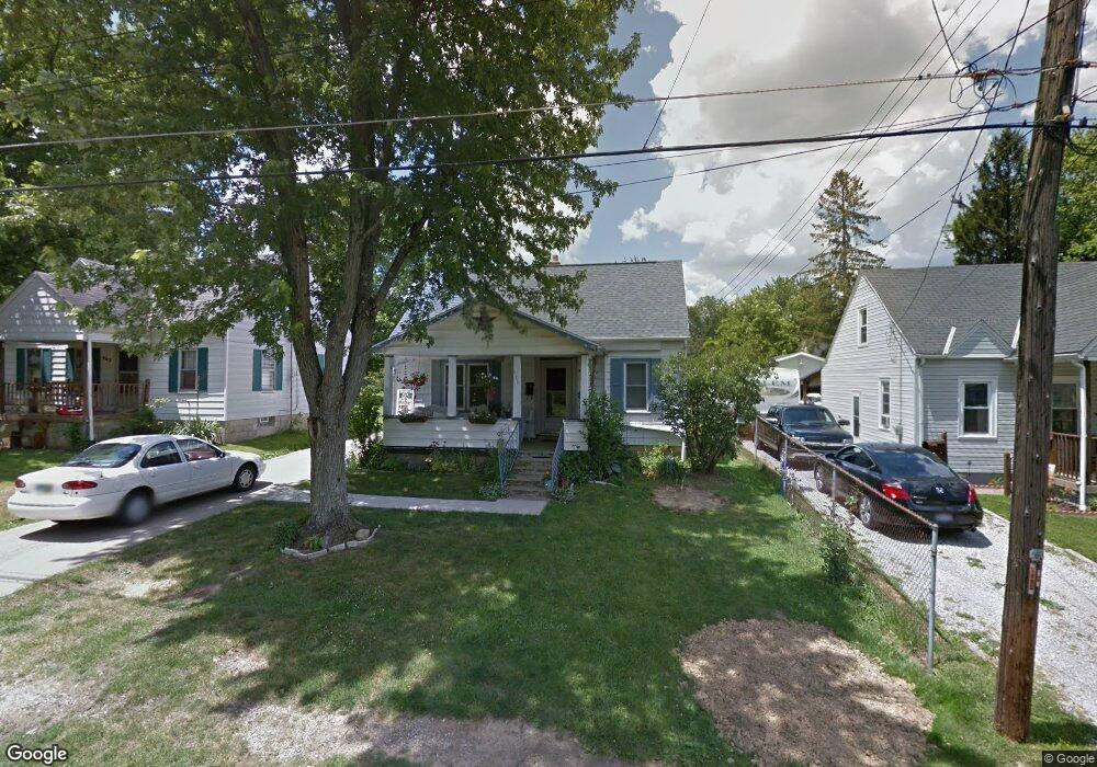
971 Herring Ave Mansfield, OH 44906
Estimated Value: $102,000 - $134,000
3
Beds
2
Baths
1,050
Sq Ft
$112/Sq Ft
Est. Value
About This Home
This home is located at 971 Herring Ave, Mansfield, OH 44906 and is currently estimated at $117,620, approximately $112 per square foot. 971 Herring Ave is a home located in Richland County with nearby schools including Foundation Academy, Mansfield Elective Academy, and Goal Digital Academy.
Ownership History
Date
Name
Owned For
Owner Type
Purchase Details
Closed on
Apr 22, 2019
Sold by
Crabtree Amy E and Crabtree Karl Amy
Bought by
Finlay Properties Llc
Current Estimated Value
Purchase Details
Closed on
Jun 2, 2000
Sold by
Griffitts Walter M
Bought by
Karl Rodney E and Karl Amy E
Home Financials for this Owner
Home Financials are based on the most recent Mortgage that was taken out on this home.
Original Mortgage
$60,997
Interest Rate
8.18%
Mortgage Type
FHA
Purchase Details
Closed on
May 5, 1992
Bought by
Griffitts Walter M
Create a Home Valuation Report for This Property
The Home Valuation Report is an in-depth analysis detailing your home's value as well as a comparison with similar homes in the area
Home Values in the Area
Average Home Value in this Area
Purchase History
| Date | Buyer | Sale Price | Title Company |
|---|---|---|---|
| Finlay Properties Llc | $54,000 | Southern Title | |
| Karl Rodney E | $61,500 | -- | |
| Griffitts Walter M | -- | -- |
Source: Public Records
Mortgage History
| Date | Status | Borrower | Loan Amount |
|---|---|---|---|
| Previous Owner | Karl Rodney E | $60,997 |
Source: Public Records
Tax History Compared to Growth
Tax History
| Year | Tax Paid | Tax Assessment Tax Assessment Total Assessment is a certain percentage of the fair market value that is determined by local assessors to be the total taxable value of land and additions on the property. | Land | Improvement |
|---|---|---|---|---|
| 2024 | $1,532 | $27,050 | $2,880 | $24,170 |
| 2023 | $1,532 | $27,050 | $2,880 | $24,170 |
| 2022 | $1,444 | $20,970 | $2,740 | $18,230 |
| 2021 | $1,438 | $20,970 | $2,740 | $18,230 |
| 2020 | $1,447 | $20,970 | $2,740 | $18,230 |
| 2019 | $1,386 | $17,880 | $2,320 | $15,560 |
| 2018 | $1,306 | $17,880 | $2,320 | $15,560 |
| 2017 | $1,359 | $17,880 | $2,320 | $15,560 |
| 2016 | $1,445 | $16,910 | $2,370 | $14,540 |
| 2015 | $1,172 | $16,910 | $2,370 | $14,540 |
| 2014 | $1,513 | $16,910 | $2,370 | $14,540 |
| 2012 | $658 | $17,800 | $2,500 | $15,300 |
Source: Public Records
Map
Nearby Homes
- 939 Country Club Dr
- 0 Herring Ave
- 946 Belmont Ave
- 933 Fairfax Ave
- 876 Fairfax Ave
- 874 Fairfax Ave
- 741 Burger Ave
- 1170 Fairfax Ave
- 0 Stone Rd
- 673 Armstrong St Unit 23
- 674 Averill Ave
- 641 Averill Ave
- 356 Warren Rd
- 0 Highway 30
- 1169 Seminole Ave
- 1168 & 1171 Seminole Ave
- 1234 Walker St
- 688 Mcpherson St
- 0 State Route 314 Unit 9069650
- 0 State Route 314 Unit 9067316
- 977 Herring Ave
- 967 Herring Ave
- 981 Herring Ave
- 970 Averill Ave
- 964 Averill Ave
- 987 Herring Ave
- 957 Herring Ave
- 980 Averill Ave
- 984 Averill Ave
- 991 Herring Ave
- 978 Herring Ave
- 951 Herring Ave
- 954 Averill Ave
- 982 Herring Ave
- 990 Averill Ave
- 954 Herring Ave
- 950 Averill Ave
- 988 Herring Ave
- 997 Herring Ave
- 945 Herring Ave