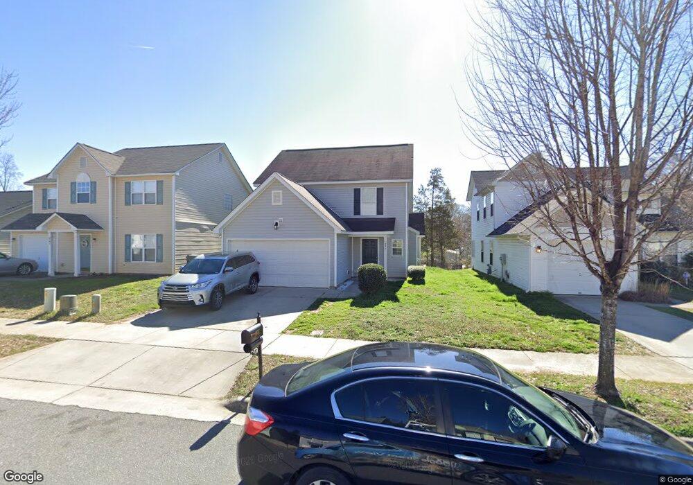
971 Ramsgate Dr SW Concord, NC 28025
Estimated Value: $289,000 - $315,000
4
Beds
3
Baths
1,688
Sq Ft
$176/Sq Ft
Est. Value
About This Home
This home is located at 971 Ramsgate Dr SW, Concord, NC 28025 and is currently estimated at $297,275, approximately $176 per square foot. 971 Ramsgate Dr SW is a home located in Cabarrus County with nearby schools including A.T. Allen Elementary School, C.C. Griffin Middle School, and Central Cabarrus High School.
Ownership History
Date
Name
Owned For
Owner Type
Purchase Details
Closed on
Oct 4, 2013
Sold by
Secretary Of Hud
Bought by
Perez Uriel
Current Estimated Value
Home Financials for this Owner
Home Financials are based on the most recent Mortgage that was taken out on this home.
Original Mortgage
$77,228
Outstanding Balance
$58,589
Interest Rate
4.75%
Mortgage Type
FHA
Estimated Equity
$238,686
Purchase Details
Closed on
Aug 22, 2008
Sold by
Royce Homes North Carolina Llc
Bought by
Denis Laurieann M
Home Financials for this Owner
Home Financials are based on the most recent Mortgage that was taken out on this home.
Original Mortgage
$128,803
Interest Rate
6.32%
Mortgage Type
FHA
Purchase Details
Closed on
Dec 1, 2006
Sold by
Dan Moser Co Inc
Bought by
Royce Homes North Carolina Llc
Create a Home Valuation Report for This Property
The Home Valuation Report is an in-depth analysis detailing your home's value as well as a comparison with similar homes in the area
Home Values in the Area
Average Home Value in this Area
Purchase History
| Date | Buyer | Sale Price | Title Company |
|---|---|---|---|
| Perez Uriel | -- | None Available | |
| Denis Laurieann M | $141,000 | None Available | |
| Royce Homes North Carolina Llc | $479,000 | None Available |
Source: Public Records
Mortgage History
| Date | Status | Borrower | Loan Amount |
|---|---|---|---|
| Open | Perez Uriel | $77,228 | |
| Previous Owner | Denis Laurieann M | $128,803 |
Source: Public Records
Tax History
| Year | Tax Paid | Tax Assessment Tax Assessment Total Assessment is a certain percentage of the fair market value that is determined by local assessors to be the total taxable value of land and additions on the property. | Land | Improvement |
|---|---|---|---|---|
| 2025 | $2,990 | $300,200 | $68,000 | $232,200 |
| 2024 | $2,990 | $300,200 | $68,000 | $232,200 |
| 2023 | $2,219 | $181,890 | $40,000 | $141,890 |
| 2022 | $2,219 | $181,890 | $40,000 | $141,890 |
| 2021 | $2,219 | $181,890 | $40,000 | $141,890 |
| 2020 | $2,219 | $181,890 | $40,000 | $141,890 |
| 2019 | $1,625 | $133,190 | $20,000 | $113,190 |
| 2018 | $1,632 | $135,970 | $20,000 | $115,970 |
| 2017 | $1,604 | $135,970 | $20,000 | $115,970 |
| 2016 | $952 | $123,360 | $24,000 | $99,360 |
| 2015 | $1,456 | $123,360 | $24,000 | $99,360 |
| 2014 | $1,456 | $123,360 | $24,000 | $99,360 |
Source: Public Records
Map
Nearby Homes
- 1039 Manston Place SW
- 4194 Clifftonville Ave SW
- 836 Chastain Ave
- 3969 Potts Grove Place
- 608 Nannyberry Ln
- 741 Nannyberry Ln
- 4003 Long Arrow Dr Unit 366
- 4018 Bethesda Place
- 303 Olde North Church Dr Unit 38
- 685 Continental Dr
- 1308 Roseberry Place SW
- 3560 Us Highway 601 S
- 5016 Hildreth Ct
- 4227 Kiser Woods Dr SW
- 5248 Ellie Ct
- 1562 Piney Church Rd
- 3044 Parade Ln SW
- 456 Debra Cir SW
- 5582 Flowes Store Rd
- 847 Kathryn Dr SE
- 967 Ramsgate Dr SW
- 975 Ramsgate Dr SW
- 979 Ramsgate Dr SW
- 963 Ramsgate Dr SW
- 983 Ramsgate Dr SW
- 959 Ramsgate Dr SW
- 970 Ramsgate Dr SW
- 974 Ramsgate Dr SW
- 966 Ramsgate Dr SW
- 966 Ramsgate Dr SW Unit 128
- 955 Ramsgate Dr SW
- 978 Ramsgate Dr SW
- 962 Ramsgate Dr SW
- 982 Ramsgate Dr SW
- 958 Ramsgate Dr SW
- 951 Ramsgate Dr SW
- 986 Ramsgate Dr SW
- 4129 Margate St SW
- 990 Ramsgate Dr SW
- 949 Ramsgate Dr SW
Your Personal Tour Guide
Ask me questions while you tour the home.