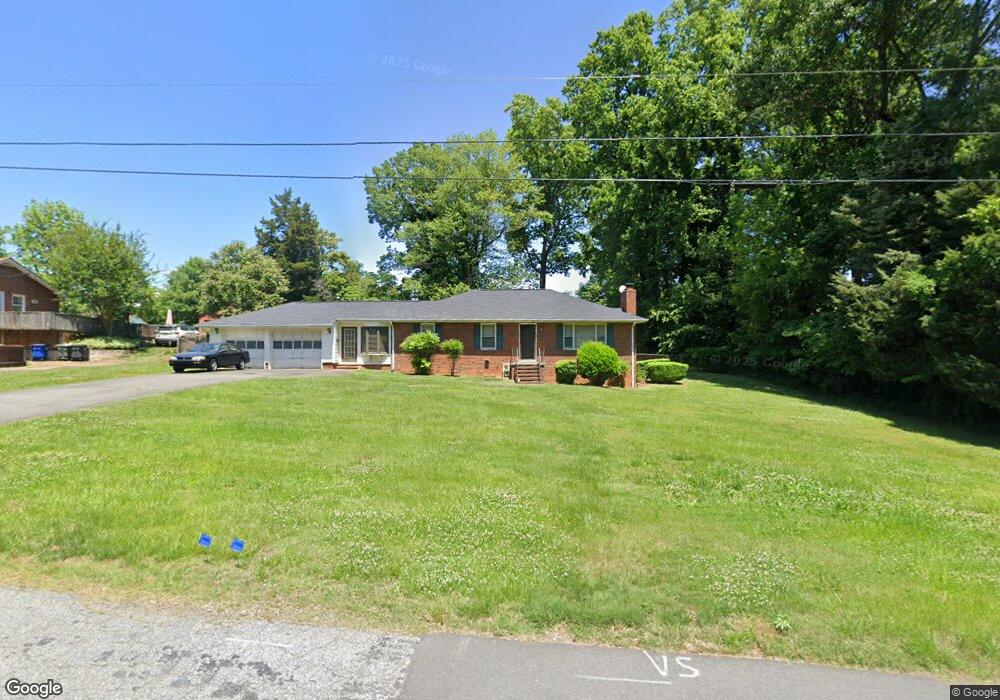
971 Rock Spring Dr Winston Salem, NC 27105
Northeast Winston-Salem NeighborhoodEstimated Value: $230,000 - $249,000
6
Beds
4
Baths
2,576
Sq Ft
$93/Sq Ft
Est. Value
About This Home
This home is located at 971 Rock Spring Dr, Winston Salem, NC 27105 and is currently estimated at $240,849, approximately $93 per square foot. 971 Rock Spring Dr is a home located in Forsyth County with nearby schools including Gibson Elementary School, Northwest Middle, and North Forsyth High.
Ownership History
Date
Name
Owned For
Owner Type
Purchase Details
Closed on
Nov 10, 2003
Sold by
Parris James Thomas and Parris Renet
Bought by
Williams Tangee S
Current Estimated Value
Home Financials for this Owner
Home Financials are based on the most recent Mortgage that was taken out on this home.
Original Mortgage
$108,202
Outstanding Balance
$48,895
Interest Rate
5.75%
Mortgage Type
FHA
Estimated Equity
$191,954
Create a Home Valuation Report for This Property
The Home Valuation Report is an in-depth analysis detailing your home's value as well as a comparison with similar homes in the area
Home Values in the Area
Average Home Value in this Area
Purchase History
| Date | Buyer | Sale Price | Title Company |
|---|---|---|---|
| Williams Tangee S | $110,000 | -- |
Source: Public Records
Mortgage History
| Date | Status | Borrower | Loan Amount |
|---|---|---|---|
| Open | Williams Tangee S | $108,202 |
Source: Public Records
Tax History Compared to Growth
Tax History
| Year | Tax Paid | Tax Assessment Tax Assessment Total Assessment is a certain percentage of the fair market value that is determined by local assessors to be the total taxable value of land and additions on the property. | Land | Improvement |
|---|---|---|---|---|
| 2025 | $1,756 | $206,200 | $34,500 | $171,700 |
| 2024 | $1,676 | $125,200 | $27,600 | $97,600 |
| 2023 | $1,676 | $125,200 | $27,600 | $97,600 |
| 2022 | $1,645 | $125,200 | $27,600 | $97,600 |
| 2021 | $1,615 | $125,200 | $27,600 | $97,600 |
| 2020 | $1,113 | $80,600 | $17,300 | $63,300 |
| 2019 | $1,121 | $80,600 | $17,300 | $63,300 |
| 2018 | $1,065 | $80,600 | $17,300 | $63,300 |
| 2016 | $1,358 | $103,151 | $17,250 | $85,901 |
| 2015 | $1,337 | $103,151 | $17,250 | $85,901 |
| 2014 | $1,297 | $103,151 | $17,250 | $85,901 |
Source: Public Records
Map
Nearby Homes
- 00 Germanton Rd
- 5722 Germanton Rd
- 930 Rock Spring Dr
- 1217 Mardele Ln
- 5615 Plantation Dr
- 550 Holly Ridge Dr
- 5802 Germanton Rd
- 604 Berrywood St
- 600 Berrywood St
- 6029 Crestridge Ln
- 605 Berrywood St
- 6021 Crestridge Ln Unit 1003
- 5833 Germanton Rd
- 0 Phelps Cir NE
- 347 Old Hollow Rd
- 790 Shellhabour Blvd
- 5325 Gyddie Dr
- 0000 Leslie Dr
- 000 Leslie Dr
- 0 Sandhill Dr
- 965 Rock Spring Dr
- 5650 Germanton Rd
- 5654 Germanton Rd
- 959 Rock Spring Dr Unit 12
- 562 Old Hollow Rd
- 966 Rock Spring Dr Unit 88
- 544 Old Hollow Rd
- 960 Rock Spring Dr
- 953 Rock Spring Dr
- 564 Old Hollow Rd
- 540 Old Hollow Rd
- 1105 Twin Oak Dr
- 5673 Plantation Dr
- 5655 Germanton Rd
- 947 Rock Spring Dr Unit 16
- 536 Old Hollow Rd
- 1104 Twin Oak Dr
- 942 Rock Spring Dr
- 5669 Plantation Dr
- 547 Old Hollow Rd