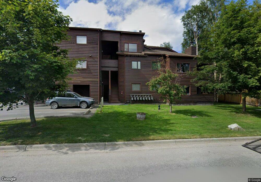
9710 Vanguard Dr Unit 79 Anchorage, AK 99507
Abbott Loop NeighborhoodEstimated Value: $130,000 - $203,000
2
Beds
1
Bath
825
Sq Ft
$213/Sq Ft
Est. Value
About This Home
This home is located at 9710 Vanguard Dr Unit 79, Anchorage, AK 99507 and is currently estimated at $175,935, approximately $213 per square foot. 9710 Vanguard Dr Unit 79 is a home located in Anchorage Municipality with nearby schools including Spring Hill Elementary School, Hanshew Middle School, and Service High School.
Ownership History
Date
Name
Owned For
Owner Type
Purchase Details
Closed on
Nov 29, 1990
Sold by
Federal National Mortgage Assn
Bought by
Storer Andrew J and Maas Charles I
Current Estimated Value
Home Financials for this Owner
Home Financials are based on the most recent Mortgage that was taken out on this home.
Original Mortgage
$39,500
Interest Rate
10.35%
Mortgage Type
Seller Take Back
Create a Home Valuation Report for This Property
The Home Valuation Report is an in-depth analysis detailing your home's value as well as a comparison with similar homes in the area
Home Values in the Area
Average Home Value in this Area
Purchase History
| Date | Buyer | Sale Price | Title Company |
|---|---|---|---|
| Storer Andrew J | -- | -- | |
| Storer Andrew J | -- | -- |
Source: Public Records
Mortgage History
| Date | Status | Borrower | Loan Amount |
|---|---|---|---|
| Closed | Storer Andrew J | $39,500 |
Source: Public Records
Tax History Compared to Growth
Tax History
| Year | Tax Paid | Tax Assessment Tax Assessment Total Assessment is a certain percentage of the fair market value that is determined by local assessors to be the total taxable value of land and additions on the property. | Land | Improvement |
|---|---|---|---|---|
| 2025 | -- | $176,500 | -- | $176,500 |
| 2024 | $2,381 | $155,300 | $0 | $155,300 |
| 2023 | $2,381 | $139,800 | $0 | $139,800 |
| 2022 | $2,270 | $134,800 | $0 | $134,800 |
| 2021 | $2,245 | $124,600 | $0 | $124,600 |
| 2020 | $2,213 | $130,200 | $0 | $130,200 |
| 2019 | $0 | $123,100 | $0 | $123,100 |
| 2018 | -- | $131,600 | $0 | $131,600 |
| 2017 | -- | $126,000 | $0 | $126,000 |
| 2016 | -- | $121,600 | $0 | $121,600 |
| 2015 | -- | $124,500 | $0 | $124,500 |
| 2014 | -- | $120,100 | $0 | $120,100 |
Source: Public Records
Map
Nearby Homes
- 9700 Vanguard Dr Unit 70
- 9710 Vanguard Dr Unit 80
- 9730 Vanguard Dr Unit 12
- 1917 Colony Place Unit 33
- 1914 Sturbridge Ct Unit 3
- 2060 Sturbridge Cir
- 9830 Reliance Dr
- 9599 Brayton Dr Unit 422
- 267 Loop Unit 267
- 10260 Jamestown Dr Unit A8
- 1611 Betula Cir
- 10261 Arborvitae Dr
- 9499 Brayton Dr Unit 39
- 9499 Brayton Dr Unit 152
- 9499 Brayton Dr Unit 245
- 1900-1941 Marthas Vineyard Cir
- 10285 Arborvitae Dr
- 8000 Independence Park Dr
- 10009 Thimble Berry Dr
- 9130 Golovin St
- 9710 Vanguard Dr Unit 88
- 9710 Vanguard Dr Unit 87
- 9710 Vanguard Dr Unit 86
- 9710 Vanguard Dr Unit 85
- 9710 Vanguard Dr Unit 84
- 9710 Vanguard Dr Unit 83
- 9710 Vanguard Dr Unit 82
- 9710 Vanguard Dr Unit 81
- 9710 Vanguard Dr Unit 78
- 9710 Vanguard Dr Unit 77
- 9710 Vanguard Dr Unit 76
- 9710 Vanguard Dr Unit 75
- 9710 Vanguard Dr Unit 74
- 9710 Vanguard Dr Unit 73
- 9710 Vanguard Dr
- 9700 Vanguard Dr Unit 72
- 9700 Vanguard Dr Unit 71
- 9700 Vanguard Dr Unit 69
- 9700 Vanguard Dr Unit 68
- 9700 Vanguard Dr Unit 67