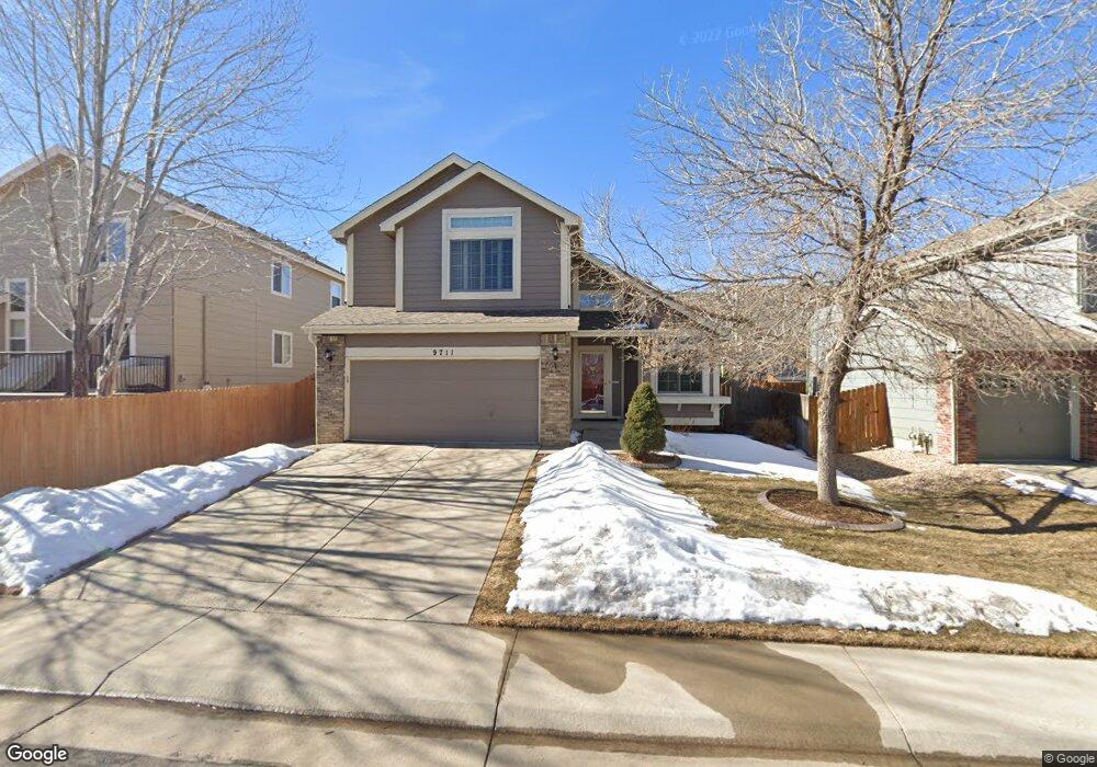
9711 Kendall Ct Westminster, CO 80021
Westcliff & Cambridge NeighborhoodEstimated Value: $563,730 - $672,000
3
Beds
5
Baths
1,492
Sq Ft
$424/Sq Ft
Est. Value
About This Home
This home is located at 9711 Kendall Ct, Westminster, CO 80021 and is currently estimated at $631,933, approximately $423 per square foot. 9711 Kendall Ct is a home located in Jefferson County with nearby schools including Adams Elementary School, Mandalay Middle School, and Standley Lake High School.
Ownership History
Date
Name
Owned For
Owner Type
Purchase Details
Closed on
Sep 30, 2022
Sold by
Lyman Catherine M
Bought by
Catherine Mary Lyman-Robble Trust
Current Estimated Value
Purchase Details
Closed on
Aug 27, 1998
Sold by
Parker Ronald L and Parker Debra M
Bought by
Lyman Catherine M
Home Financials for this Owner
Home Financials are based on the most recent Mortgage that was taken out on this home.
Original Mortgage
$125,000
Interest Rate
6.9%
Purchase Details
Closed on
Jun 27, 1997
Sold by
U S Home Corp
Bought by
Parker Ronald L and Parker Debra M
Home Financials for this Owner
Home Financials are based on the most recent Mortgage that was taken out on this home.
Original Mortgage
$145,552
Interest Rate
7.94%
Mortgage Type
FHA
Create a Home Valuation Report for This Property
The Home Valuation Report is an in-depth analysis detailing your home's value as well as a comparison with similar homes in the area
Home Values in the Area
Average Home Value in this Area
Purchase History
| Date | Buyer | Sale Price | Title Company |
|---|---|---|---|
| Catherine Mary Lyman-Robble Trust | -- | -- | |
| Lyman Catherine M | $175,000 | North American Title | |
| Parker Ronald L | $150,541 | Stewart Title |
Source: Public Records
Mortgage History
| Date | Status | Borrower | Loan Amount |
|---|---|---|---|
| Previous Owner | Lyman Catherine M | $125,000 | |
| Previous Owner | Parker Ronald L | $145,552 |
Source: Public Records
Tax History Compared to Growth
Tax History
| Year | Tax Paid | Tax Assessment Tax Assessment Total Assessment is a certain percentage of the fair market value that is determined by local assessors to be the total taxable value of land and additions on the property. | Land | Improvement |
|---|---|---|---|---|
| 2024 | $1,902 | $31,670 | $11,146 | $20,524 |
| 2023 | $1,902 | $31,670 | $11,146 | $20,524 |
| 2022 | $1,706 | $28,886 | $8,488 | $20,398 |
| 2021 | $1,731 | $29,717 | $8,732 | $20,985 |
| 2020 | $1,539 | $27,333 | $7,937 | $19,396 |
| 2019 | $1,515 | $27,333 | $7,937 | $19,396 |
| 2018 | $1,320 | $24,210 | $6,491 | $17,719 |
| 2017 | $1,182 | $24,210 | $6,491 | $17,719 |
| 2016 | $1,145 | $23,244 | $6,233 | $17,011 |
| 2015 | $1,431 | $23,244 | $6,233 | $17,011 |
| 2014 | $1,431 | $17,807 | $5,572 | $12,235 |
Source: Public Records
Map
Nearby Homes
- 9657 Kendall Ct
- 6563 W 96th Place
- 6598 W 96th Dr
- 6620 W 95th Place
- 6317 W 95th Ave
- 6401 W 95th Ave
- 6319 W 95th Ave
- 6794 W 98th Cir
- 6200 W 95th Ave
- 9405 Otis St
- 9530 Gray St
- 9322 Kendall St
- 9304 Kendall St
- 5584 W 96th Place
- 5892 W 94th Place
- 9212 Lamar St
- 5731 W 92nd Ave Unit 125
- 5443 W 97th Place
- 5721 W 92nd Ave Unit 96
- 5411 W 97th Place Unit D
- 9717 Kendall Ct
- 6413 W 96th Dr
- 6427 W 96th Dr
- 9723 Kendall Ct
- 6441 W 96th Dr
- 9729 Kendall Ct
- 9712 Kendall Ct
- 9706 Kendall Ct
- 9681 Kendall Ct
- 9700 Kendall Ct
- 9718 Kendall Ct
- 9724 Kendall Ct
- 6455 W 96th Dr
- 9694 Kendall Ct
- 6469 W 96th Dr
- 9668 Lamar Place
- 9675 Kendall Ct
- 9730 Kendall Ct
- 9688 Kendall Ct
- 9736 Kendall Ct