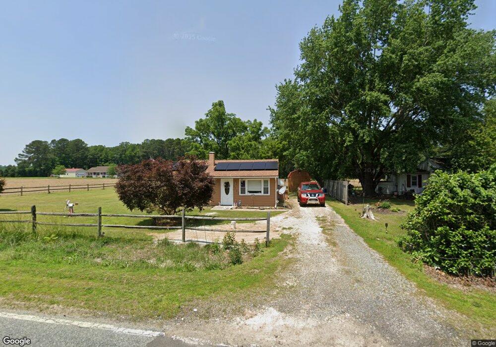
9712 Foy Rd Denton, MD 21629
Estimated Value: $154,000 - $231,000
--
Bed
1
Bath
818
Sq Ft
$241/Sq Ft
Est. Value
About This Home
This home is located at 9712 Foy Rd, Denton, MD 21629 and is currently estimated at $196,999, approximately $240 per square foot. 9712 Foy Rd is a home located in Caroline County with nearby schools including Denton Elementary School, Lockerman Middle School, and North Caroline High School.
Ownership History
Date
Name
Owned For
Owner Type
Purchase Details
Closed on
Sep 11, 2003
Sold by
Gentry Alvin E
Bought by
Fretwell Irvin T
Current Estimated Value
Purchase Details
Closed on
Mar 17, 1987
Sold by
Blight Richard C and Blight Linda R
Bought by
Gentry Alvin E
Home Financials for this Owner
Home Financials are based on the most recent Mortgage that was taken out on this home.
Original Mortgage
$39,900
Interest Rate
9.05%
Purchase Details
Closed on
May 15, 1978
Sold by
Schaefer Richard W
Bought by
Blight Richard C and Blight Linda R
Home Financials for this Owner
Home Financials are based on the most recent Mortgage that was taken out on this home.
Original Mortgage
$21,000
Interest Rate
9.55%
Create a Home Valuation Report for This Property
The Home Valuation Report is an in-depth analysis detailing your home's value as well as a comparison with similar homes in the area
Home Values in the Area
Average Home Value in this Area
Purchase History
| Date | Buyer | Sale Price | Title Company |
|---|---|---|---|
| Fretwell Irvin T | $85,800 | -- | |
| Gentry Alvin E | $39,900 | -- | |
| Blight Richard C | $19,500 | -- |
Source: Public Records
Mortgage History
| Date | Status | Borrower | Loan Amount |
|---|---|---|---|
| Previous Owner | Gentry Alvin E | $39,900 | |
| Previous Owner | Blight Richard C | $21,000 | |
| Closed | Fretwell Irvin T | -- |
Source: Public Records
Tax History Compared to Growth
Tax History
| Year | Tax Paid | Tax Assessment Tax Assessment Total Assessment is a certain percentage of the fair market value that is determined by local assessors to be the total taxable value of land and additions on the property. | Land | Improvement |
|---|---|---|---|---|
| 2025 | $1,072 | $108,600 | $45,000 | $63,600 |
| 2024 | $1,072 | $103,133 | $0 | $0 |
| 2023 | $1,018 | $97,667 | $0 | $0 |
| 2022 | $967 | $92,200 | $45,000 | $47,200 |
| 2021 | $910 | $89,600 | $0 | $0 |
| 2020 | $910 | $87,000 | $0 | $0 |
| 2019 | $882 | $84,400 | $34,700 | $49,700 |
| 2018 | $961 | $82,500 | $0 | $0 |
| 2017 | $940 | $80,600 | $0 | $0 |
| 2016 | -- | $78,700 | $0 | $0 |
| 2015 | $820 | $78,700 | $0 | $0 |
| 2014 | $820 | $78,700 | $0 | $0 |
Source: Public Records
Map
Nearby Homes
- 406 Morning Glory Dr
- The Queen Anne Plan at The Gardens
- The Dorchester Plan at The Gardens
- The Corsica Plan at The Gardens
- The Kent II Plan at The Gardens
- The Somerset Plan at The Gardens
- 1202 Blue Heron Dr
- 1105 Market St
- 1403 Blue Heron Dr
- 1005 Market St
- 1111 Ruddy Duck Ct
- 1626 Blue Heron Dr
- 314 Kerr Ave
- 1111 Trice Meadows Cir
- 311 Kerr Ave
- 121 Edenton Ln
- 302 Kerr Ave
- 1233 Painted Fern Rd
- 515 Franklin St
- 334 Deep Shore Rd
- 9724 Foy Rd
- 9730 Foy Rd
- 9721 Foy Rd
- 9699 Foy Rd
- 9698 Foy Rd
- 9725 Foy Rd
- 9691 Foy Rd
- 311 Morning Glory Dr
- 309 Morning Glory Dr
- 9746 Foy Rd
- 313 Morning Glory Dr
- 307 Morning Glory Dr
- 315 Morning Glory Dr
- 317 Morning Glory Dr
- 9729 Foy Rd
- 9685 Foy Rd
- 303 Morning Glory Dr
- 314 Morning Glory Dr
- 319 Morning Glory Dr
- 301 Morning Glory Dr