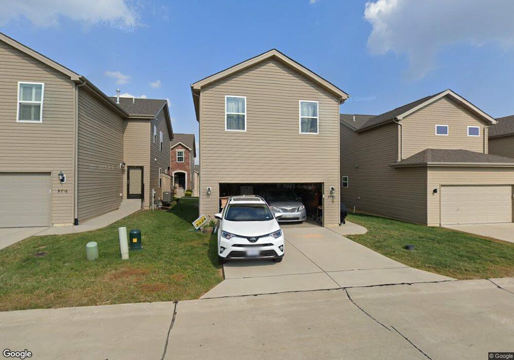
9712 Wilderness Battle Cir St. Louis, MO 63123
Estimated Value: $442,980 - $503,000
4
Beds
4
Baths
1,960
Sq Ft
$242/Sq Ft
Est. Value
About This Home
This home is located at 9712 Wilderness Battle Cir, St. Louis, MO 63123 and is currently estimated at $475,245, approximately $242 per square foot. 9712 Wilderness Battle Cir is a home located in St. Louis County with nearby schools including Sappington Elementary School, Sperreng Middle School, and Lindbergh High School.
Ownership History
Date
Name
Owned For
Owner Type
Purchase Details
Closed on
Jun 29, 2018
Sold by
Winkel Nathaniel G and Winkel Rachel
Bought by
Gentsch Ryan and Gentsch Jennifer
Current Estimated Value
Home Financials for this Owner
Home Financials are based on the most recent Mortgage that was taken out on this home.
Original Mortgage
$279,000
Outstanding Balance
$241,828
Interest Rate
4.6%
Mortgage Type
New Conventional
Estimated Equity
$233,417
Purchase Details
Closed on
Sep 22, 2015
Sold by
Mcbride Grants View Llc
Bought by
Winkel Nathaniel G and Winkel Rachel
Home Financials for this Owner
Home Financials are based on the most recent Mortgage that was taken out on this home.
Original Mortgage
$185,000
Interest Rate
3.99%
Mortgage Type
New Conventional
Create a Home Valuation Report for This Property
The Home Valuation Report is an in-depth analysis detailing your home's value as well as a comparison with similar homes in the area
Home Values in the Area
Average Home Value in this Area
Purchase History
| Date | Buyer | Sale Price | Title Company |
|---|---|---|---|
| Gentsch Ryan | $310,000 | Title Partners Agency Llc | |
| Winkel Nathaniel G | $291,823 | Title Partners Agency Llc |
Source: Public Records
Mortgage History
| Date | Status | Borrower | Loan Amount |
|---|---|---|---|
| Open | Gentsch Ryan | $279,000 | |
| Previous Owner | Winkel Nathaniel G | $185,000 |
Source: Public Records
Tax History Compared to Growth
Tax History
| Year | Tax Paid | Tax Assessment Tax Assessment Total Assessment is a certain percentage of the fair market value that is determined by local assessors to be the total taxable value of land and additions on the property. | Land | Improvement |
|---|---|---|---|---|
| 2025 | $4,455 | $74,730 | $17,370 | $57,360 |
| 2024 | $4,455 | $67,950 | $10,850 | $57,100 |
| 2023 | $4,444 | $67,950 | $10,850 | $57,100 |
| 2022 | $4,586 | $62,320 | $8,680 | $53,640 |
| 2021 | $4,062 | $62,320 | $8,680 | $53,640 |
| 2020 | $3,999 | $59,200 | $10,410 | $48,790 |
| 2019 | $3,989 | $59,200 | $10,410 | $48,790 |
| 2018 | $4,096 | $55,310 | $10,410 | $44,900 |
| 2017 | $4,052 | $55,310 | $10,410 | $44,900 |
| 2016 | $4,328 | $56,120 | $10,410 | $45,710 |
| 2015 | -- | $10,410 | $10,410 | $0 |
Source: Public Records
Map
Nearby Homes
- 9742 Croftwood Dr
- 3 Grantview Ln
- 5 Grantview Ln
- 10649 W Knollshire Dr
- 7508 Bull Run Dr
- 9008 Fernald Dr
- 10360 Roscommon Dr
- 7369 Whitehaven Dr
- 10300 Grant Forest Ln
- 10161 Squire Meadows Dr Unit E
- 10161 Squire Meadows Dr Unit C
- 7636 Fort Henry Dr
- 10016 Kilmeade Dr
- 7424 Granbury Cir
- 9188 Rusticwood Trail
- 8875 Rock Forest Dr
- 8853 Raleigh Dr
- 11000 Torigney Dr
- 11042 Wylestone Ct
- 7910 Royal Arms Ct Unit 1
- 9712 Wilderness Battle Cir
- 9708 Wilderness Battle Cir
- 9716 Wilderness Battle Cir
- 9704 Wilderness Battle Cir
- 9720 Wilderness Battle Cir
- 9747 Wilderness Battle Dr
- 9751 Wilderness Battle Dr Unit 22
- 9743 Wilderness Battle Dr Unit 20
- 9724 Wilderness Battle Cir
- 9739 Wilderness Battle Cir
- 9739 Wilderness Battle Dr Unit 19
- 9739 Wilderness Battle Dr
- 9735 Wilderness Battle Cir
- 9735 Wilderness Battle Dr
- 9728 Wilderness Battle Cir
- 9734 Wilderness Battle Dr Unit 26
- 9734 Wilderness Battle Dr
- 9731 Wilderness Battle Dr
- 9746 Wilderness Battle Dr
- 9732 Wilderness Battle Cir