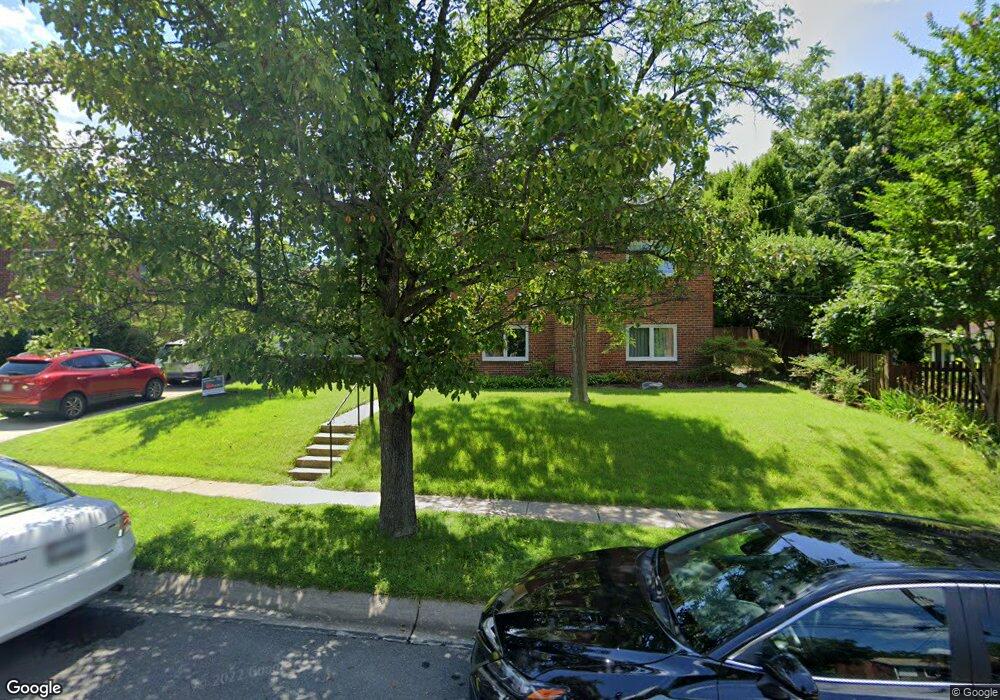
9714 Singleton Dr Bethesda, MD 20817
Wyngate NeighborhoodEstimated Value: $919,000 - $1,040,000
Studio
3
Baths
1,431
Sq Ft
$690/Sq Ft
Est. Value
About This Home
This home is located at 9714 Singleton Dr, Bethesda, MD 20817 and is currently estimated at $988,097, approximately $690 per square foot. 9714 Singleton Dr is a home located in Montgomery County with nearby schools including Wyngate Elementary School, North Bethesda Middle School, and Walter Johnson High School.
Ownership History
Date
Name
Owned For
Owner Type
Purchase Details
Closed on
May 24, 1999
Sold by
Riblett William R and Riblett M D
Bought by
Whitescarver Douglas E and Whitescarver A N
Current Estimated Value
Purchase Details
Closed on
Dec 29, 1995
Sold by
William R Riblett
Bought by
William R Riblett Et Al Tr
Create a Home Valuation Report for This Property
The Home Valuation Report is an in-depth analysis detailing your home's value as well as a comparison with similar homes in the area
Home Values in the Area
Average Home Value in this Area
Purchase History
| Date | Buyer | Sale Price | Title Company |
|---|---|---|---|
| Whitescarver Douglas E | $266,000 | -- | |
| Riblett William R | -- | -- | |
| Riblett William R Et Al Tr | -- | -- | |
| Riblett William R Et Al Tr | -- | -- | |
| William R Riblett Et Al Tr | -- | -- |
Source: Public Records
Tax History
| Year | Tax Paid | Tax Assessment Tax Assessment Total Assessment is a certain percentage of the fair market value that is determined by local assessors to be the total taxable value of land and additions on the property. | Land | Improvement |
|---|---|---|---|---|
| 2025 | $9,626 | $794,733 | -- | -- |
| 2024 | $9,626 | $772,700 | $557,200 | $215,500 |
| 2023 | $8,597 | $745,200 | $0 | $0 |
| 2022 | $7,881 | $717,700 | $0 | $0 |
| 2021 | $7,410 | $690,200 | $530,600 | $159,600 |
| 2020 | $7,410 | $684,233 | $0 | $0 |
| 2019 | $7,308 | $678,267 | $0 | $0 |
| 2018 | $7,224 | $672,300 | $505,300 | $167,000 |
| 2017 | $6,938 | $635,833 | $0 | $0 |
| 2016 | -- | $599,367 | $0 | $0 |
| 2015 | $5,228 | $562,900 | $0 | $0 |
| 2014 | $5,228 | $545,733 | $0 | $0 |
Source: Public Records
Map
Nearby Homes
- 9715 Singleton Dr
- 6216 Rockhurst Rd
- 9831 Singleton Dr
- 6226 Stoneham Ct
- 6308 Rockhurst Rd
- 6311 Carnegie Dr
- 9403 Ewing Dr
- 9309 Lindale Dr
- 5901 Kingswood Rd
- 9302 Bulls Run Pkwy
- 5812 Lone Oak Dr
- 9504 Hollins Ct
- 6417 Camrose Terrace
- 9909 Dickens Ave
- 5805 Conway Rd
- 9216 Shelton St
- 5430 Whitley Park Terrace
- 9901 Fernwood Rd
- 9309 Old Georgetown Rd
- 5450 Whitley Park Terrace Unit 413
- 9712 Singleton Dr
- 9609 Bulls Run Pkwy
- 9607 Bulls Run Pkwy
- 9710 Singleton Dr
- 6017 Kingsford Ct
- 9605 Bulls Run Pkwy
- 9719 Singleton Dr
- 6021 Kingsford Rd
- 6015 Kingsford Ct
- 9717 Singleton Dr
- 9721 Singleton Dr
- 9708 Singleton Dr
- 6019 Kingsford Ct
- 9723 Singleton Dr
- 9601 Bulls Run Pkwy
- 9713 Singleton Dr
- 9706 Singleton Dr
- 6013 Kingsford Ct
- 9711 Singleton Dr
- 6011 Kingsford Ct
Your Personal Tour Guide
Ask me questions while you tour the home.