Estimated Value: $113,000 - $263,578
3
Beds
2
Baths
2,362
Sq Ft
$75/Sq Ft
Est. Value
About This Home
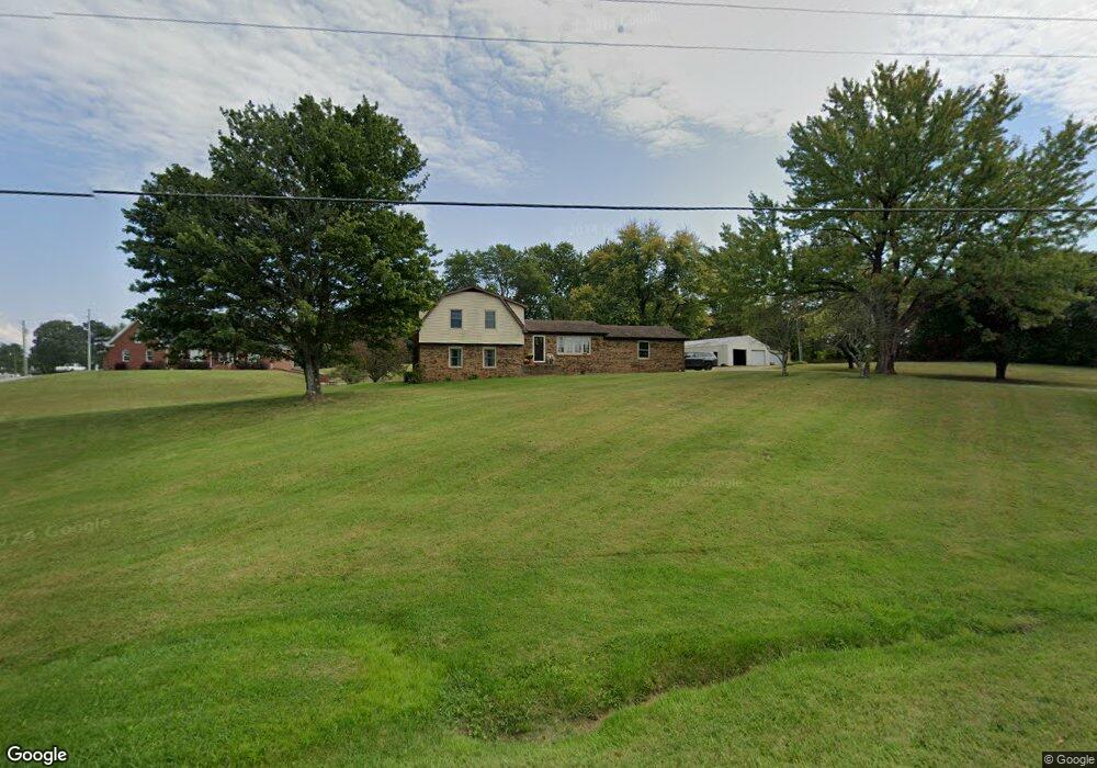
This home is located at 9715 State Route 132 W, Clay, KY 42404 and is currently estimated at $177,895, approximately $75 per square foot. 9715 State Route 132 W is a home located in Webster County with nearby schools including Webster County High School.
Ownership History
Date
Name
Owned For
Owner Type
Purchase Details
Closed on
Feb 11, 2022
Sold by
Wayne Jackson Travis and Wayne Jo Brandy
Bought by
Jackson Brandy Jo
Current Estimated Value
Purchase Details
Closed on
Apr 13, 2012
Sold by
Grigg M Brandon
Bought by
Jackson Travis Wayne and Hayes Brandy Jo
Home Financials for this Owner
Home Financials are based on the most recent Mortgage that was taken out on this home.
Original Mortgage
$139,569
Interest Rate
3.75%
Mortgage Type
FHA
Purchase Details
Closed on
Nov 13, 2009
Sold by
Owen Kristy and Owen Jimmy D
Bought by
Grigg M Brandon
Create a Home Valuation Report for This Property
The Home Valuation Report is an in-depth analysis detailing your home's value as well as a comparison with similar homes in the area
Home Values in the Area
Average Home Value in this Area
Purchase History
| Date | Buyer | Sale Price | Title Company |
|---|---|---|---|
| Jackson Brandy Jo | -- | Rosenberg Jay A | |
| Jackson Travis Wayne | $143,200 | None Available | |
| Grigg M Brandon | -- | -- |
Source: Public Records
Mortgage History
| Date | Status | Borrower | Loan Amount |
|---|---|---|---|
| Previous Owner | Jackson Travis Wayne | $139,569 |
Source: Public Records
Tax History Compared to Growth
Tax History
| Year | Tax Paid | Tax Assessment Tax Assessment Total Assessment is a certain percentage of the fair market value that is determined by local assessors to be the total taxable value of land and additions on the property. | Land | Improvement |
|---|---|---|---|---|
| 2024 | $1,897 | $168,900 | $0 | $0 |
| 2023 | $1,727 | $153,000 | $0 | $0 |
| 2022 | $1,734 | $153,000 | $0 | $0 |
| 2021 | $1,761 | $153,000 | $0 | $0 |
| 2020 | $1,788 | $153,000 | $0 | $0 |
| 2019 | $1,633 | $143,200 | $0 | $0 |
| 2018 | $1,630 | $143,200 | $0 | $0 |
| 2017 | $1,585 | $143,200 | $0 | $0 |
| 2016 | $1,519 | $143,200 | $0 | $0 |
| 2015 | -- | $143,200 | $0 | $0 |
| 2012 | -- | $116,000 | $0 | $0 |
Source: Public Records
Map
Nearby Homes
- 329 W Railroad St
- 86 Taylor St
- 154 Taylor St
- 8618 State Route 132 W
- 68 Nelson St
- 19 Russell St
- 3535 State Route 2837
- 4793 S St Rt 109
- 173 Green Rd
- 105 Ewing Place
- 0 Sullivan Rd Unit LotWP001
- 314 N Willow St
- 201 Marlin St
- 0 Bellville Rd
- 1501 Old Henderson Rd
- 200 N Finley Ave
- 106 N Broadway St
- 000 Kentucky 120
- 0 Kentucky 120
- 130 E Main St
- 9639 State Route 132 W
- 9670 State Route 132 W
- 9664 State Route 132 W
- 144 Henry Dr
- 9634 State Route 132 W
- 90 Henry Dr
- 9602 State Route 132 W
- 58 Henry Dr
- 9865 State Route 132 W
- 9821 State Route 132 W
- 40 Henry Dr
- 28 Henry Dr
- 150 Henry Dr
- 116 Adam Ln
- 4 Henry Dr
- 536 State Route 109 S
- 9490 State Route 132 W
- 334 State Route 109 S
- 348 State Route 109 S
- 320 State Route 109 S