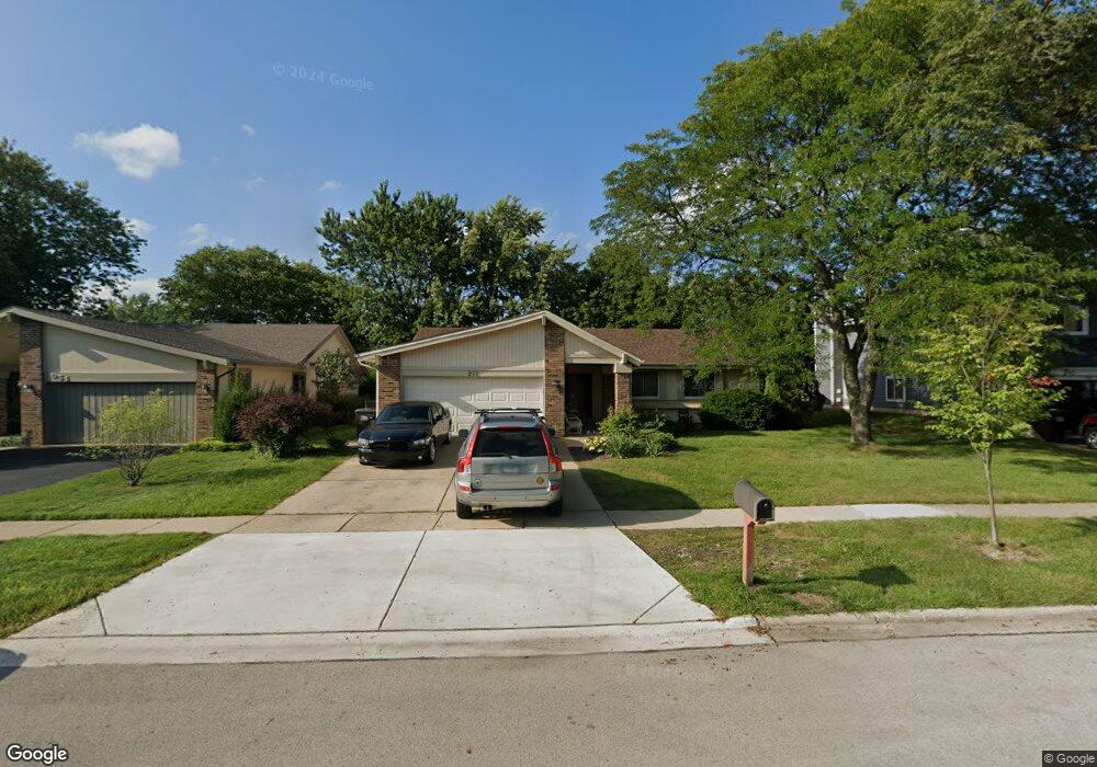
972 Buffalo Creek Dr Lake Zurich, IL 60047
Estimated Value: $394,000 - $440,000
--
Bed
2
Baths
1,607
Sq Ft
$254/Sq Ft
Est. Value
About This Home
This home is located at 972 Buffalo Creek Dr, Lake Zurich, IL 60047 and is currently estimated at $408,146, approximately $253 per square foot. 972 Buffalo Creek Dr is a home located in Lake County with nearby schools including Sarah Adams Elementary School, Lake Zurich Middle School - South Campus, and Lake Zurich High School.
Ownership History
Date
Name
Owned For
Owner Type
Purchase Details
Closed on
May 27, 2003
Sold by
Livelsberger Gregory and Livelsberger Jeanne M
Bought by
Nielsen Barbara
Current Estimated Value
Home Financials for this Owner
Home Financials are based on the most recent Mortgage that was taken out on this home.
Original Mortgage
$212,400
Interest Rate
5.71%
Mortgage Type
Balloon
Purchase Details
Closed on
Aug 16, 2000
Sold by
Firstar Bank Na
Bought by
Livelsberger Gregory and Livelsberger Jeanne M
Create a Home Valuation Report for This Property
The Home Valuation Report is an in-depth analysis detailing your home's value as well as a comparison with similar homes in the area
Home Values in the Area
Average Home Value in this Area
Purchase History
| Date | Buyer | Sale Price | Title Company |
|---|---|---|---|
| Nielsen Barbara | $236,000 | -- | |
| Livelsberger Gregory | -- | -- | |
| Livelsberger Gregory | -- | -- |
Source: Public Records
Mortgage History
| Date | Status | Borrower | Loan Amount |
|---|---|---|---|
| Closed | Nielsen Barbara | $212,400 |
Source: Public Records
Tax History Compared to Growth
Tax History
| Year | Tax Paid | Tax Assessment Tax Assessment Total Assessment is a certain percentage of the fair market value that is determined by local assessors to be the total taxable value of land and additions on the property. | Land | Improvement |
|---|---|---|---|---|
| 2024 | $8,177 | $115,657 | $23,755 | $91,902 |
| 2023 | $6,738 | $112,551 | $23,117 | $89,434 |
| 2022 | $6,738 | $92,122 | $18,852 | $73,270 |
| 2021 | $6,449 | $88,525 | $18,369 | $70,156 |
| 2020 | $6,333 | $88,525 | $18,369 | $70,156 |
| 2019 | $6,237 | $87,753 | $18,209 | $69,544 |
| 2018 | $6,103 | $86,307 | $19,588 | $66,719 |
| 2017 | $6,061 | $85,267 | $19,352 | $65,915 |
| 2016 | $5,936 | $82,567 | $18,739 | $63,828 |
| 2015 | $5,843 | $78,642 | $17,848 | $60,794 |
| 2014 | $5,628 | $75,176 | $19,750 | $55,426 |
| 2012 | $5,415 | $75,335 | $19,792 | $55,543 |
Source: Public Records
Map
Nearby Homes
- 795 Harvest Dr
- 21839 Cambridge Dr
- 600 Ivy Ct
- 21742 N Ashley St
- 533 Surryse Rd
- 1266 Thorndale Ln
- 20992 W Preserve Dr
- 21186 W Preserve Dr
- 898 S Rand Rd
- 429 Grand Ave
- 461 N Newberry Ct
- 22206 N Prairie Ln
- 21031 N Quentin Rd
- 21763 Deerpath Rd
- 21041-51 N Quentin Rd
- 99 Quentin Rd
- 21265 W East Cuba Rd
- 22145 W White Pine Rd
- 155 Canterbury Way
- 119 Roman Ln
- 990 Buffalo Creek Dr
- 954 Buffalo Creek Dr
- 938 Buffalo Creek Dr
- 1002 Pheasant Ridge Dr
- 985 Buffalo Creek Dr
- 955 Buffalo Creek Dr
- 1008 Pheasant Ridge Dr
- 926 Buffalo Creek Dr
- 939 Buffalo Creek Dr
- 975 Sandlewood Ct
- 995 Sandlewood Ct
- 1020 Pheasant Ridge Dr Unit 6
- 980 Pheasant Ridge Dr
- 1005 Sandlewood Ct Unit 6
- 904 Buffalo Creek Dr
- 993 Pheasant Ridge Dr
- 790 Brookfield Ct
- 1005 Pheasant Ridge Dr
- LOT 18 Brookfield Ct
- 1034 Pheasant Ridge Dr