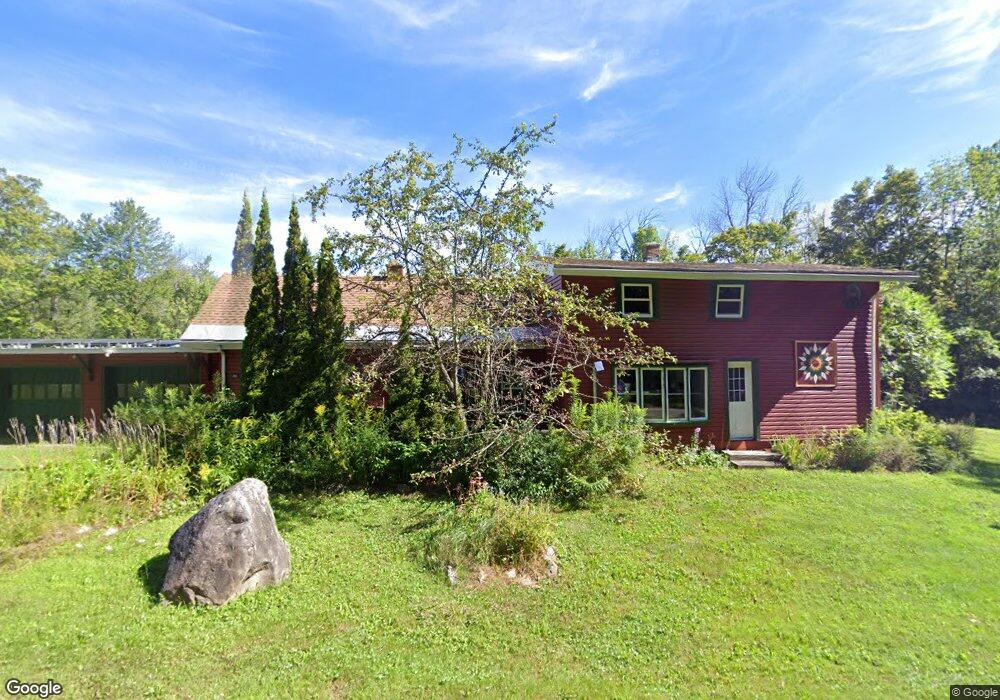
972 County Rd Becket, MA 01223
Estimated Value: $313,000 - $378,000
3
Beds
1
Bath
1,476
Sq Ft
$230/Sq Ft
Est. Value
About This Home
This home is located at 972 County Rd, Becket, MA 01223 and is currently estimated at $339,425, approximately $229 per square foot. 972 County Rd is a home located in Berkshire County with nearby schools including Wahconah Regional High School.
Ownership History
Date
Name
Owned For
Owner Type
Purchase Details
Closed on
Oct 5, 2012
Sold by
Connors Sean E and Connors Debra H
Bought by
Petosa James A and Grassmann Jamie
Current Estimated Value
Purchase Details
Closed on
Jul 31, 2009
Sold by
Mcnulty Edna E
Bought by
Walsh Sarah M and Staman Colby
Home Financials for this Owner
Home Financials are based on the most recent Mortgage that was taken out on this home.
Original Mortgage
$100,000
Interest Rate
5.43%
Mortgage Type
Purchase Money Mortgage
Purchase Details
Closed on
Aug 23, 1995
Sold by
Walters Theodore W and Walters Sandra J
Bought by
Mcnulty John A and Mcnulty Edna E
Home Financials for this Owner
Home Financials are based on the most recent Mortgage that was taken out on this home.
Original Mortgage
$86,000
Interest Rate
7.32%
Mortgage Type
Purchase Money Mortgage
Create a Home Valuation Report for This Property
The Home Valuation Report is an in-depth analysis detailing your home's value as well as a comparison with similar homes in the area
Home Values in the Area
Average Home Value in this Area
Purchase History
| Date | Buyer | Sale Price | Title Company |
|---|---|---|---|
| Petosa James A | $151,000 | -- | |
| Walsh Sarah M | $113,000 | -- | |
| Mcnulty John A | $86,000 | -- |
Source: Public Records
Mortgage History
| Date | Status | Borrower | Loan Amount |
|---|---|---|---|
| Previous Owner | Mcnulty John A | $31,900 | |
| Previous Owner | Walsh Sarah M | $100,000 | |
| Previous Owner | Mcnulty John A | $86,000 |
Source: Public Records
Tax History
| Year | Tax Paid | Tax Assessment Tax Assessment Total Assessment is a certain percentage of the fair market value that is determined by local assessors to be the total taxable value of land and additions on the property. | Land | Improvement |
|---|---|---|---|---|
| 2025 | $2,128 | $242,900 | $22,400 | $220,500 |
| 2024 | $2,410 | $246,700 | $21,400 | $225,300 |
| 2023 | $2,268 | $210,800 | $18,700 | $192,100 |
| 2022 | $1,682 | $156,900 | $24,900 | $132,000 |
| 2020 | $1,682 | $151,800 | $24,900 | $126,900 |
| 2019 | $1,683 | $152,000 | $24,900 | $127,100 |
| 2018 | $1,652 | $152,000 | $24,900 | $127,100 |
| 2017 | $1,602 | $152,000 | $24,900 | $127,100 |
| 2016 | $1,599 | $152,900 | $24,900 | $128,000 |
| 2015 | $1,598 | $152,900 | $24,900 | $128,000 |
| 2014 | $1,596 | $152,900 | $24,900 | $128,000 |
Source: Public Records
Map
Nearby Homes
- 0 Yokum Pond Rd
- Lot 3 Yokum Pond Rd
- 3258 Main St
- 3949 Jacobs Ladder Rd
- 885 Washington Mountain Rd
- 674 Benton Hill Rd
- LOT9 Benton Hill Rd
- LOT10 Benton Hill Rd
- Lot 2B Leland Rd
- Lot 2 Leland Rd
- 593 Woodmere Rd
- 973 Fred Snow Rd
- 40 Ryan Rd
- 138 Upper Valley Rd
- 159 Simmons Rd
- 1570 B Washington Mountain Rd
- 50 Beach Rd
- 106 E Shore Rd
- 161 Otis Rd
- 289 Antelope Dr
- 956 County Rd
- 1004 County Rd
- 767 County Rd
- 1054 County Rd
- 1090 County Rd
- 1123 County Rd
- 806 County Rd
- 1132 County Rd
- 809 County Rd
- 1220 County Rd
- 1230 County Rd
- 104 Stanley Rd Unit 108
- 668 County Rd
- 0 Captain Whitney Rd Unit 72326196
- 0 Captain Whitney Rd Unit 72326188
- 40.09 Stoney Brook
- 40.8 Stoney Brook Rd
- 0 Captain Whitney Rd Unit 71727973
- 0 Captain Whitney Rd Unit 71952436
Your Personal Tour Guide
Ask me questions while you tour the home.