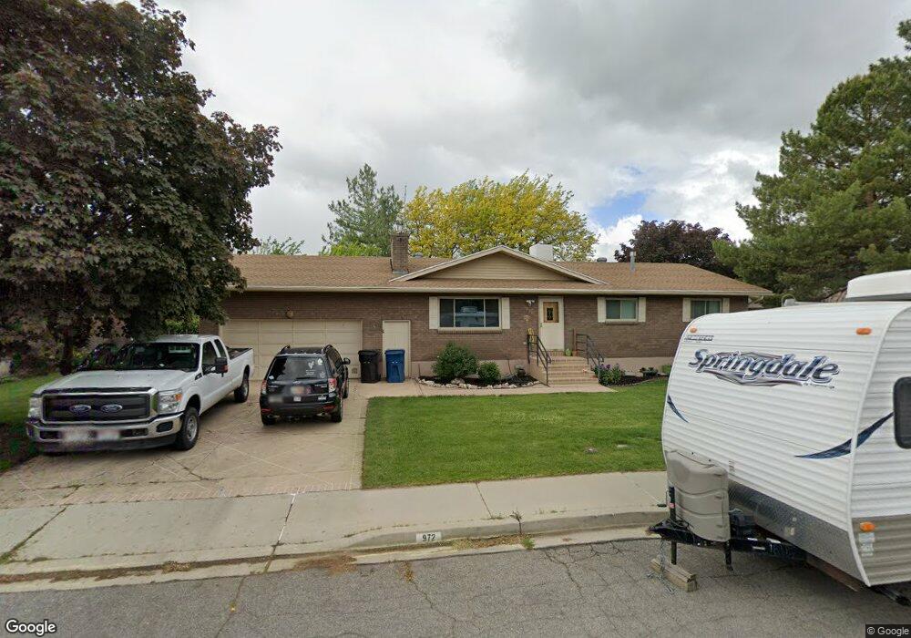
972 Maple Dr Spanish Fork, UT 84660
Estimated Value: $525,000 - $626,000
5
Beds
4
Baths
2,900
Sq Ft
$199/Sq Ft
Est. Value
About This Home
This home is located at 972 Maple Dr, Spanish Fork, UT 84660 and is currently estimated at $576,641, approximately $198 per square foot. 972 Maple Dr is a home located in Utah County with nearby schools including Canyon Elementary School, Spanish Fork Jr High School, and Spanish Fork High School.
Ownership History
Date
Name
Owned For
Owner Type
Purchase Details
Closed on
May 13, 2024
Sold by
Piazzola Joseph R
Bought by
Brooks Jessica Ann and Brooks John Jacob
Current Estimated Value
Home Financials for this Owner
Home Financials are based on the most recent Mortgage that was taken out on this home.
Original Mortgage
$353,316
Outstanding Balance
$347,646
Interest Rate
6.82%
Mortgage Type
New Conventional
Estimated Equity
$228,995
Purchase Details
Closed on
Aug 31, 2017
Sold by
Yount Harold
Bought by
Piazzola Joseph R
Home Financials for this Owner
Home Financials are based on the most recent Mortgage that was taken out on this home.
Original Mortgage
$267,602
Interest Rate
3.87%
Mortgage Type
FHA
Purchase Details
Closed on
Mar 3, 2008
Sold by
Davis Kathy J and Richey Kathy J
Bought by
Yount Harold and Yount Jeannette
Home Financials for this Owner
Home Financials are based on the most recent Mortgage that was taken out on this home.
Original Mortgage
$348,457
Interest Rate
3.1%
Mortgage Type
Reverse Mortgage Home Equity Conversion Mortgage
Purchase Details
Closed on
Nov 18, 2003
Sold by
Creer William N and Creer Larae W
Bought by
J Ballard Homes Inc
Purchase Details
Closed on
Jun 27, 2003
Sold by
Richey Kathy J and Yount Harold
Bought by
Yount Harold and Yount Jeannette
Home Financials for this Owner
Home Financials are based on the most recent Mortgage that was taken out on this home.
Original Mortgage
$134,400
Interest Rate
5.26%
Mortgage Type
Purchase Money Mortgage
Purchase Details
Closed on
Mar 27, 2001
Sold by
Republic Mtg Insurance Company
Bought by
Richey Kathy J and Yount Harold
Home Financials for this Owner
Home Financials are based on the most recent Mortgage that was taken out on this home.
Original Mortgage
$132,200
Interest Rate
7.06%
Purchase Details
Closed on
Jun 19, 2000
Sold by
Baker James and Baker Julie
Bought by
Federal Home Loans Mtg Corp
Create a Home Valuation Report for This Property
The Home Valuation Report is an in-depth analysis detailing your home's value as well as a comparison with similar homes in the area
Home Values in the Area
Average Home Value in this Area
Purchase History
| Date | Buyer | Sale Price | Title Company |
|---|---|---|---|
| Brooks Jessica Ann | -- | Old Republic Title | |
| Piazzola Joseph R | -- | Inwest Title | |
| Yount Harold | -- | Inwest Title | |
| Yount Harold | -- | Mountainside Title Insuranc | |
| J Ballard Homes Inc | -- | First American Title Co | |
| Yount Harold | -- | Title One Inc | |
| Richey Kathy J | -- | Equity Title Agency Inc | |
| Federal Home Loans Mtg Corp | $147,847 | Backman Stewart Title |
Source: Public Records
Mortgage History
| Date | Status | Borrower | Loan Amount |
|---|---|---|---|
| Open | Brooks Jessica Ann | $353,316 | |
| Previous Owner | Piazzola Joseph R | $267,602 | |
| Previous Owner | Yount Harold | $348,457 | |
| Previous Owner | Yount Harold | $134,400 | |
| Previous Owner | Richey Kathy J | $132,200 |
Source: Public Records
Tax History
| Year | Tax Paid | Tax Assessment Tax Assessment Total Assessment is a certain percentage of the fair market value that is determined by local assessors to be the total taxable value of land and additions on the property. | Land | Improvement |
|---|---|---|---|---|
| 2025 | $2,554 | $293,315 | -- | -- |
| 2024 | $2,554 | $263,230 | $0 | $0 |
| 2023 | $2,572 | $265,430 | $0 | $0 |
| 2022 | $2,477 | $250,635 | $0 | $0 |
| 2021 | $2,123 | $343,700 | $110,300 | $233,400 |
| 2020 | $2,010 | $316,400 | $100,300 | $216,100 |
| 2019 | $1,824 | $302,100 | $86,000 | $216,100 |
| 2018 | $1,666 | $266,700 | $78,800 | $187,900 |
| 2017 | $1,541 | $132,550 | $0 | $0 |
| 2016 | $1,445 | $122,650 | $0 | $0 |
| 2015 | $1,404 | $117,810 | $0 | $0 |
| 2014 | $1,355 | $114,070 | $0 | $0 |
Source: Public Records
Map
Nearby Homes
- 1105 S 200 E
- 2998 Canyon Dr Unit 333
- 3014 Canyon Dr Unit 332
- 2256 E 760 S Unit 7
- 886 S 1240 E
- 816 S 1300 #15gc E
- 834 S 1300 #16gc E
- 789 S 1300 E
- 815 S 1300 E Unit 34
- 762 S 1360 E
- 762 S 1360 E Unit 25
- 857 S 1300 E Unit 32
- 857 S 1300 E
- 1330 E 410 S
- 1110 E 1025 S
- 232 E 860 S Unit 158
- 222 E 860 S Unit 154
- 1025 S 3100 E Unit 320
- 2583 E 300 S Unit 21
- 1434 E 410 S
Your Personal Tour Guide
Ask me questions while you tour the home.