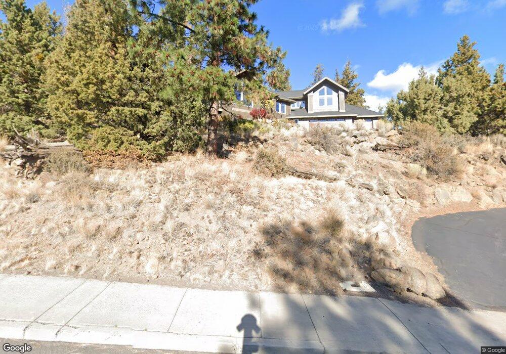
972 NW Summit Dr Bend, OR 97701
Awbrey Butte NeighborhoodEstimated Value: $1,159,000 - $1,361,000
3
Beds
3
Baths
2,521
Sq Ft
$492/Sq Ft
Est. Value
About This Home
This home is located at 972 NW Summit Dr, Bend, OR 97701 and is currently estimated at $1,240,575, approximately $492 per square foot. 972 NW Summit Dr is a home located in Deschutes County with nearby schools including North Star Elementary School, Pacific Crest Middle School, and Summit High School.
Ownership History
Date
Name
Owned For
Owner Type
Purchase Details
Closed on
Apr 27, 2018
Sold by
Simmons India
Bought by
Sykora Alycia N and Hill Timothy A
Current Estimated Value
Purchase Details
Closed on
Apr 24, 2018
Sold by
Simmons India
Bought by
Sykora Alycia N and Hill Timothy A
Purchase Details
Closed on
Dec 5, 2005
Sold by
Simmons India
Bought by
Simmons India
Home Financials for this Owner
Home Financials are based on the most recent Mortgage that was taken out on this home.
Original Mortgage
$400,000
Interest Rate
6.14%
Mortgage Type
New Conventional
Create a Home Valuation Report for This Property
The Home Valuation Report is an in-depth analysis detailing your home's value as well as a comparison with similar homes in the area
Home Values in the Area
Average Home Value in this Area
Purchase History
| Date | Buyer | Sale Price | Title Company |
|---|---|---|---|
| Sykora Alycia N | $711,000 | First American Title | |
| Sykora Alycia N | $711,000 | First American Title | |
| Simmons India | -- | First Amer Title Ins Co Or |
Source: Public Records
Mortgage History
| Date | Status | Borrower | Loan Amount |
|---|---|---|---|
| Previous Owner | Simmons India | $400,000 |
Source: Public Records
Tax History
| Year | Tax Paid | Tax Assessment Tax Assessment Total Assessment is a certain percentage of the fair market value that is determined by local assessors to be the total taxable value of land and additions on the property. | Land | Improvement |
|---|---|---|---|---|
| 2025 | $10,702 | $633,370 | -- | -- |
| 2024 | $10,296 | $614,930 | -- | -- |
| 2023 | $9,544 | $597,020 | $0 | $0 |
| 2022 | $8,905 | $562,760 | $0 | $0 |
| 2021 | $8,918 | $546,370 | $0 | $0 |
| 2020 | $8,461 | $546,370 | $0 | $0 |
| 2019 | $8,225 | $530,460 | $0 | $0 |
| 2018 | $7,993 | $515,010 | $0 | $0 |
| 2017 | $7,758 | $500,010 | $0 | $0 |
| 2016 | $7,399 | $485,450 | $0 | $0 |
| 2015 | $7,194 | $471,320 | $0 | $0 |
| 2014 | $6,982 | $457,600 | $0 | $0 |
Source: Public Records
Map
Nearby Homes
- 2850 NW Lucus Ct
- 2975 NW Lucus Ct
- 3061 NW Jewell Way
- 1166 NW Redfield Cir
- 3057 NW Colonial Dr
- 2980 NW Lucus Ct
- 2903 NW Fairway Heights Dr
- 520 NW Divot Dr
- 3122 NW Colonial Dr
- 3130 N West Colonial Dr
- 3031 NW Hidden Ridge Dr
- 3160 NW Colonial Dr
- 664 NW Powell Butte Loop
- 2984 NW Hidden Ridge Dr
- 3082 NW Hidden Ridge Dr
- 3162 NW Craftsman Dr
- 2545 NW Awbrey Rd
- 2580 N West Awbrey Point Cir Unit 1&2
- 625 NW Compass Ln
- 1200 NW Constellation Dr
- 986 NW Summit Dr
- 1005 NW Meissner Ct
- 958 NW Summit Dr
- 1017 NW Meissner Ct
- 2855 NW Lucus Ct
- 1012 NW Meissner Ct
- 2845 NW Lucus Ct
- 0 NW Meissner Ct
- 1000 NW Meissner Ct
- 1000 NW Summit Dr
- 2865 NW Lucus Ct
- 1039 NW Meissner Ct
- 944 NW Summit Dr
- 2875 NW Lucus Ct
- 1019 NW Hale Ct
- 3001 NW Colonial Dr
- 1160 NW Redfield Cir
- 3009 NW Colonial Dr
- 1020 NW Farewell Dr
Your Personal Tour Guide
Ask me questions while you tour the home.