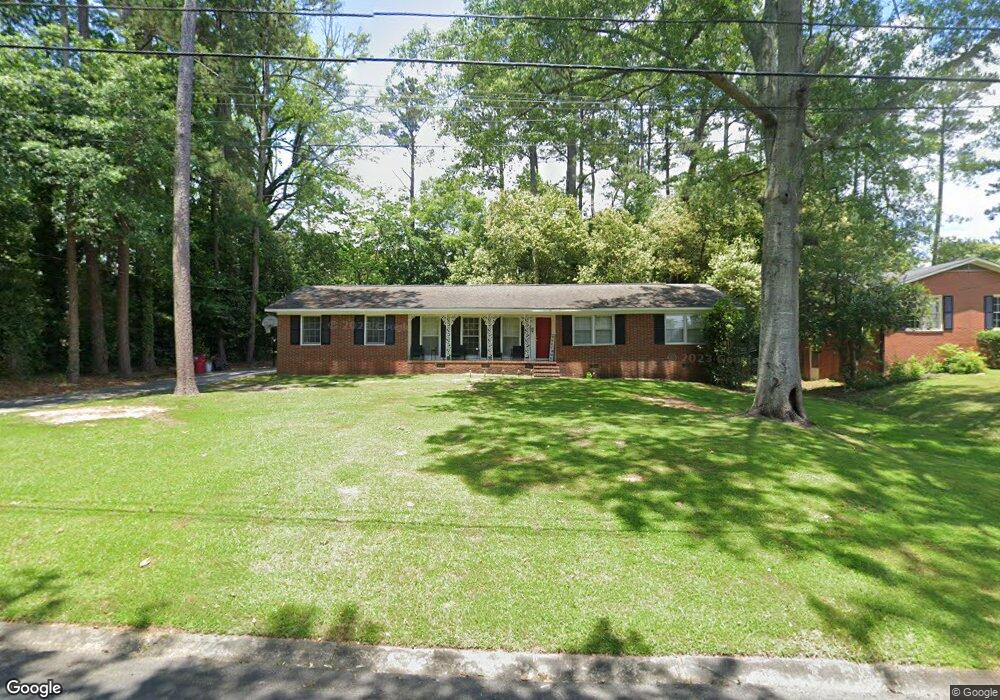
972 Ousley Place Macon, GA 31210
Estimated Value: $138,000 - $206,000
3
Beds
2
Baths
1,434
Sq Ft
$126/Sq Ft
Est. Value
About This Home
This home is located at 972 Ousley Place, Macon, GA 31210 and is currently estimated at $179,987, approximately $125 per square foot. 972 Ousley Place is a home located in Bibb County with nearby schools including Lane Elementary School, Howard Middle School, and Howard High School.
Ownership History
Date
Name
Owned For
Owner Type
Purchase Details
Closed on
Dec 5, 2023
Sold by
Dina Properties Llc
Bought by
Hkw Holdings Llc
Current Estimated Value
Home Financials for this Owner
Home Financials are based on the most recent Mortgage that was taken out on this home.
Original Mortgage
$1,443,750
Outstanding Balance
$1,418,764
Interest Rate
7.79%
Mortgage Type
New Conventional
Estimated Equity
-$1,238,777
Purchase Details
Closed on
Dec 7, 2018
Sold by
Mcgouirk James Patrick and Mcgouirk Kecia
Bought by
Dma Properties Llc
Purchase Details
Closed on
Nov 1, 2000
Bought by
Mcgouirk James Patrick
Create a Home Valuation Report for This Property
The Home Valuation Report is an in-depth analysis detailing your home's value as well as a comparison with similar homes in the area
Home Values in the Area
Average Home Value in this Area
Purchase History
| Date | Buyer | Sale Price | Title Company |
|---|---|---|---|
| Hkw Holdings Llc | $2,062,500 | None Listed On Document | |
| Dma Properties Llc | $56,000 | None Available | |
| Mcgouirk James Patrick | $96,500 | -- |
Source: Public Records
Mortgage History
| Date | Status | Borrower | Loan Amount |
|---|---|---|---|
| Open | Hkw Holdings Llc | $1,443,750 |
Source: Public Records
Tax History Compared to Growth
Tax History
| Year | Tax Paid | Tax Assessment Tax Assessment Total Assessment is a certain percentage of the fair market value that is determined by local assessors to be the total taxable value of land and additions on the property. | Land | Improvement |
|---|---|---|---|---|
| 2025 | $1,404 | $57,125 | $12,220 | $44,905 |
| 2024 | $1,363 | $53,683 | $12,220 | $41,463 |
| 2023 | $1,232 | $48,519 | $12,220 | $36,299 |
| 2022 | $1,685 | $48,679 | $9,024 | $39,655 |
| 2021 | $1,607 | $42,293 | $7,580 | $34,713 |
| 2020 | $1,602 | $41,252 | $7,580 | $33,672 |
| 2019 | $877 | $37,091 | $7,580 | $29,511 |
| 2018 | $1,778 | $33,648 | $6,858 | $26,790 |
| 2017 | $935 | $31,954 | $7,244 | $24,710 |
| 2016 | $818 | $30,653 | $7,244 | $23,409 |
| 2015 | $1,159 | $30,653 | $7,244 | $23,409 |
| 2014 | $1,502 | $32,758 | $8,049 | $24,710 |
Source: Public Records
Map
Nearby Homes
- 870 Glen Hill Ct
- 859 Forest Lake Dr S
- 1344 Lake Valley Rd
- 1270 Lake Valley Rd
- 825 Forest Lake Dr S
- 1161 Ousley Place
- 1224 Timberlane Dr
- 3678 Northside Dr
- 3658 Northside Dr
- 3640 Northside Dr
- 3622 Northside Dr
- 121 Brookstone Way
- 731 Lokchapee Dr
- 753 Lokchapee Dr
- 938 Lundy Terrace
- 3602 Northside Dr
- 4070 Carrie Ct
- 1197 Matthews Place
- 4630 Sprucewood Dr
- 4015 Elnora Dr
- 964 Ousley Place
- 980 Ousley Place
- 979 Hill Place
- 971 Hill Place
- 987 Hill Place
- 973 Ousley Place
- 950 Ousley Place
- 990 Ousley Place
- 981 Ousley Place
- 963 Hill Place
- 963 Hill Place Unit B15
- 0 Hill Place Unit 3145814
- 0 Hill Place Unit 8152287
- 0 Hill Place Unit 7085843
- 0 Hill Place Unit 3236785
- 995 Hill Place
- 951 Ousley Place
- 940 Ousley Place
- 991 Ousley Place
- 104 Camden Trace