Estimated Value: $344,000 - $400,506
3
Beds
1
Bath
2,276
Sq Ft
$167/Sq Ft
Est. Value
About This Home
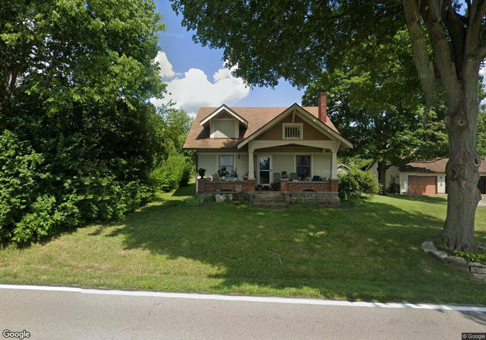
This home is located at 972 Union Rd, Xenia, OH 45385 and is currently estimated at $380,127, approximately $167 per square foot. 972 Union Rd is a home located in Greene County with nearby schools including Xenia High School and Legacy Christian Academy.
Ownership History
Date
Name
Owned For
Owner Type
Purchase Details
Closed on
Oct 28, 2005
Sold by
Hoag Sharon L
Bought by
Vanhoose Samuel D and Vanhoose Vicki L
Current Estimated Value
Home Financials for this Owner
Home Financials are based on the most recent Mortgage that was taken out on this home.
Original Mortgage
$195,000
Outstanding Balance
$119,209
Interest Rate
8%
Mortgage Type
Fannie Mae Freddie Mac
Estimated Equity
$260,919
Create a Home Valuation Report for This Property
The Home Valuation Report is an in-depth analysis detailing your home's value as well as a comparison with similar homes in the area
Home Values in the Area
Average Home Value in this Area
Purchase History
| Date | Buyer | Sale Price | Title Company |
|---|---|---|---|
| Vanhoose Samuel D | $195,000 | -- |
Source: Public Records
Mortgage History
| Date | Status | Borrower | Loan Amount |
|---|---|---|---|
| Open | Vanhoose Samuel D | $195,000 |
Source: Public Records
Tax History Compared to Growth
Tax History
| Year | Tax Paid | Tax Assessment Tax Assessment Total Assessment is a certain percentage of the fair market value that is determined by local assessors to be the total taxable value of land and additions on the property. | Land | Improvement |
|---|---|---|---|---|
| 2024 | $4,377 | $91,820 | $30,700 | $61,120 |
| 2023 | $4,377 | $91,820 | $30,700 | $61,120 |
| 2022 | $3,930 | $74,740 | $26,700 | $48,040 |
| 2021 | $3,980 | $74,740 | $26,700 | $48,040 |
| 2020 | $3,821 | $74,740 | $26,700 | $48,040 |
| 2019 | $3,724 | $68,470 | $23,550 | $44,920 |
| 2018 | $3,738 | $68,470 | $23,550 | $44,920 |
| 2017 | $3,717 | $68,470 | $23,550 | $44,920 |
| 2016 | $3,533 | $62,260 | $23,030 | $39,230 |
| 2015 | $3,542 | $62,260 | $23,030 | $39,230 |
| 2014 | $3,401 | $62,260 | $23,030 | $39,230 |
Source: Public Records
Map
Nearby Homes
- 0 U S 68
- 966 U S 68
- 260 Pocahontas St
- 100 Prugh Ave
- 46 Lake St
- 523 Newport Rd
- 633 Xenia Ave
- 148 Home Ave
- 222 Washington St
- 373 Hill St
- 400 S Detroit St
- 0 Gultice Rd Unit 940427
- 293 S Miami Ave
- 530 Cincinnati Ave
- 453 Walnut St
- 36 Leaman St
- 920 Wright Cycle Blvd
- 926 Wright Cycle Blvd
- 654 E 3rd St
- 75 W 2nd St