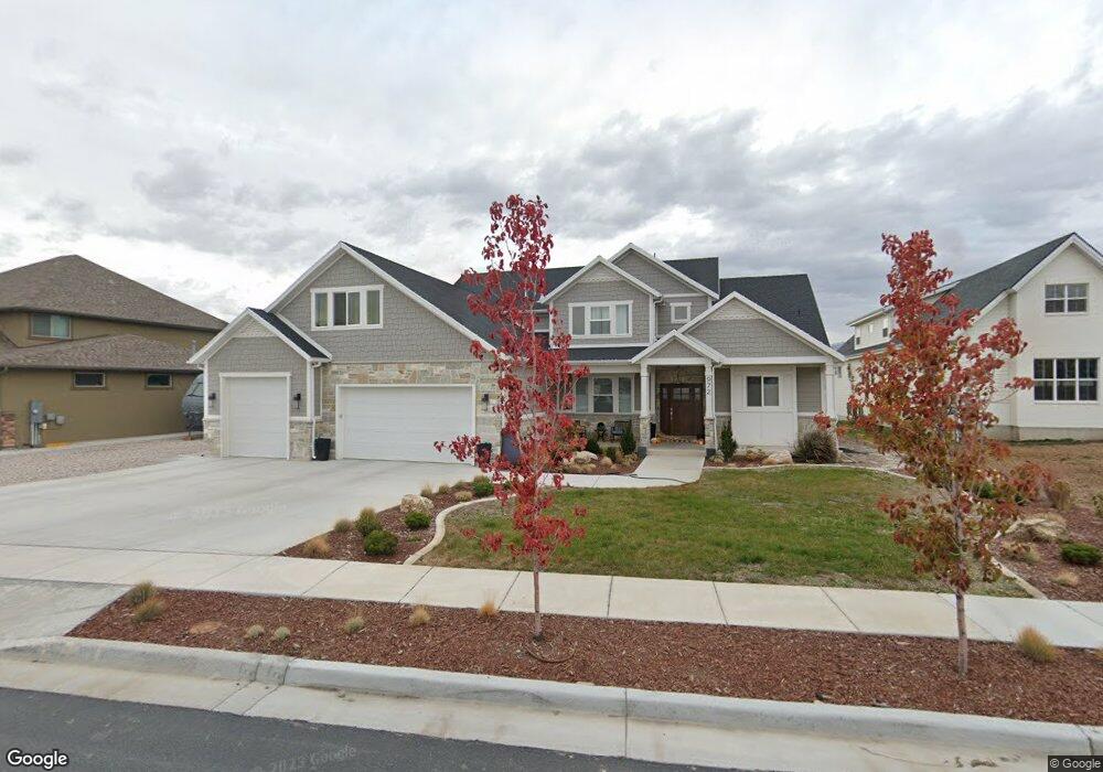
972 W 1950 N Unit 131 West Bountiful, UT 84087
Estimated Value: $971,000 - $1,245,000
5
Beds
4
Baths
3,607
Sq Ft
$297/Sq Ft
Est. Value
About This Home
This home is located at 972 W 1950 N Unit 131, West Bountiful, UT 84087 and is currently estimated at $1,069,894, approximately $296 per square foot. 972 W 1950 N Unit 131 is a home located in Davis County with nearby schools including West Bountiful Elementary School, Bountiful Junior High School, and Viewmont High School.
Ownership History
Date
Name
Owned For
Owner Type
Purchase Details
Closed on
Sep 24, 2022
Sold by
Thompson Shane Rollins and Thompson Kayla Jenks
Bought by
Thompson Living Trust
Current Estimated Value
Purchase Details
Closed on
May 2, 2019
Sold by
Day Lay One Llc
Bought by
Thompson Shane and Thompson Kayla
Home Financials for this Owner
Home Financials are based on the most recent Mortgage that was taken out on this home.
Original Mortgage
$483,500
Interest Rate
4.2%
Mortgage Type
Construction
Create a Home Valuation Report for This Property
The Home Valuation Report is an in-depth analysis detailing your home's value as well as a comparison with similar homes in the area
Home Values in the Area
Average Home Value in this Area
Purchase History
| Date | Buyer | Sale Price | Title Company |
|---|---|---|---|
| Thompson Living Trust | -- | -- | |
| Thompson Shane | -- | Us Title Company |
Source: Public Records
Mortgage History
| Date | Status | Borrower | Loan Amount |
|---|---|---|---|
| Previous Owner | Thompson Shane | $483,500 |
Source: Public Records
Tax History Compared to Growth
Tax History
| Year | Tax Paid | Tax Assessment Tax Assessment Total Assessment is a certain percentage of the fair market value that is determined by local assessors to be the total taxable value of land and additions on the property. | Land | Improvement |
|---|---|---|---|---|
| 2025 | $5,643 | $479,600 | $157,934 | $321,666 |
| 2024 | $5,444 | $470,250 | $131,137 | $339,113 |
| 2023 | $5,299 | $833,000 | $239,185 | $593,815 |
| 2022 | $5,183 | $453,750 | $121,863 | $331,887 |
| 2021 | $4,903 | $658,000 | $178,570 | $479,430 |
| 2020 | $3,127 | $391,740 | $181,740 | $210,000 |
| 2019 | $2,164 | $173,523 | $173,523 | $0 |
Source: Public Records
Map
Nearby Homes
- 988 W 1950 N Unit 134
- 1084 W Audrey Ln Unit 20
- 1084 W Audrey Ln
- 2035 N 800 W
- 2257 N 830 W
- 825 W 1320 N
- 668 W 2300 N
- 637 W 1600 N
- 548 S 675 W
- Lincoln Farmhouse Plan at Belmont Farms
- Belmont Traditional Plan at Belmont Farms
- Hampton Traditional Plan at Belmont Farms
- 324 S 600 W
- 239 Lyman Ln
- 234 Leah Cir
- 204 Lyman Ln
- 420 Rawlins Cir
- 366 W 1000 N
- 1552 N 200 W
- 235 W 1400 N
- 978 W 1950 N
- 968 W 1950 N Unit 130
- 968 W 1950 N
- 969 W 1950 N Unit 108
- 969 W 1950 N
- 973 W 1950 N Unit 107
- 984 W 1950 N Unit 133
- 984 W 1950 N
- 958 W 1950 N
- 979 W 1950 N Unit 106
- 979 W 1950 N
- 988 W 1950 N
- 1993 N 950 W
- 959 W 1950 N Unit 109
- 953 W 1950 N Unit 110
- 953 W 1950 N
- 971 W 2100 N
- 985 W 1950 N Unit 105
- 985 W 1950 N
- 965 W 2100 N