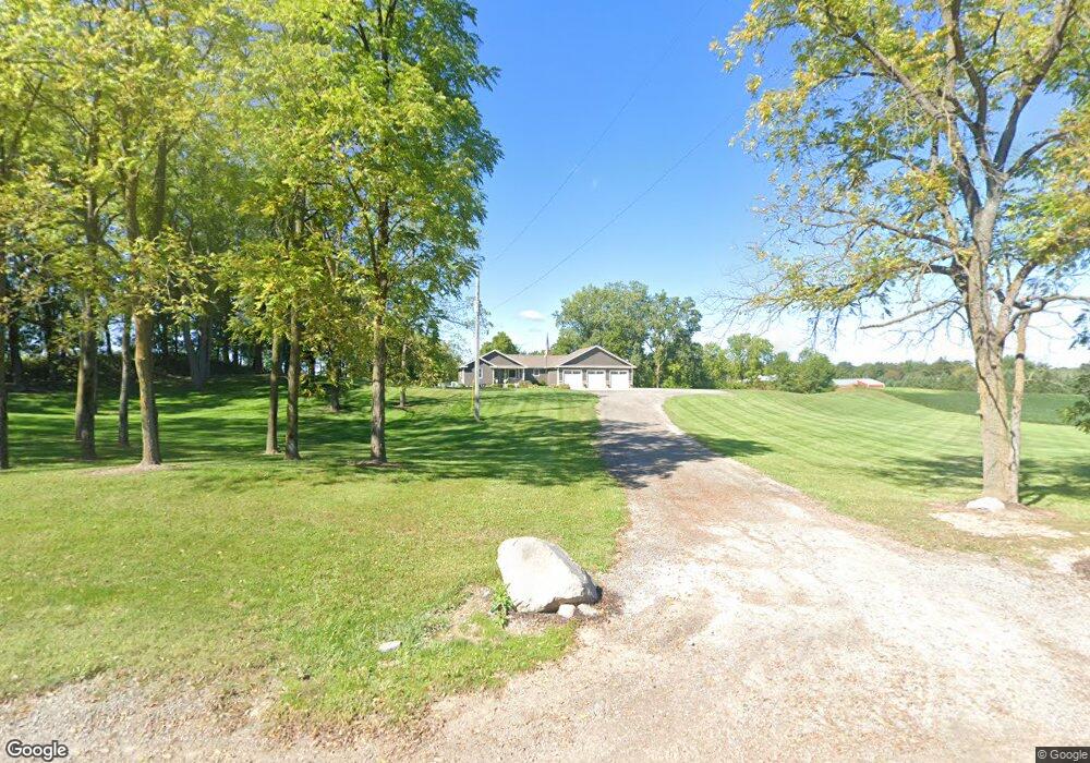
9720 Briggs Hwy Addison, MI 49220
Estimated Value: $329,000 - $531,000
--
Bed
1
Bath
1,614
Sq Ft
$259/Sq Ft
Est. Value
About This Home
This home is located at 9720 Briggs Hwy, Addison, MI 49220 and is currently estimated at $418,176, approximately $259 per square foot. 9720 Briggs Hwy is a home with nearby schools including Addison Elementary School, Addison Middle School, and Addison High School.
Ownership History
Date
Name
Owned For
Owner Type
Purchase Details
Closed on
Jun 21, 2016
Sold by
Ferris Brook H
Bought by
Ferris Brook M
Current Estimated Value
Purchase Details
Closed on
Aug 29, 2014
Sold by
Luckham Tonya Catherine and Schiller Tonya Catherine
Bought by
Ferris & Sons Milk Hauling Inc
Create a Home Valuation Report for This Property
The Home Valuation Report is an in-depth analysis detailing your home's value as well as a comparison with similar homes in the area
Home Values in the Area
Average Home Value in this Area
Purchase History
| Date | Buyer | Sale Price | Title Company |
|---|---|---|---|
| Ferris Brook M | -- | None Available | |
| Ferris & Sons Milk Hauling Inc | $62,500 | None Available |
Source: Public Records
Tax History Compared to Growth
Tax History
| Year | Tax Paid | Tax Assessment Tax Assessment Total Assessment is a certain percentage of the fair market value that is determined by local assessors to be the total taxable value of land and additions on the property. | Land | Improvement |
|---|---|---|---|---|
| 2025 | $2,932 | $175,600 | $0 | $0 |
| 2024 | $1,358 | $165,600 | $0 | $0 |
| 2023 | -- | $146,600 | $0 | $0 |
| 2022 | $2,688 | $127,300 | $0 | $0 |
| 2021 | $2,636 | $124,100 | $0 | $0 |
| 2020 | $2,556 | $101,200 | $0 | $0 |
| 2019 | $47,239 | $101,200 | $0 | $0 |
| 2018 | $868 | $131,072 | $0 | $0 |
| 2017 | $722 | $0 | $0 | $0 |
| 2016 | $657 | $0 | $0 | $0 |
| 2014 | -- | $0 | $0 | $0 |
Source: Public Records
Map
Nearby Homes
- 17475 U S 223
- 9010 U S 127
- 8484 N Rollin Hwy
- 14581 Glenbeigh Ln
- 14429 Kildare Ln
- 14408 Kildare Ln
- V/L E Chicago Rd
- 14378 Kildare Ln
- 14391 Killybegs Ln
- 13778 Shannon Dr
- 305 N Steer St
- 14601 Brookhurst Dr
- 14750 Hilltop Dr
- 10400 Ferris Ct
- 10911 Devils Lake Hwy
- 15858 Lelah Ln
- 13912 Grandpoint Dr
- 19900 Lewis Rd
- 10421 E Greenlawn Dr
- 135 S Steer St
- 9000 N Rollin Hwy
- 9930 Briggs Hwy
- 9931 Briggs Hwy
- 9949 U S 127
- 9949 Us Highway 127
- 10000 Briggs Hwy Unit BLK
- 9999 Us Highway 127
- 9580 Briggs Hwy
- 9578 Briggs Hwy
- 9560 Briggs Hwy
- 10000 U S 127
- 9720 Us Highway 127
- 10293 Us Highway 127 Unit 127
- 10293 Us Highway 127
- 10293 Us Highway 127
- 10293 Us Highway 127 Unit 127
- 10301 Us Highway 127
- 9986 Us Highway 127
- 10140 Briggs Hwy
- 17877 Us Highway 223