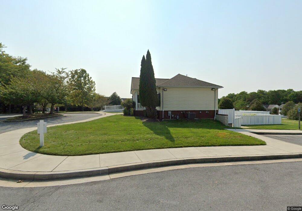
9720 Watts Rd Owings Mills, MD 21117
Estimated Value: $3,372,384
--
Bed
--
Bath
7,680
Sq Ft
$439/Sq Ft
Est. Value
About This Home
This home is located at 9720 Watts Rd, Owings Mills, MD 21117 and is currently estimated at $3,372,384, approximately $439 per square foot. 9720 Watts Rd is a home located in Baltimore County with nearby schools including New Town Elementary School, Deer Park Middle Magnet School, and New Town High.
Ownership History
Date
Name
Owned For
Owner Type
Purchase Details
Closed on
Jun 30, 2016
Sold by
O-Lance Llc
Bought by
Sarina & Ariana Holdings Llc
Current Estimated Value
Home Financials for this Owner
Home Financials are based on the most recent Mortgage that was taken out on this home.
Original Mortgage
$2,479,000
Outstanding Balance
$1,984,078
Interest Rate
3.66%
Mortgage Type
Commercial
Estimated Equity
$1,398,598
Purchase Details
Closed on
Jun 25, 1998
Sold by
G B C Limited Partnership
Bought by
O Lance Llc
Create a Home Valuation Report for This Property
The Home Valuation Report is an in-depth analysis detailing your home's value as well as a comparison with similar homes in the area
Home Values in the Area
Average Home Value in this Area
Purchase History
| Date | Buyer | Sale Price | Title Company |
|---|---|---|---|
| Sarina & Ariana Holdings Llc | $2,100,000 | Diamond Title Insurance Corp | |
| O Lance Llc | $212,500 | -- |
Source: Public Records
Mortgage History
| Date | Status | Borrower | Loan Amount |
|---|---|---|---|
| Open | Sarina & Ariana Holdings Llc | $2,479,000 |
Source: Public Records
Tax History Compared to Growth
Tax History
| Year | Tax Paid | Tax Assessment Tax Assessment Total Assessment is a certain percentage of the fair market value that is determined by local assessors to be the total taxable value of land and additions on the property. | Land | Improvement |
|---|---|---|---|---|
| 2025 | $33,820 | $1,910,700 | -- | -- |
| 2024 | $33,820 | $1,900,800 | $534,800 | $1,366,000 |
| 2023 | $15,228 | $1,900,800 | $534,800 | $1,366,000 |
| 2022 | $31,056 | $1,900,800 | $534,800 | $1,366,000 |
| 2021 | $26,394 | $1,900,800 | $534,800 | $1,366,000 |
| 2020 | $20,327 | $1,677,167 | $0 | $0 |
| 2019 | $23,411 | $1,453,533 | $0 | $0 |
| 2018 | $17,811 | $1,229,900 | $534,800 | $695,100 |
| 2017 | $5,309 | $1,220,133 | $0 | $0 |
| 2016 | $15,979 | $1,210,367 | $0 | $0 |
| 2015 | $15,979 | $1,200,600 | $0 | $0 |
| 2014 | $15,979 | $1,200,600 | $0 | $0 |
Source: Public Records
Map
Nearby Homes
- 9613 Watts Rd
- 9905 Bon Haven Ln
- 9903 Bon Haven Ln
- 9816 Bon Haven Ln
- 5206 Stone Shop Cir
- 4611 Mews Dr
- 9831 Endora Ct
- 4670 Mews Dr
- 5227 Wagon Shed Cir
- 9538 Meadows Farm Dr
- 9510 Coyle Rd Unit 109
- 9500 Side Brook Rd Unit 304
- 9943 Middle Mill Dr
- 4751 Shellbark Rd
- 9002 Groffs Mill Dr
- 9935 Middle Mill Dr Unit 31
- 8923 Groffs Mill Dr Unit 8923
- 8931 Groffs Mill Dr Unit 8931
- 4701 Wainwright Cir
- 9910 Middle Mill Dr