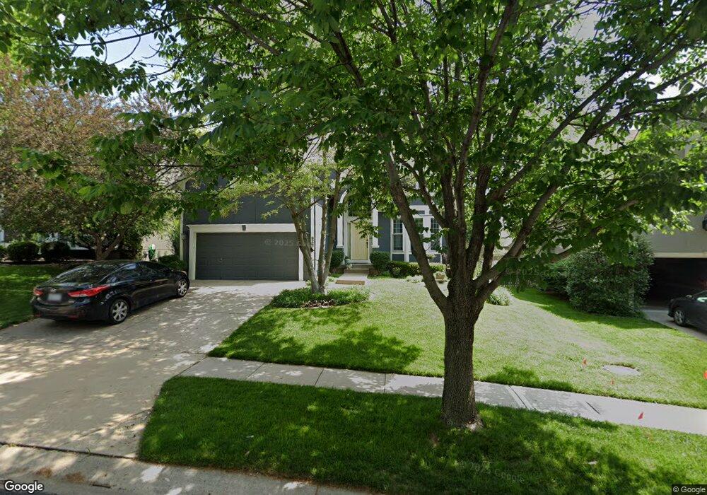
9725 Millridge Dr Lenexa, KS 66220
Estimated Value: $505,050 - $540,000
4
Beds
3
Baths
2,186
Sq Ft
$238/Sq Ft
Est. Value
About This Home
This home is located at 9725 Millridge Dr, Lenexa, KS 66220 and is currently estimated at $521,013, approximately $238 per square foot. 9725 Millridge Dr is a home located in Johnson County with nearby schools including Manchester Park Elementary School, Prairie Trail Middle School, and Olathe Northwest High School.
Ownership History
Date
Name
Owned For
Owner Type
Purchase Details
Closed on
Feb 13, 2002
Sold by
Mack Colt Homes Inc
Bought by
Fulton Timothy R and Fulton Cristy L
Current Estimated Value
Home Financials for this Owner
Home Financials are based on the most recent Mortgage that was taken out on this home.
Original Mortgage
$160,000
Interest Rate
7.1%
Purchase Details
Closed on
Dec 27, 2001
Sold by
Manchester Partners Llc
Bought by
Mack Colt Homes Inc
Home Financials for this Owner
Home Financials are based on the most recent Mortgage that was taken out on this home.
Original Mortgage
$160,000
Interest Rate
7.1%
Create a Home Valuation Report for This Property
The Home Valuation Report is an in-depth analysis detailing your home's value as well as a comparison with similar homes in the area
Home Values in the Area
Average Home Value in this Area
Purchase History
| Date | Buyer | Sale Price | Title Company |
|---|---|---|---|
| Fulton Timothy R | -- | Security Land Title Company | |
| Mack Colt Homes Inc | -- | Security Land Title Company |
Source: Public Records
Mortgage History
| Date | Status | Borrower | Loan Amount |
|---|---|---|---|
| Previous Owner | Fulton Timothy R | $160,000 | |
| Previous Owner | Mack Colt Homes Inc | $140,000 |
Source: Public Records
Tax History
| Year | Tax Paid | Tax Assessment Tax Assessment Total Assessment is a certain percentage of the fair market value that is determined by local assessors to be the total taxable value of land and additions on the property. | Land | Improvement |
|---|---|---|---|---|
| 2025 | $6,162 | $52,958 | $12,412 | $40,546 |
| 2024 | $6,162 | $50,221 | $12,412 | $37,809 |
| 2023 | $6,202 | $49,531 | $12,412 | $37,119 |
| 2022 | $5,679 | $44,218 | $9,933 | $34,285 |
| 2021 | $5,277 | $39,020 | $9,069 | $29,951 |
| 2020 | $5,308 | $38,882 | $9,069 | $29,813 |
| 2019 | $5,212 | $37,893 | $7,881 | $30,012 |
| 2018 | $4,972 | $35,731 | $7,881 | $27,850 |
| 2017 | $5,130 | $36,087 | $7,881 | $28,206 |
| 2016 | $4,747 | $34,132 | $7,886 | $26,246 |
| 2015 | $4,445 | $31,947 | $7,886 | $24,061 |
| 2013 | -- | $29,900 | $7,886 | $22,014 |
Source: Public Records
Map
Nearby Homes
- 21516 W 99th St
- 22076 W 99th Terrace
- 22017 W 99th Terrace
- 21901 W 99th Terrace
- 22005 W 99th Terrace
- 22077 W 99th Terrace
- 21926 W 99th Terrace
- 21320 W 98th St
- 21938 W 99th Terrace
- 21913 W 99th Terrace
- 21925 W 99th Terrace
- 22064 W 99th Terrace
- 9950 Brockway St
- 9962 Brockway St
- 10026 Aurora St
- 22053 W 99th Terrace
- 8285 Brockway St
- 9700 Chelsea St
- 9938 Brockway St
- 21715 W 100th Terrace
- 9721 Millridge Dr
- 9737 Millridge Dr
- 21620 W 98th St
- 9719 Millridge Dr
- 21614 W 98th St
- 9741 Millridge Dr
- 21609 W 97th Terrace
- 21610 W 98th St
- 21605 W 97th Terrace
- 21613 W 97th Terrace
- 21700 W 98th St
- 9715 Millridge Dr
- 9722 Millridge Dr
- 21606 W 98th St
- 9718 Millridge Dr
- 21601 W 97th Terrace
- 9711 Millridge Dr
- 21704 W 98th St
- 9714 Millridge Dr
- 21617 W 97th Terrace
Your Personal Tour Guide
Ask me questions while you tour the home.