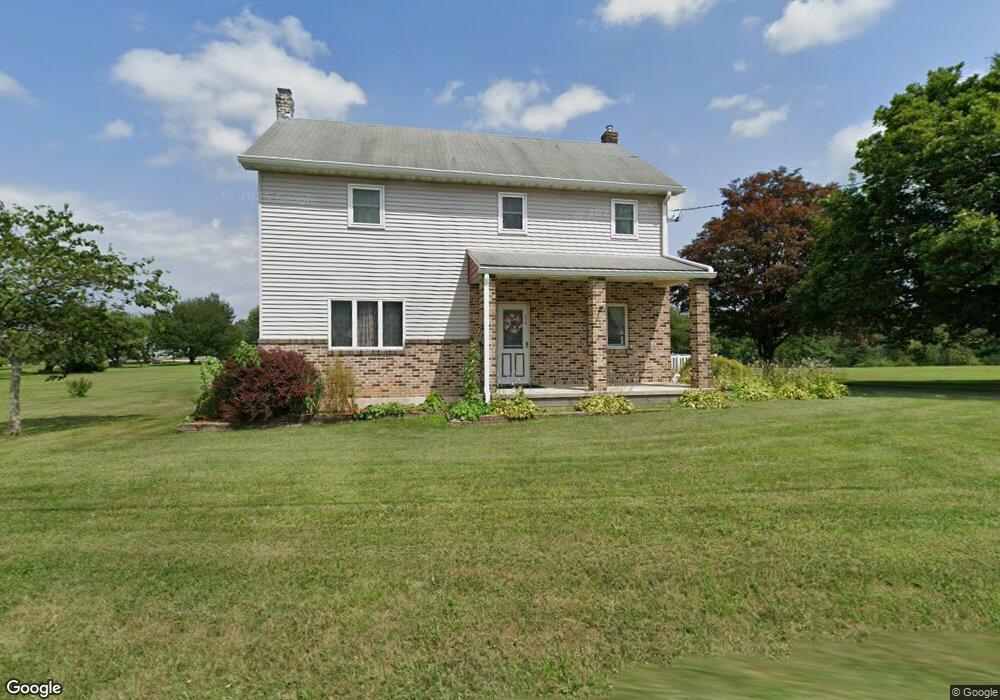
973 Mahoning Mountain Rd Lehighton, PA 18235
Estimated Value: $330,450 - $453,000
4
Beds
2
Baths
2,280
Sq Ft
$170/Sq Ft
Est. Value
About This Home
This home is located at 973 Mahoning Mountain Rd, Lehighton, PA 18235 and is currently estimated at $387,863, approximately $170 per square foot. 973 Mahoning Mountain Rd is a home located in Carbon County with nearby schools including Lehighton Area High School, Sts. Peter & Paul School, and Valley Ridge Academy.
Ownership History
Date
Name
Owned For
Owner Type
Purchase Details
Closed on
Aug 5, 2021
Sold by
Zipp Edwin J and Zipp Beverly S
Bought by
Neifert Scott D and Neifert Juliane T
Current Estimated Value
Home Financials for this Owner
Home Financials are based on the most recent Mortgage that was taken out on this home.
Original Mortgage
$216,000
Outstanding Balance
$196,411
Interest Rate
2.9%
Mortgage Type
New Conventional
Estimated Equity
$191,452
Purchase Details
Closed on
Jun 7, 2013
Sold by
Wentz Marjorie E
Bought by
Zipp Beverly S and Wentz John R
Purchase Details
Closed on
Jun 22, 1983
Bought by
Zipp Edwin J and Zipp Beverly S
Create a Home Valuation Report for This Property
The Home Valuation Report is an in-depth analysis detailing your home's value as well as a comparison with similar homes in the area
Home Values in the Area
Average Home Value in this Area
Purchase History
| Date | Buyer | Sale Price | Title Company |
|---|---|---|---|
| Neifert Scott D | $270,000 | Carbon Search & Stlmt Svcs I | |
| Zipp Beverly S | -- | None Available | |
| Zipp Edwin J | $40,000 | -- |
Source: Public Records
Mortgage History
| Date | Status | Borrower | Loan Amount |
|---|---|---|---|
| Open | Neifert Scott D | $216,000 |
Source: Public Records
Tax History Compared to Growth
Tax History
| Year | Tax Paid | Tax Assessment Tax Assessment Total Assessment is a certain percentage of the fair market value that is determined by local assessors to be the total taxable value of land and additions on the property. | Land | Improvement |
|---|---|---|---|---|
| 2025 | $5,023 | $65,650 | $9,800 | $55,850 |
| 2024 | $4,826 | $65,650 | $9,800 | $55,850 |
| 2023 | $4,777 | $65,650 | $9,800 | $55,850 |
| 2022 | $4,711 | $65,650 | $9,800 | $55,850 |
| 2021 | $4,572 | $65,650 | $9,800 | $55,850 |
| 2020 | $4,456 | $65,650 | $9,800 | $55,850 |
| 2019 | $4,227 | $65,650 | $9,800 | $55,850 |
| 2018 | $4,177 | $65,650 | $9,800 | $55,850 |
| 2017 | $4,177 | $65,650 | $9,800 | $55,850 |
| 2016 | -- | $65,650 | $9,800 | $55,850 |
| 2015 | -- | $65,650 | $9,800 | $55,850 |
| 2014 | -- | $65,650 | $9,800 | $55,850 |
Source: Public Records
Map
Nearby Homes
- 408 Bridge St
- 410 S 8th St
- 134 Bridge St
- 8 Lentz Ave
- 260 S 3rd St
- 639 Iron St
- 522 Iron St
- 236 S 2nd St
- 230 S 2nd St
- 196 S 3rd St
- 142 Bankway St
- 515 Mahoning St
- 40 Apache
- 0 Emily Plan at Summit Point Unit PACC2005480
- 0 Copper Beech Plan at Summit Ridge Unit PACC2005478
- 0 Black Cherry Plan at Summit Ridge Unit PACC2005474
- 0 Ridge
- 119 S 3rd St
- 44 Apache
- 2516 Mahoning Mountain Rd
- 992 Mahoning Mountain Rd
- 966 Mahoning Mountain Rd
- 1010 Mahoning Mountain Rd
- 1791 Upper Nis Hollow Dr
- 1023 Mahoning Mountain Rd
- 1012 Mahoning Mountain Rd
- 1778 Upper Nis Hollow Dr
- 1761 Upper Nis Hollow Dr
- 1073 Mahoning Mountain Rd
- 1776 Upper Nis Hollow Dr
- 1076 Mahoning Mountain Rd
- 1058 Mahoning Mountain Rd
- 1093 Mahoning Mountain Rd
- 1754 Upper Nis Hollow Dr
- 1753 Upper Nis Hollow Dr
- 1139 Mahoning Mountain Rd
- 1717 Upper Nis Hollow Dr
- 1647 Upper Nis Hollow Dr
- 1171 Mahoning Mountain Rd
- 1619 Upper Nis Hollow Dr