Estimated Value: $78,370 - $117,000
2
Beds
1
Bath
918
Sq Ft
$112/Sq Ft
Est. Value
About This Home
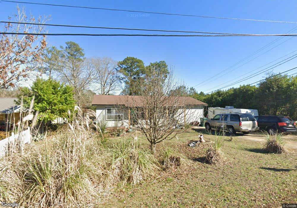
This home is located at 973 Matthews Ave, Ozark, AL 36360 and is currently estimated at $102,843, approximately $112 per square foot. 973 Matthews Ave is a home located in Dale County with nearby schools including Lisenby Primary School, Mixon Intermediate School, and D. A. Smith Middle School.
Ownership History
Date
Name
Owned For
Owner Type
Purchase Details
Closed on
Oct 5, 2021
Sold by
Hall Ann and Hall Robert
Bought by
Hall Ann and Rodriguez Trista Ann
Current Estimated Value
Home Financials for this Owner
Home Financials are based on the most recent Mortgage that was taken out on this home.
Original Mortgage
$44,099
Outstanding Balance
$40,214
Interest Rate
2.8%
Mortgage Type
New Conventional
Estimated Equity
$62,629
Purchase Details
Closed on
Oct 11, 2016
Sold by
Hall Ann and Mcdonald Aka Ann
Bought by
Hall Ann
Create a Home Valuation Report for This Property
The Home Valuation Report is an in-depth analysis detailing your home's value as well as a comparison with similar homes in the area
Home Values in the Area
Average Home Value in this Area
Purchase History
| Date | Buyer | Sale Price | Title Company |
|---|---|---|---|
| Hall Ann | -- | None Available | |
| Hall Ann | -- | -- |
Source: Public Records
Mortgage History
| Date | Status | Borrower | Loan Amount |
|---|---|---|---|
| Open | Hall Ann | $44,099 |
Source: Public Records
Tax History Compared to Growth
Tax History
| Year | Tax Paid | Tax Assessment Tax Assessment Total Assessment is a certain percentage of the fair market value that is determined by local assessors to be the total taxable value of land and additions on the property. | Land | Improvement |
|---|---|---|---|---|
| 2024 | $362 | $7,160 | $420 | $6,740 |
| 2023 | $362 | $6,180 | $360 | $5,820 |
| 2022 | $202 | $5,060 | $720 | $4,340 |
| 2021 | $184 | $4,720 | $380 | $4,340 |
| 2020 | $184 | $4,720 | $380 | $4,340 |
| 2019 | $184 | $4,720 | $380 | $4,340 |
| 2018 | $168 | $4,400 | $400 | $4,000 |
| 2017 | $168 | $4,400 | $400 | $4,000 |
| 2016 | $185 | $4,740 | $400 | $4,340 |
| 2015 | $185 | $4,740 | $400 | $4,340 |
| 2014 | $181 | $4,660 | $400 | $4,260 |
| 2013 | $180 | $4,660 | $400 | $4,260 |
Source: Public Records
Map
Nearby Homes
- 252 Del Rio Terrace
- 0 Del Rio Terrace
- 480 Gunter St
- 0 Briar Cliff Dr Lot 1 Blk D
- 0 Briar Cliff Rd Lot 5 Bk E
- 729 Pine Ave
- 166 Garner Dr
- 13.35 Acres U S 231
- 4.3 Acres U S 231
- 1.5 Acres U S 231
- 00 Lot 9 & 10 Sandy Hill
- 203 Ozark Ave
- 00
- 236 Choctaw Ave
- 1.144 Acres S Highway 231
- 129 Jackson St
- 152 Short Pine Ave
- 00 Fairview Street Oak Ave
- 179 Dixie Dr
- 876 Camilla Ave
- 879 Matthews Ave
- 959 Matthews Ave
- 167 Valentine St
- 919 Matthews Ave
- 151 Valentine St
- 223 Valentine St
- 998 Matthews Ave
- 1010 Matthews Ave
- 213 Valentine St
- 952 Matthews Ave
- 143 Valentine St
- 143 Valentine St
- 932 Matthews Ave
- 148 Valentine St
- 133 Valentine St
- 1024 Matthews Ave
- 901 Matthews Ave
- 286 Ruby St
- 304 Ruby St
- 810 Matthews Ave