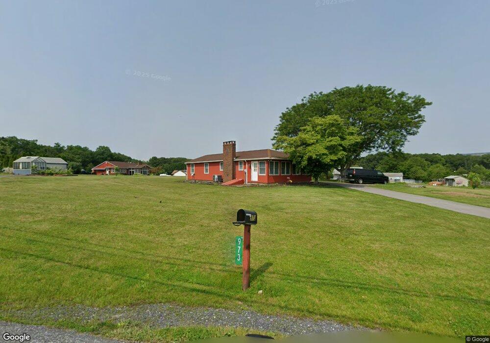
973 Pear Rd Walnutport, PA 18088
Estimated Value: $267,000 - $315,000
3
Beds
1
Bath
1,104
Sq Ft
$261/Sq Ft
Est. Value
About This Home
This home is located at 973 Pear Rd, Walnutport, PA 18088 and is currently estimated at $287,682, approximately $260 per square foot. 973 Pear Rd is a home located in Northampton County with nearby schools including Lehigh Elementary School, Northampton Area Middle School, and Northampton Area High School.
Ownership History
Date
Name
Owned For
Owner Type
Purchase Details
Closed on
Sep 9, 2022
Sold by
Doll Ruth M
Bought by
Doll Heather
Current Estimated Value
Home Financials for this Owner
Home Financials are based on the most recent Mortgage that was taken out on this home.
Original Mortgage
$155,677
Outstanding Balance
$148,695
Interest Rate
5.22%
Mortgage Type
FHA
Estimated Equity
$138,987
Purchase Details
Closed on
Jul 1, 1998
Bought by
Doll John R and Doll Ruth M
Purchase Details
Closed on
Aug 1, 1980
Bought by
Not Provided
Create a Home Valuation Report for This Property
The Home Valuation Report is an in-depth analysis detailing your home's value as well as a comparison with similar homes in the area
Home Values in the Area
Average Home Value in this Area
Purchase History
| Date | Buyer | Sale Price | Title Company |
|---|---|---|---|
| Doll Heather | $222,000 | -- | |
| Doll John R | -- | -- | |
| Not Provided | -- | -- |
Source: Public Records
Mortgage History
| Date | Status | Borrower | Loan Amount |
|---|---|---|---|
| Open | Doll Heather | $155,677 |
Source: Public Records
Tax History Compared to Growth
Tax History
| Year | Tax Paid | Tax Assessment Tax Assessment Total Assessment is a certain percentage of the fair market value that is determined by local assessors to be the total taxable value of land and additions on the property. | Land | Improvement |
|---|---|---|---|---|
| 2025 | $544 | $50,400 | $20,500 | $29,900 |
| 2024 | $3,705 | $50,400 | $20,500 | $29,900 |
| 2023 | $3,639 | $50,400 | $20,500 | $29,900 |
| 2022 | $3,639 | $50,400 | $20,500 | $29,900 |
| 2021 | $3,648 | $50,400 | $20,500 | $29,900 |
| 2020 | $3,648 | $50,400 | $20,500 | $29,900 |
| 2019 | $3,595 | $50,400 | $20,500 | $29,900 |
| 2018 | $3,542 | $50,400 | $20,500 | $29,900 |
| 2017 | $3,465 | $50,400 | $20,500 | $29,900 |
| 2016 | -- | $50,400 | $20,500 | $29,900 |
| 2015 | -- | $50,400 | $20,500 | $29,900 |
| 2014 | -- | $50,400 | $20,500 | $29,900 |
Source: Public Records
Map
Nearby Homes
- 1015 Honeysuckle Rd
- 4405 Lehigh Dr
- 137 E Zimmer Dr
- 4441 Lehigh Dr
- 723 Fir Dr
- 1222 Debby Ct
- 1225 Meyer Dr
- 127 Zimmer Dr W Unit 127
- 93 Nashua St
- 79 De Rose St
- 12 E Zimmer Dr
- 32 De Rose St
- 0 Walnut Dr
- 38 De Rose St
- 0 Deer Path Dr Unit 767888
- 1410 Heytesbury Rd
- 1412 Heytesbury Rd
- 3983 Hastings Rd
- 4083 W Mountain View Dr
- 57 Zimmer Dr W