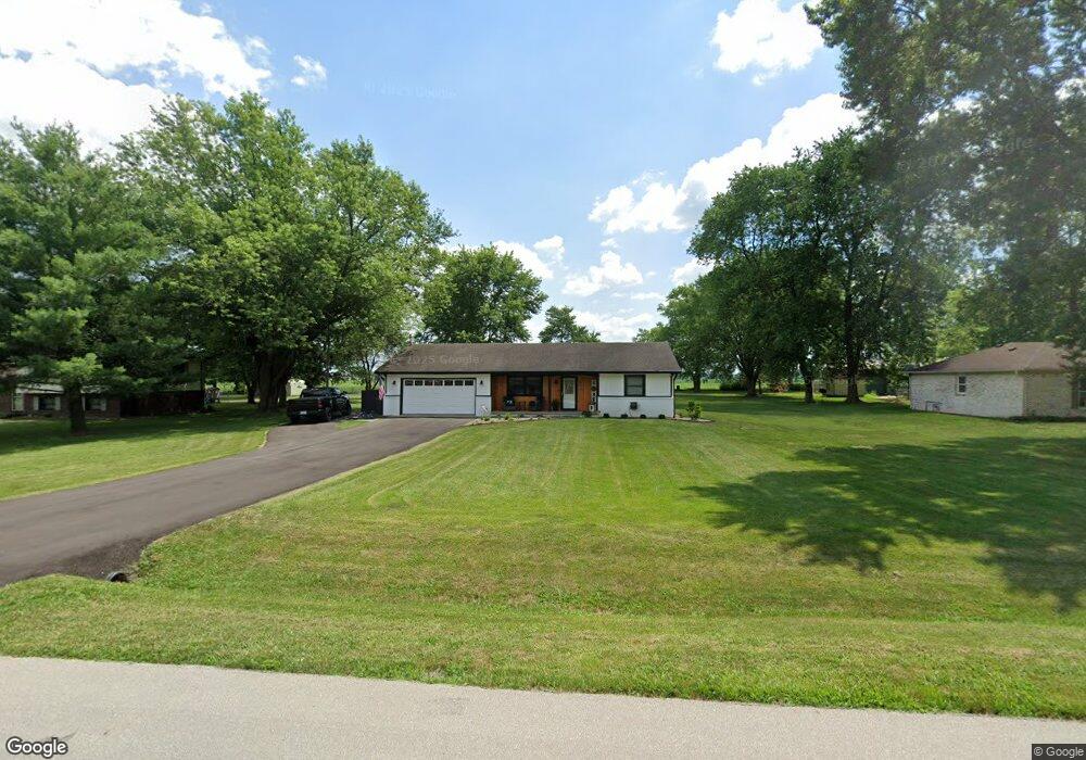
973 Rustic Ln Whiteland, IN 46184
Estimated Value: $227,000 - $260,000
3
Beds
2
Baths
1,340
Sq Ft
$185/Sq Ft
Est. Value
About This Home
This home is located at 973 Rustic Ln, Whiteland, IN 46184 and is currently estimated at $248,178, approximately $185 per square foot. 973 Rustic Ln is a home located in Johnson County with nearby schools including Pleasant Crossing Elementary School, Clark-Pleasant Middle School, and Whiteland Community High School.
Ownership History
Date
Name
Owned For
Owner Type
Purchase Details
Closed on
Aug 8, 2024
Sold by
Cawood Michael W
Bought by
Lamar John E and Lamar Jennifer L
Current Estimated Value
Home Financials for this Owner
Home Financials are based on the most recent Mortgage that was taken out on this home.
Original Mortgage
$237,500
Outstanding Balance
$234,807
Interest Rate
6.86%
Mortgage Type
New Conventional
Estimated Equity
$13,371
Purchase Details
Closed on
Feb 24, 2008
Sold by
Cawood Debbie A
Bought by
Cawood Michael W
Create a Home Valuation Report for This Property
The Home Valuation Report is an in-depth analysis detailing your home's value as well as a comparison with similar homes in the area
Home Values in the Area
Average Home Value in this Area
Purchase History
| Date | Buyer | Sale Price | Title Company |
|---|---|---|---|
| Lamar John E | $250,000 | Mvp National Title | |
| Cawood Michael W | -- | None Available |
Source: Public Records
Mortgage History
| Date | Status | Borrower | Loan Amount |
|---|---|---|---|
| Open | Lamar John E | $237,500 |
Source: Public Records
Tax History
| Year | Tax Paid | Tax Assessment Tax Assessment Total Assessment is a certain percentage of the fair market value that is determined by local assessors to be the total taxable value of land and additions on the property. | Land | Improvement |
|---|---|---|---|---|
| 2025 | $1,467 | $226,900 | $40,000 | $186,900 |
| 2024 | $1,467 | $182,400 | $40,300 | $142,100 |
| 2023 | $1,498 | $177,400 | $40,300 | $137,100 |
| 2022 | $1,605 | $168,000 | $30,900 | $137,100 |
| 2021 | $1,290 | $140,000 | $30,900 | $109,100 |
| 2020 | $1,020 | $122,700 | $28,100 | $94,600 |
| 2019 | $985 | $119,600 | $26,200 | $93,400 |
| 2018 | $1,011 | $120,500 | $26,200 | $94,300 |
| 2017 | $971 | $116,100 | $26,200 | $89,900 |
| 2016 | $909 | $112,800 | $26,200 | $86,600 |
| 2014 | $992 | $112,300 | $25,900 | $86,400 |
| 2013 | $992 | $112,300 | $25,900 | $86,400 |
Source: Public Records
Map
Nearby Homes
- 5861 N 75 W
- 731 W 600 N
- 346 Switchgrass Ln
- 1052 Hilltop Commons Blvd
- 3258 Hemlock St
- 126 Tracy Ridge Blvd
- 3088 Limber Pine Dr
- 821 Princeton Dr
- 1062 Berwyn Rd
- 143 Tracy Ridge Blvd
- 2914 Branch St
- 138 Crestwood Dr
- 217 Crestwood Dr
- 451 Mooreland Dr
- 153 Parkview Dr
- 817 Sylvan St
- 847 Sylvan St
- 1039 Old Adobe Ln
- 250 Southlane Dr
- 122 Bel Aire Dr
Your Personal Tour Guide
Ask me questions while you tour the home.