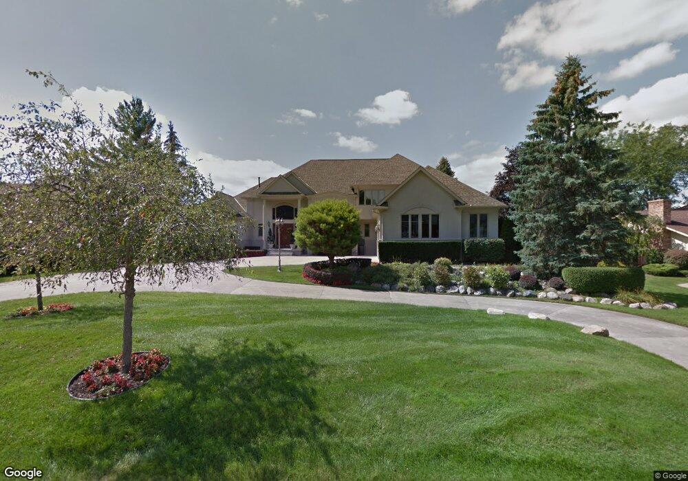
9732 Burning Tree Dr Unit Bldg-Unit Grand Blanc, MI 48439
Estimated Value: $938,000 - $1,183,993
5
Beds
6
Baths
5,127
Sq Ft
$201/Sq Ft
Est. Value
About This Home
This home is located at 9732 Burning Tree Dr Unit Bldg-Unit, Grand Blanc, MI 48439 and is currently estimated at $1,032,331, approximately $201 per square foot. 9732 Burning Tree Dr Unit Bldg-Unit is a home located in Genesee County with nearby schools including Cook Elementary School, Mason Elementary School, and Grand Blanc East Middle School.
Ownership History
Date
Name
Owned For
Owner Type
Purchase Details
Closed on
Sep 30, 2022
Sold by
Ohm Dong-Wha and Ohm Young-Jin
Bought by
Hammond Patrick K and Hammond Megan L
Current Estimated Value
Home Financials for this Owner
Home Financials are based on the most recent Mortgage that was taken out on this home.
Original Mortgage
$765,000
Outstanding Balance
$730,159
Interest Rate
5.13%
Mortgage Type
New Conventional
Estimated Equity
$302,172
Create a Home Valuation Report for This Property
The Home Valuation Report is an in-depth analysis detailing your home's value as well as a comparison with similar homes in the area
Home Values in the Area
Average Home Value in this Area
Purchase History
| Date | Buyer | Sale Price | Title Company |
|---|---|---|---|
| Hammond Patrick K | $900,000 | Mason Burgess Title |
Source: Public Records
Mortgage History
| Date | Status | Borrower | Loan Amount |
|---|---|---|---|
| Open | Hammond Patrick K | $765,000 |
Source: Public Records
Tax History Compared to Growth
Tax History
| Year | Tax Paid | Tax Assessment Tax Assessment Total Assessment is a certain percentage of the fair market value that is determined by local assessors to be the total taxable value of land and additions on the property. | Land | Improvement |
|---|---|---|---|---|
| 2025 | $22,897 | $621,700 | $0 | $0 |
| 2024 | $13,954 | $584,800 | $0 | $0 |
| 2023 | $13,313 | $529,400 | $0 | $0 |
| 2022 | $12,704 | $496,200 | $0 | $0 |
| 2021 | $12,497 | $474,400 | $0 | $0 |
| 2020 | $7,693 | $425,100 | $0 | $0 |
| 2019 | $7,578 | $434,000 | $0 | $0 |
| 2018 | $11,569 | $460,900 | $0 | $0 |
| 2017 | $10,947 | $469,500 | $0 | $0 |
| 2016 | $10,853 | $446,500 | $0 | $0 |
| 2015 | $10,342 | $347,300 | $0 | $0 |
| 2012 | -- | $272,800 | $272,800 | $0 |
Source: Public Records
Map
Nearby Homes
- 9705 Burning Tree Dr
- 9818 Burning Tree Dr
- 9310 Fairway Trail
- 6016 Plantation Dr
- 5270 Fairway Trail
- 6320 Knob Bend Dr
- 5378 Warwick Trail Unit 16
- 6326 Knob Bend Dr
- 6263 Knob Bend Dr
- 5239 E Baldwin Rd
- 5215 Sunlyn Dr
- 9095 S Saginaw Rd Unit 10
- 6264 Muirfield Dr Unit 14
- 6286 Merion Ln Unit 75
- 0 Green Tree Dr
- 5166 Warwick Woods Trail Unit 13
- 9270 Hidden Valley Ct
- 8423 Oxford Ln
- 9257 Burning Tree Dr
- 10195 Golfside Dr
- 9732 Burning Tree Dr
- 9744 Burning Tree Dr
- 9720 Burning Tree Dr
- 9735 Burning Tree Dr
- 9756 Burning Tree Dr
- 9706 Burning Tree Dr
- 9747 Burning Tree Dr
- 9719 Burning Tree Dr
- 9757 Burning Tree Dr
- 9766 Burning Tree Dr
- 9690 Burning Tree Dr
- 9767 Burning Tree Dr
- 9774 Burning Tree Dr Unit Bldg-Unit
- 9774 Burning Tree Dr
- 9678 Burning Tree Dr
- 9777 Burning Tree Dr
- 9677 Burning Tree Dr
- 9786 Burning Tree Dr
- 9787 Burning Tree Dr
- 9668 Burning Tree Dr