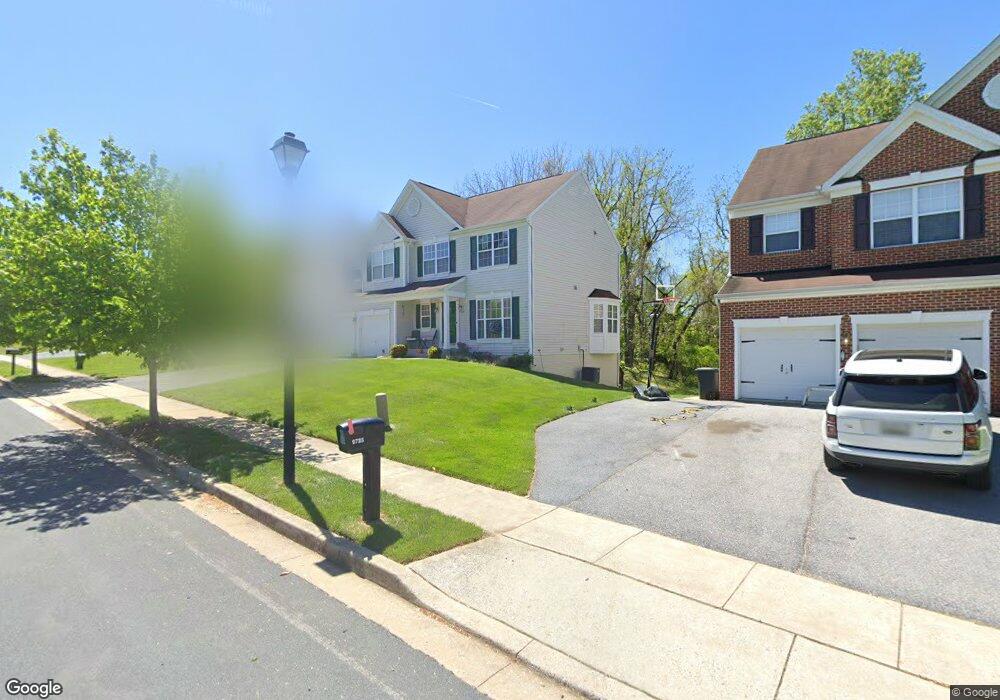
9733 Eustice Rd Randallstown, MD 21133
Estimated Value: $430,000 - $701,000
Studio
3
Baths
2,324
Sq Ft
$229/Sq Ft
Est. Value
About This Home
This home is located at 9733 Eustice Rd, Randallstown, MD 21133 and is currently estimated at $531,745, approximately $228 per square foot. 9733 Eustice Rd is a home located in Baltimore County with nearby schools including Hernwood Elementary School, Deer Park Middle Magnet School, and New Town High.
Ownership History
Date
Name
Owned For
Owner Type
Purchase Details
Closed on
Sep 6, 2006
Sold by
National Birchwood Corp
Bought by
Mclean Sylvia and Mclean Randy
Current Estimated Value
Home Financials for this Owner
Home Financials are based on the most recent Mortgage that was taken out on this home.
Original Mortgage
$74,000
Outstanding Balance
$44,271
Interest Rate
6.79%
Mortgage Type
Stand Alone Second
Estimated Equity
$487,474
Purchase Details
Closed on
Aug 28, 2006
Sold by
National Birchwood Corp
Bought by
Mclean Sylvia and Mclean Randy
Home Financials for this Owner
Home Financials are based on the most recent Mortgage that was taken out on this home.
Original Mortgage
$74,000
Outstanding Balance
$44,271
Interest Rate
6.79%
Mortgage Type
Stand Alone Second
Estimated Equity
$487,474
Create a Home Valuation Report for This Property
The Home Valuation Report is an in-depth analysis detailing your home's value as well as a comparison with similar homes in the area
Home Values in the Area
Average Home Value in this Area
Purchase History
| Date | Buyer | Sale Price | Title Company |
|---|---|---|---|
| Mclean Sylvia | $497,020 | -- | |
| Mclean Sylvia | $497,020 | -- |
Source: Public Records
Mortgage History
| Date | Status | Borrower | Loan Amount |
|---|---|---|---|
| Open | Mclean Sylvia | $74,000 | |
| Open | Mclean Sylvia | $372,750 | |
| Closed | Mclean Sylvia | $74,000 | |
| Closed | Mclean Sylvia | $372,750 |
Source: Public Records
Tax History
| Year | Tax Paid | Tax Assessment Tax Assessment Total Assessment is a certain percentage of the fair market value that is determined by local assessors to be the total taxable value of land and additions on the property. | Land | Improvement |
|---|---|---|---|---|
| 2025 | $4,835 | $395,233 | -- | -- |
| 2024 | $4,835 | $365,600 | $96,400 | $269,200 |
| 2023 | $2,339 | $361,167 | $0 | $0 |
| 2022 | $4,613 | $356,733 | $0 | $0 |
| 2021 | $4,302 | $352,300 | $96,400 | $255,900 |
| 2020 | $4,302 | $346,700 | $0 | $0 |
| 2019 | $4,075 | $341,100 | $0 | $0 |
| 2018 | $3,880 | $335,500 | $84,400 | $251,100 |
| 2017 | $3,754 | $306,800 | $0 | $0 |
| 2016 | $4,554 | $278,100 | $0 | $0 |
| 2015 | $4,554 | $249,400 | $0 | $0 |
| 2014 | $4,554 | $249,400 | $0 | $0 |
Source: Public Records
Map
Nearby Homes
- 9713 Mendoza Rd
- 10 Kiska Ct
- 9605 Mendoza Rd
- 10 Geier Ct
- 3516 Corn Stream Rd
- 9804 Marriottsville Rd
- 3618 Granite Rd
- 3558 Corn Stream Rd
- 3200 Peddicoat Ct
- 3715 Peace Chance Dr
- 9301 Silver Charm Dr
- 9401 Summer Squal Dr
- 3986 Red Deer Cir
- 9839 Branchleigh Rd
- 10013 Village Green Dr
- 3320 Offutt Rd
- 3 Dajobe Ct
- 9208A Liberty Rd
- 4129 Holbrook Rd
- 3332 Offutt Rd
- 9731 Eustice Rd
- 9729 Eustice Rd
- 9726 Eustice Rd
- 9728 Eustice Rd
- 9730 Eustice Rd
- 9737 Eustice Rd
- 9739 Eustice Rd
- 9735 Eustice Rd
- 9741 Eustice Rd
- 9724 Eustice Rd
- 9727 Eustice Rd
- 9722 Eustice Rd
- 3317 Peddicoat Ct
- 9732 Eustice Rd
- 3315 Peddicoat Ct
- 9725 Eustice Rd
- 9734 Eustice Rd
- 9725 Mendoza Rd
- 9720 Eustice Rd
- 9727 Mendoza Rd
Your Personal Tour Guide
Ask me questions while you tour the home.