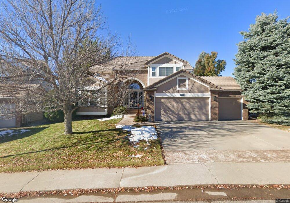
9733 Tall Grass Cir Lone Tree, CO 80124
Estimated Value: $961,987 - $1,108,000
3
Beds
3
Baths
3,145
Sq Ft
$323/Sq Ft
Est. Value
About This Home
This home is located at 9733 Tall Grass Cir, Lone Tree, CO 80124 and is currently estimated at $1,016,247, approximately $323 per square foot. 9733 Tall Grass Cir is a home located in Douglas County with nearby schools including Acres Green Elementary School, Cresthill Middle School, and Highlands Ranch High School.
Ownership History
Date
Name
Owned For
Owner Type
Purchase Details
Closed on
Sep 11, 2021
Sold by
Hone Michael and Michael None Living Trust
Bought by
Hone Michael and Michael Hone Living Trust
Current Estimated Value
Purchase Details
Closed on
Oct 16, 2019
Sold by
Hone Michael E and Bechamps Michelle
Bought by
Michael Hone Living Trust
Purchase Details
Closed on
Oct 10, 2019
Sold by
Hone Michael E
Bought by
Hone Michael E and Bechamps Michelle
Purchase Details
Closed on
Jul 13, 2015
Sold by
Hone Michael Edward and Millet Lisa Ann
Bought by
Hone Michael Edward
Home Financials for this Owner
Home Financials are based on the most recent Mortgage that was taken out on this home.
Original Mortgage
$285,000
Outstanding Balance
$217,381
Interest Rate
3.25%
Mortgage Type
Adjustable Rate Mortgage/ARM
Estimated Equity
$798,866
Purchase Details
Closed on
Oct 31, 1997
Sold by
Coward Charles S and Lenz Carol Lenz
Bought by
Hone Michael Edward and Millet Lisa Ann
Home Financials for this Owner
Home Financials are based on the most recent Mortgage that was taken out on this home.
Original Mortgage
$260,000
Interest Rate
7.27%
Purchase Details
Closed on
Mar 30, 1995
Sold by
The Ryland Group Inc
Bought by
Coward Charles S and Coward Carol Lenz
Home Financials for this Owner
Home Financials are based on the most recent Mortgage that was taken out on this home.
Original Mortgage
$202,500
Interest Rate
8.66%
Purchase Details
Closed on
Oct 7, 1994
Sold by
Ryland-Consolidated
Bought by
Ryland Group Inc
Purchase Details
Closed on
Mar 1, 1994
Sold by
Troon Village Ltd
Bought by
Ryland Consolidated
Create a Home Valuation Report for This Property
The Home Valuation Report is an in-depth analysis detailing your home's value as well as a comparison with similar homes in the area
Home Values in the Area
Average Home Value in this Area
Purchase History
| Date | Buyer | Sale Price | Title Company |
|---|---|---|---|
| Hone Michael | -- | Amrock Inc | |
| Michael Hone Living Trust | -- | None Available | |
| Hone Michael E | -- | None Available | |
| Hone Michael Edward | -- | Title Source Inc | |
| Hone Michael Edward | $325,156 | Land Title | |
| Coward Charles S | $305,681 | Land Title | |
| Ryland Group Inc | $111,100 | -- | |
| Ryland Consolidated | $1,750,000 | -- |
Source: Public Records
Mortgage History
| Date | Status | Borrower | Loan Amount |
|---|---|---|---|
| Open | Hone Michael Edward | $285,000 | |
| Closed | Hone Michael Edward | $260,000 | |
| Previous Owner | Coward Charles S | $202,500 |
Source: Public Records
Tax History Compared to Growth
Tax History
| Year | Tax Paid | Tax Assessment Tax Assessment Total Assessment is a certain percentage of the fair market value that is determined by local assessors to be the total taxable value of land and additions on the property. | Land | Improvement |
|---|---|---|---|---|
| 2024 | $6,761 | $75,860 | $11,710 | $64,150 |
| 2023 | $6,829 | $75,860 | $11,710 | $64,150 |
| 2022 | $4,783 | $52,600 | $7,930 | $44,670 |
| 2021 | $4,973 | $52,600 | $7,930 | $44,670 |
| 2020 | $4,640 | $50,280 | $8,510 | $41,770 |
| 2019 | $4,655 | $50,280 | $8,510 | $41,770 |
| 2018 | $4,029 | $46,540 | $7,390 | $39,150 |
| 2017 | $4,093 | $46,540 | $7,390 | $39,150 |
| 2016 | $4,500 | $50,130 | $7,630 | $42,500 |
| 2015 | $4,600 | $50,130 | $7,630 | $42,500 |
| 2014 | $4,348 | $44,440 | $7,510 | $36,930 |
Source: Public Records
Map
Nearby Homes
- 9493 Southern Hills Cir Unit A25
- 10884 Lyric St
- 9873 Greensview Cir
- 9851 Greensview Cir
- 8176 Lone Oak Ct
- 9308 Miles Dr Unit 5
- 9838 Cypress Point Cir
- 10102 Prestwick Trail
- 9565 Silent Hills Ln
- 9535 Silent Hills Ln
- 8260 Lodgepole Trail
- 8159 Lodgepole Trail
- 8754 Mesquite Row
- 9430 S Silent Hills Dr
- 9410 S Silent Hills Dr
- 10031 Town Ridge Ln
- 8860 Kachina Way
- 9412 La Quinta Way
- 10205 Bluffmont Dr
- 7469 La Quinta Place
- 9721 Tall Grass Cir
- 9739 Tall Grass Cir
- 9711 Tall Grass Cir
- 9747 Tall Grass Cir
- 9712 Tall Grass Cir
- 9678 Colinade Dr
- 9698 Colinade Dr
- 9668 Colinade Dr
- 9753 Tall Grass Cir
- 9703 Tall Grass Cir
- 9708 Colinade Dr
- 9704 Tall Grass Cir
- 9658 Colinade Dr
- 8705 Tall Grass Place
- 8715 Tall Grass Place
- 8725 Tall Grass Place
- 9718 Colinade Dr
- 9763 Tall Grass Cir
- 9648 Colinade Dr
- 9728 Colinade Dr