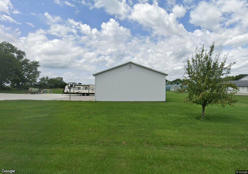
9733 W State Route 185 Covington, OH 45318
Estimated Value: $354,000 - $448,145
4
Beds
1
Bath
2,124
Sq Ft
$193/Sq Ft
Est. Value
About This Home
This home is located at 9733 W State Route 185, Covington, OH 45318 and is currently estimated at $410,048, approximately $193 per square foot. 9733 W State Route 185 is a home located in Miami County with nearby schools including Covington Elementary/Junior High School, Covington Junior High School, and Covington High School.
Ownership History
Date
Name
Owned For
Owner Type
Purchase Details
Closed on
Mar 6, 2024
Sold by
Seubert Jennifer M
Bought by
Seubert Family Revocable Trust and Seubert
Current Estimated Value
Purchase Details
Closed on
Aug 27, 2020
Sold by
Seubert Jennifer M and Seubert Justin
Bought by
Seubert Jennifer M
Home Financials for this Owner
Home Financials are based on the most recent Mortgage that was taken out on this home.
Original Mortgage
$150,000
Interest Rate
3%
Mortgage Type
New Conventional
Purchase Details
Closed on
Jan 1, 1990
Bought by
Demoss James I
Create a Home Valuation Report for This Property
The Home Valuation Report is an in-depth analysis detailing your home's value as well as a comparison with similar homes in the area
Home Values in the Area
Average Home Value in this Area
Purchase History
| Date | Buyer | Sale Price | Title Company |
|---|---|---|---|
| Seubert Family Revocable Trust | -- | Northwest Title | |
| Seubert Jennifer M | -- | Radian Settlement Svcs Inc | |
| Demoss James I | -- | -- |
Source: Public Records
Mortgage History
| Date | Status | Borrower | Loan Amount |
|---|---|---|---|
| Previous Owner | Seubert Jennifer M | $150,000 |
Source: Public Records
Tax History Compared to Growth
Tax History
| Year | Tax Paid | Tax Assessment Tax Assessment Total Assessment is a certain percentage of the fair market value that is determined by local assessors to be the total taxable value of land and additions on the property. | Land | Improvement |
|---|---|---|---|---|
| 2024 | $3,527 | $104,830 | $26,530 | $78,300 |
| 2023 | $3,527 | $104,830 | $26,530 | $78,300 |
| 2022 | $3,572 | $104,830 | $26,530 | $78,300 |
| 2021 | $2,943 | $80,650 | $20,410 | $60,240 |
| 2020 | $2,950 | $80,650 | $20,410 | $60,240 |
| 2019 | $2,642 | $72,560 | $20,410 | $52,150 |
| 2018 | $2,161 | $60,380 | $15,400 | $44,980 |
| 2017 | $1,887 | $51,630 | $15,400 | $36,230 |
| 2016 | $1,812 | $51,630 | $15,400 | $36,230 |
| 2015 | $1,753 | $48,690 | $14,530 | $34,160 |
| 2014 | $1,753 | $48,690 | $14,530 | $34,160 |
| 2013 | $1,762 | $48,690 | $14,530 | $34,160 |
Source: Public Records
Map
Nearby Homes
- 7648 Piqua-Clayton Rd
- 330 Liberty St
- 124 E Keller St
- 310 E Main St
- 9145 W US Route 36
- 731 N Pearl St
- 501 N Main St Unit C1
- 10770 U S 36
- 520 N Pearl St
- 320 E Church St
- 235 E Church St
- 219 E Church St
- 324 E Elm St
- 133 W Broadway St
- 427 S Miami Ave
- 231 E Vine St
- 142 W James St
- 124 N Main St
- 206 W Elm St
- 211 W Elm St
- 9665 W State Route 185
- 9733 Ohio 185
- 9629 W State Route 185
- 9551 W State Route 185
- 9860 W State Route 185
- 9911 Ohio 185
- 9911 W State Route 185
- 10140 W State Route 185
- 9610 W Union Church Rd
- 8656 N Rangeline Rd
- 10265 W State Route 185
- 9395 W Union Church Rd
- 10262 W State Route 185
- 8822 N Rangeline Rd
- 8360 N Rangeline Rd
- 9225 W Union Church Rd
- 8385 Rakestraw Rd
- 6245 Rakestraw Rd
- 8970 W State Route 185
- 8130 N Rangeline Rd